In collaboration with Picea, Inc., the Conservation Biology Institute (CBI) conducted a comprehensive natural resource inventory for the Squaxin Island Tribe, located in western Washington at the southern extent of Puget Sound. The inventory focused on local and regional forest resources, emphasizing forest composition and age structure within both tribal lands and the surrounding region.
Using the Data Basin platform, approximately 200 relevant spatial datasets were curated and organized within a secure, private group space accessible to tribal members. As part of the analysis, a land cover update was performed, and forest condition profiles were developed by ownership type—with special attention to tribal lands—and by subwatershed.
The assessment revealed a wide range of forest conditions across the landscape. The resulting inventory is intended to serve as a dynamic, “living” resource, enabling the tribe to make informed management decisions grounded in the best available map-based data and science.
The current version of the Haying and Grazing (H&G) tool allows USDA staff to process emergency and non-emergency H&G requests, approve and certify them, and access them easily for reports.
This version has been designed to assist staff and reduce workloads when the landowner comes into the field office to make a request. In future versions, USDA may decide to make the entire process digital, and allow landowners to submit requests, digitally sign and certify approved requests from their homes.
CBI is building state-of-art, user-driven tools for the USDA CRP program to streamline workflows and improve cost efficiency
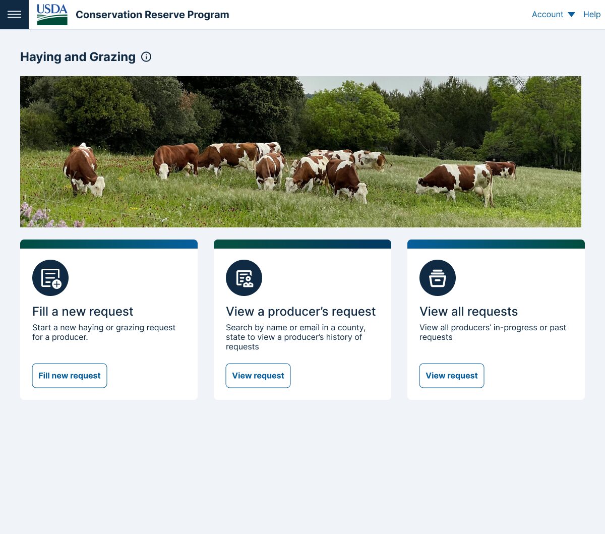
The pilot H&G tool is available to USDA staff and they will need to contact Cole or Justin at CBI to be registered in a secure system to access the tool.
Rapid assessment of vegetation cover and quality designed for CRP Landowners and Farmers.
The USDA Mobile Field App allows producers to provide a quick status check of their fields contracted under the Conservation Reserve Program (CRP). It also provides valuable validation data improving the accuracy of assessments based on remote sensing and machine learning. It can be easily customized for other vegetation assessments. It is currently designed to help improve communication between producers and USDA staff, and aid in easy reporting and record keeping.
CBI in partnership with producers and USDA Staff designed and built an easy-to-use field app that takes 10 minutes to get an accurate assessment of vegetation cover and quality of CRP fields
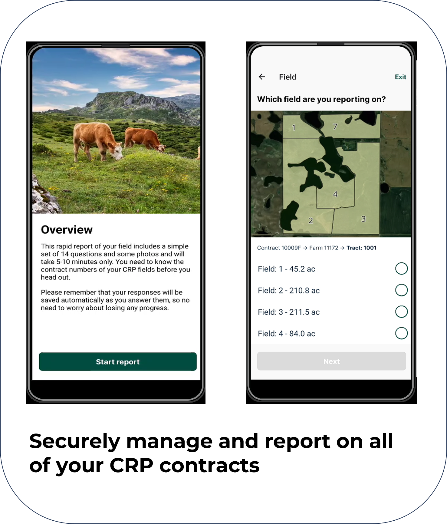
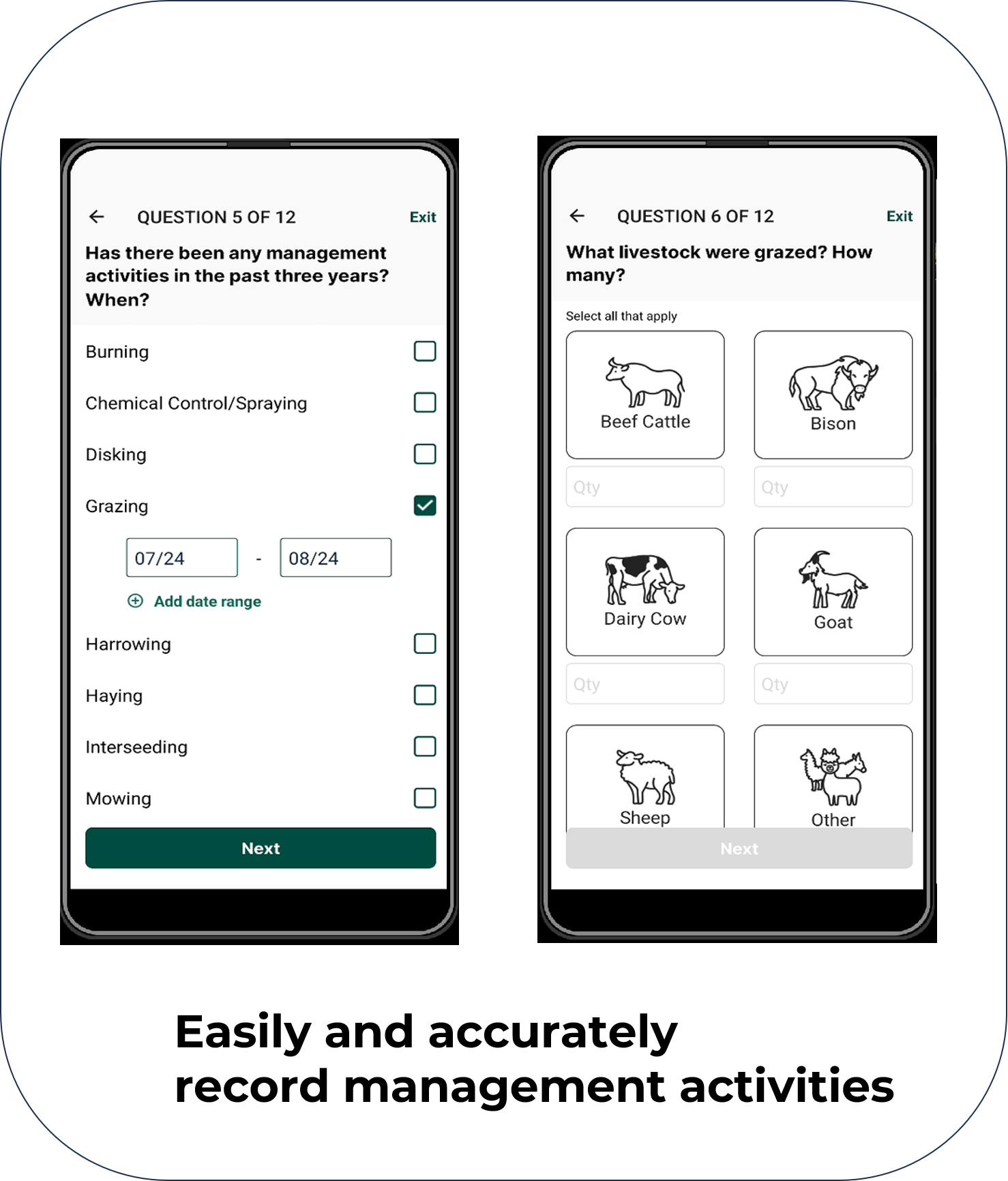
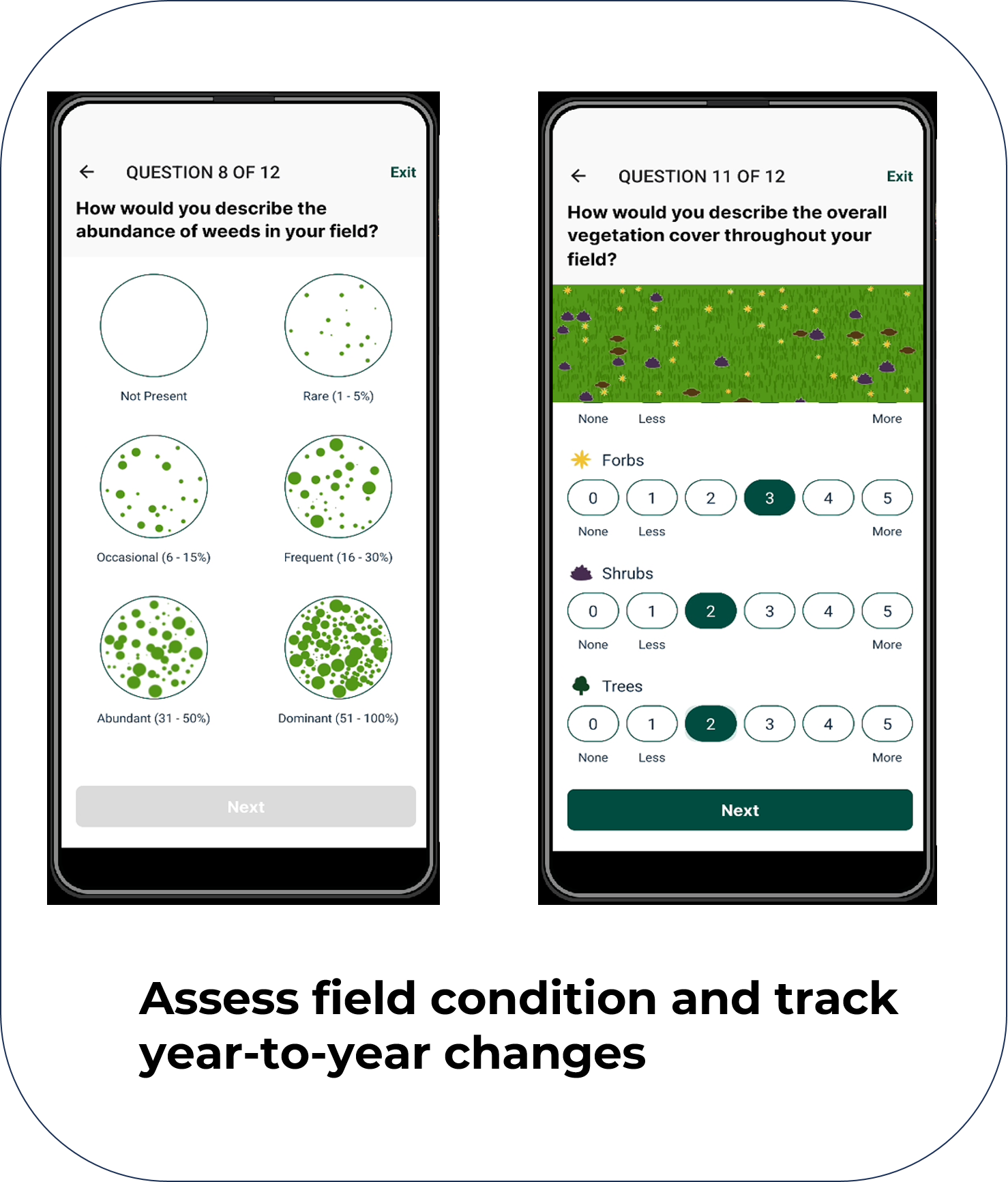
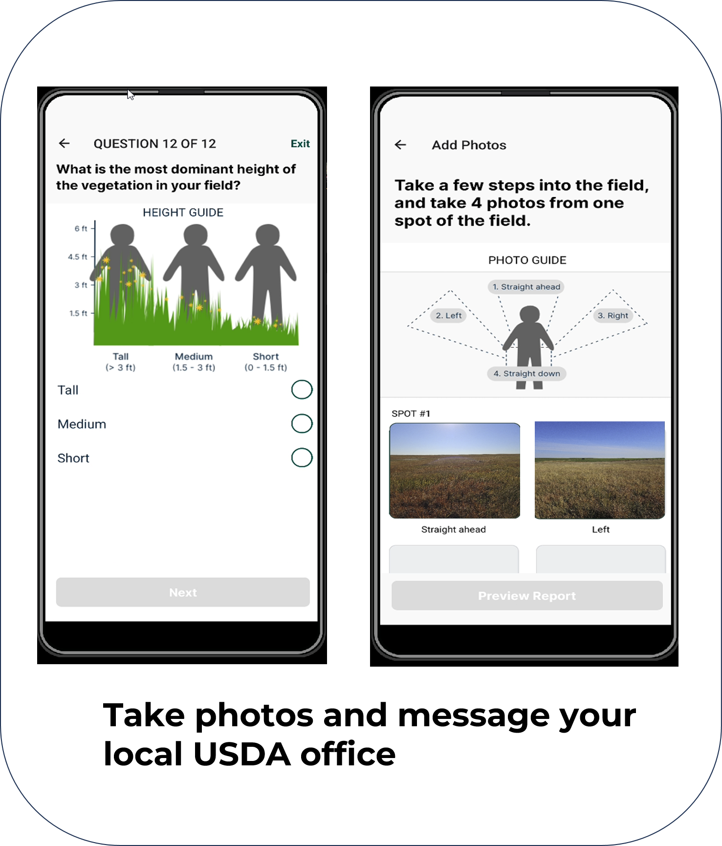

Providing Tools for USDA Monitoring and Assessment
CBI is using the latest remote sensing, machine learning, and modeling approaches to assess the quality of grasslands and pollinator habitat. Outputs from this analysis will be delivered to USDA through an online-decision support system, designed and built by CBI, called the USDA Conservation Toolkit. This suite of map-based tools will support the USDA Conservation Reserve Program (CRP) and other land-based conservation and restoration programs operating across the United States. CRP currently covers ~24.8 million acres of working lands nationwide.
Goal: Assess ecosystems services across the CRP portfolio
- Generate products to support USDA policies and program initiatives
- Provide actionable conservation intelligence

Targets
- Quantify foundational supporting ecosystem services across CRP enrollments
- Grasslands ecosystem quality
- Pollinator habitat quality
- Incorporate resulting spatial data and metrics into online applications, allowing for program reporting at multiple scales
- A priority for this effort is to quantify the CRP national portfolio return on investment, screening enrolled farms, and assessing at state, regional and national scales
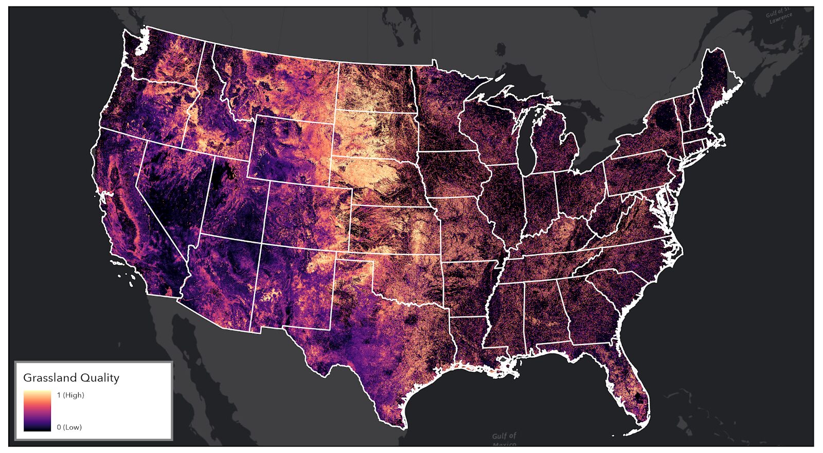
CBI CRP Grassland Quality Model – Overview
Components
- Integrative, comprehensive approach to modeling using the best available spatial data and remotely sensed metrics (e.g. National vegetation surveys, NLCD, Rangeland Analysis Platform (RAP), custom CBI products)
- Leverages outputs from the Google Earth Engine (GEE) cloud-computing platform with CBI’s customized library of 200+ vegetation indices
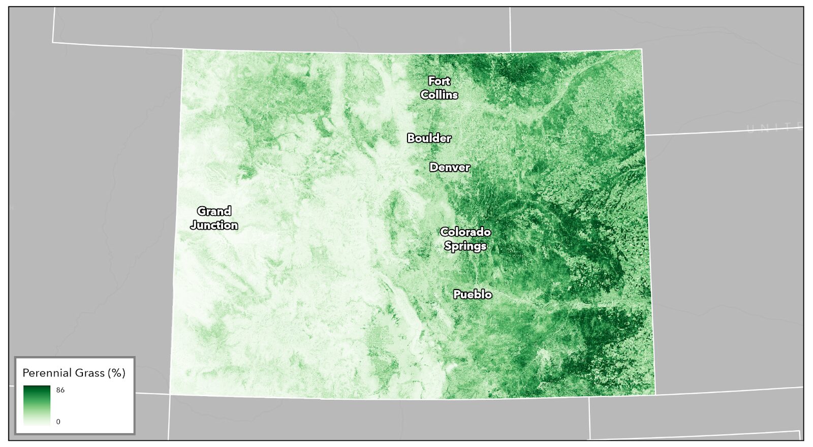
What does it tell us?
- Indicator for ecosystem health, form, function, and supporting services strength, based on the USDA grassland operational definition (USDA-NRCS 2024, National Resources Inventory Grazing Land On-Site Data Collection Handbook)
- Complements existing frameworks (Rangeland Health Assessment) and other modeling efforts (RAP, K. Barnes 2024)
What does it offer USDA?
- Multi-scale (non-monetary), valuation of ecosystem condition for CRP enrolled lands and surrounding landscape
- Insights on baseline field-level condition and landscape-level spatial analytics for CRP assessment and reporting
- Illustrates CRP return on investment at a programmatic scale and quantifies enrolled land performance with nuanced metrics
How is it unique?
- Hierarchical measure of grassland ecosystem vigor, community composition, and resilience
- Expandable framework produces multidimensional metrics to quantify patterns across the landscape
- Summarizes information across CRP farms and practices
- Offers insights on baseline current state and local condition at multiple scales
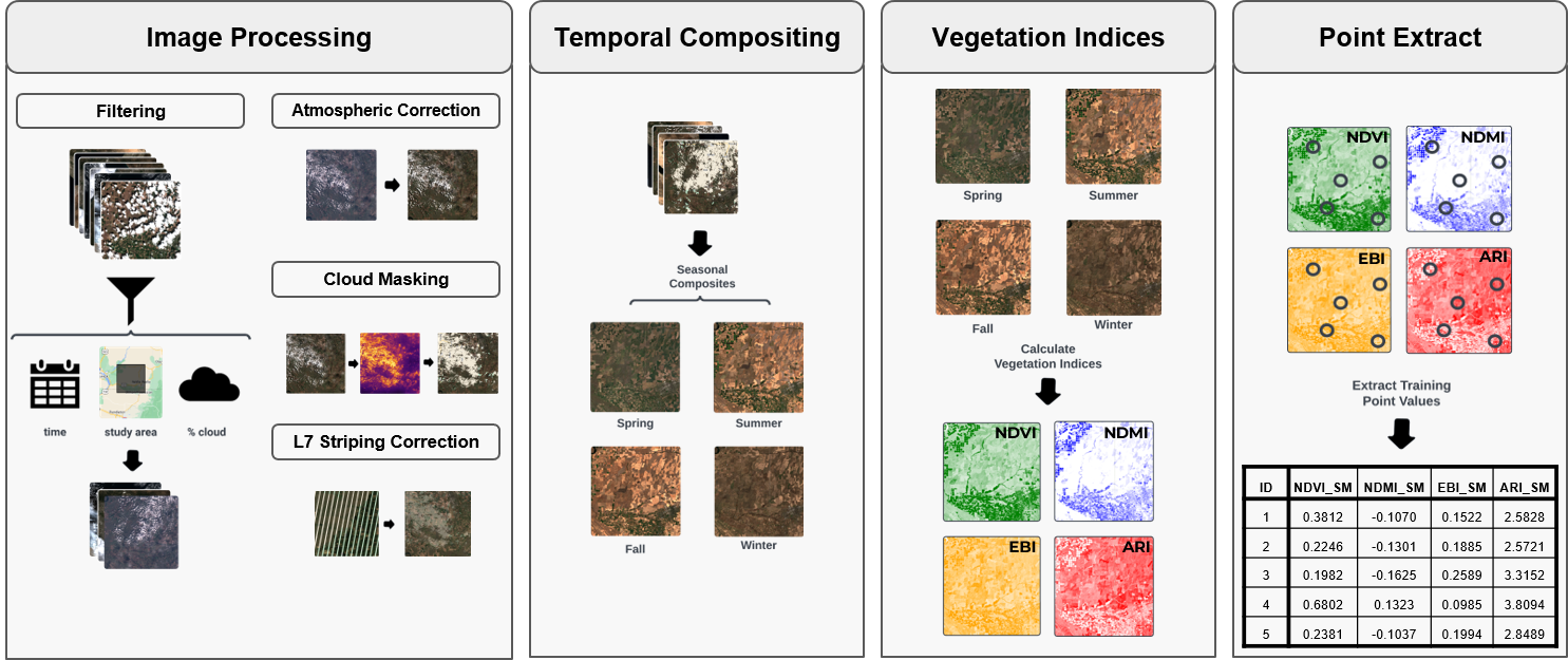
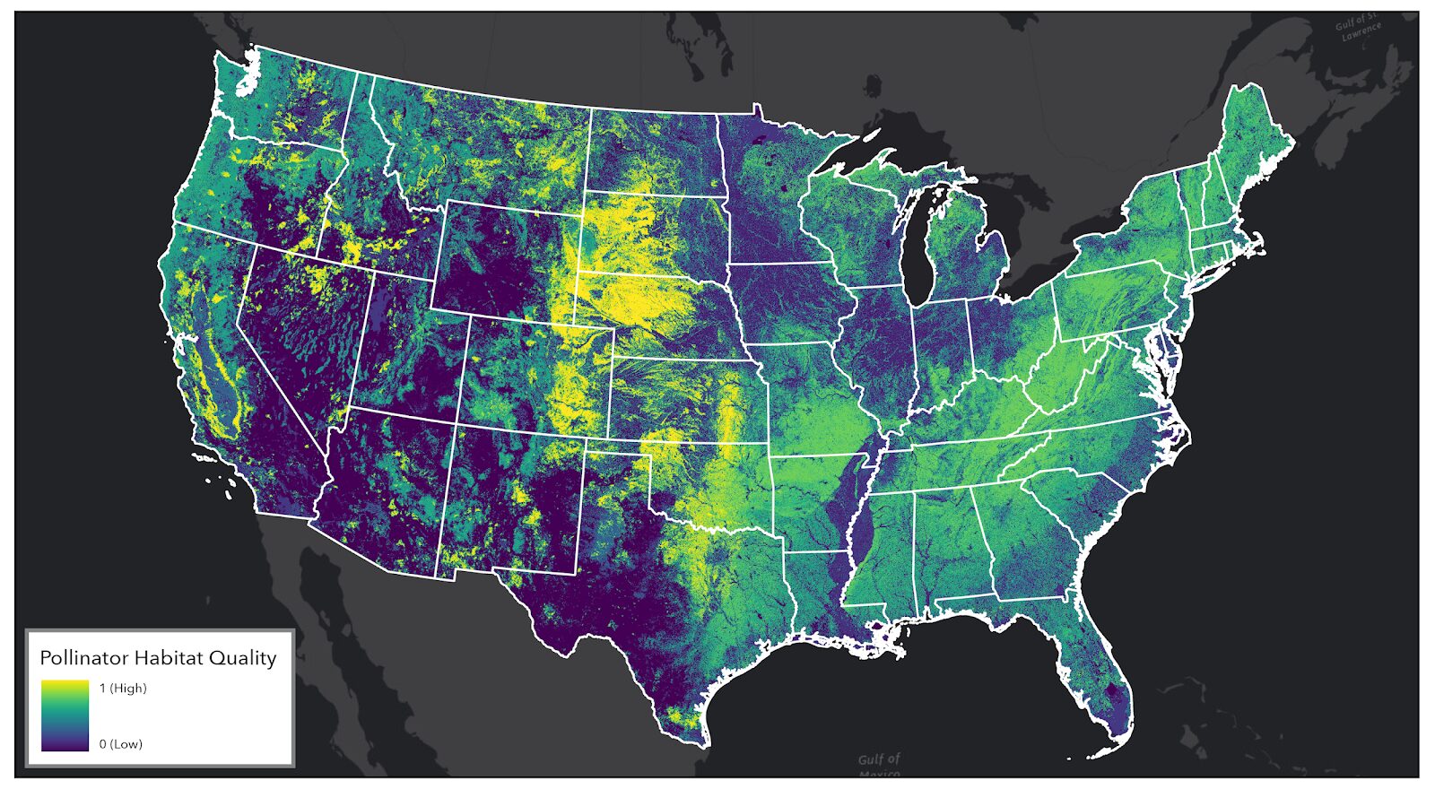
Pollinator Habitat Quality Model – Overview
Components
- Integrative, comprehensive approach to modeling using the best available spatial data and remotely sensed metrics (e.g. US National Phenology Network, NLCD, Rangeland Analysis Platform (RAP), NatureServe Explorer, custom CBI products)
What does it tell us?
- Describes pollinator natural resource needs and spatial use of the landscape
- Indicator for pollinator population health and pollination service strength
- Spatial complement to on-ground pollinator assessments funded by USDA
What does it offer USDA?
- Multi-dimensional, non-monetary valuation of pollinator habitat
- Foundation for field to landscape-level spatial analytics for CRP assessment and reporting
- Illustrates CRP return on investment at a programmatic scale and quantifies enrolled land performance with nuanced metrics
How is it unique?
- Builds on the benchmark InVest© model framework
- Informed by 300,000 bee observations from the Global Biodiversity Information Facility (GBIF)
- Innovations for bee flight, nesting, and floral suitability estimates
The USDA Conservation Reserve Program (CRP) works with private landowners to advance conservation on their lands. This voluntary program currently comprises over 23 million acres making it an extremely important component of conservation in America, particularly in locations with limited public conservation lands. Management actions taken on enrolled lands include augmenting native vegetation for pollinators, providing habitat for grassland plants and animals, increasing biodiversity, reducing soil erosion, and improving water quality.
CBI is working with USDA to improve the effectiveness and efficiency of the program as it strives to expand enrollment in the coming years. Working in several pilot states (Mississippi, Kansas, Colorado, Washington, Nebraska, and the Dakotas), CBI is focusing on the following tasks:
- Create an online service open to the public that assists landowners to identify plant mixes most appropriate for their locations and management goals and vendors where seeds/seedlings can be acquired.
- For agency and CRP contract holders, create an online service that helps manage emergency haying/grazing requests.
- Develop and implement technology and protocols (e.g., phone field assessment app) that will involve contract holders more in the implementation of their agreements, which will provide important monitoring for improved program evaluation.
- Improve mapping and monitoring of forests and grasslands as they relate to CRP goals and objectives using the latest remote sensing technology, machine learning, and high-end processing resources.
- Conduct spatial analyses to help the program prioritize areas for more targeted enrollment.
- For agency users, provide an online service that allows for rapid and meaningful assessments of conservation management outcomes on CRP lands.
CBI Takes a Field Trip!
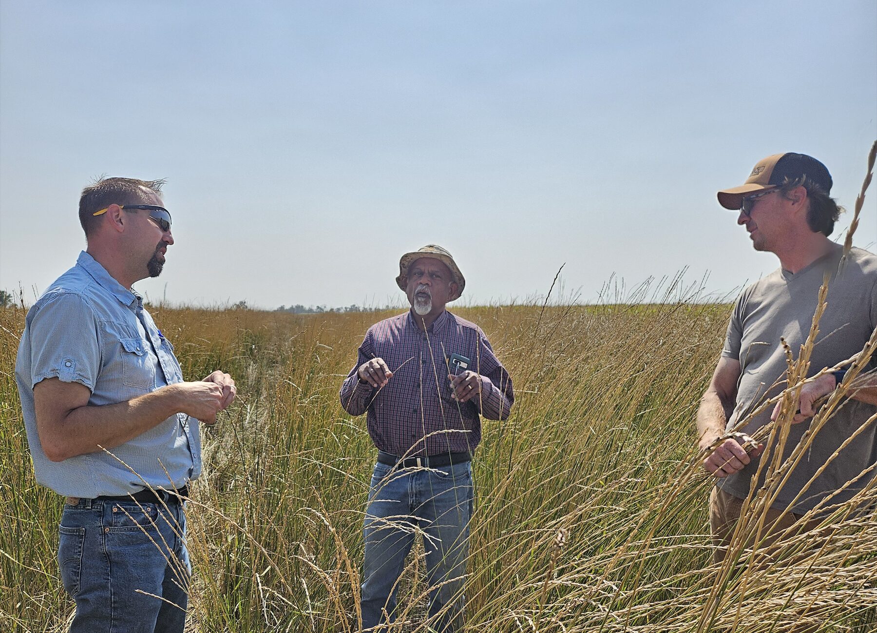
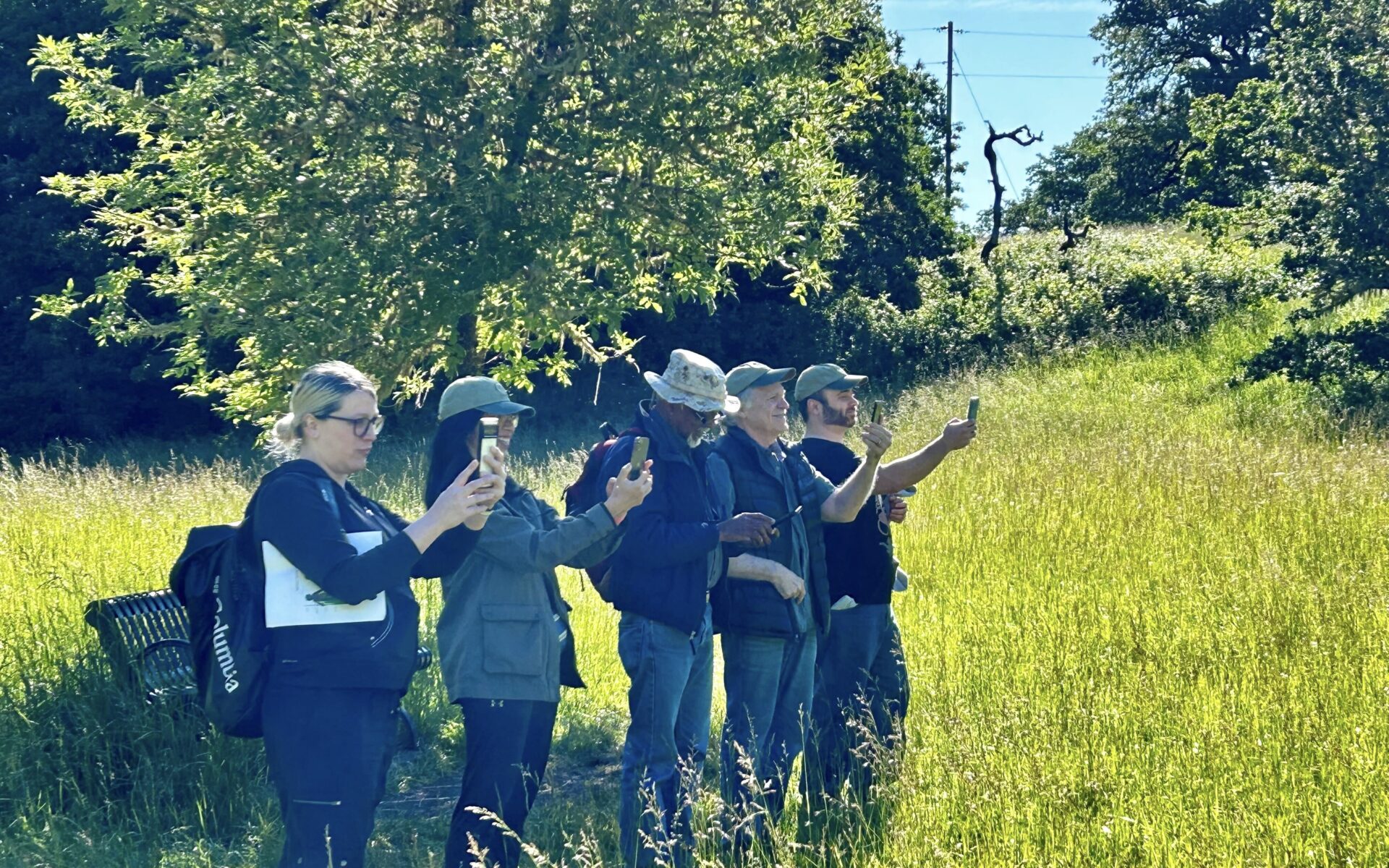
CBI headed to Jamestown, North Dakota, to speak with producers and USDA county staff regarding the USDA Mobile App, a tool designed for self-reporting, assessment, and communication surrounding CRP fields. We tested the app on over 35 fields to incorporate feedback from on-the-ground users, train remote sensing data, and test the effectiveness and ease-of-use of the tool. We coordinated with USGS, as well, testing this app on several of their pollinator plots, in conjunction with another CBI project.
Additionally, CBI traveled to Bismark and spoke with state NRCS staff, in order to hone and edit management questions and expand the usefulness of the app for reporting requirements and data gathering. Our experience was invaluable, as truthful reactions and deliberate responses from those who will eventually be using the tool, are critical in creating something that will be utilized and, ultimately, successful.
Helping dairy farmers choose climate-smart manure management systems for potential funding from the California Depart of Food and Agriculture through their Alternate Manure Management Program (AMMP)

The CDFA AMMP Project Planning Tool provides California dairy and livestock operators an opportunity to easily visualize an alternative manure management practice that reduces carbon emissions, using simple ways of mapping proposed operations on the farm. The Tool increases access for potential applicants to create maps describing their current and proposed manure management, thus improving their AMMP grant applications, and our ability to review projects efficiently. The CBI team did an amazing job communicating with us regularly, offering suggestions, and helping put our ideas and the rather complex elements of our grant program together into a really beautiful and user-friendly tool.
Alyssa Louie – Senior Environmental Scientist, California Department of Food and Agriculture
The Columbia Plateau in eastern Washington supports productive farmland and rangeland as well as native shrub-steppe habitat of which only 40% remains intact. The region also contains some of the most sought after land in the state for utility scale solar energy development, which is an important component of its future energy portfolio that strives to produce 80% of the state’s electricity from renewable sources by 2030 and 100% carbon-free by 2040.
CBI has been chosen by the Washington State University Energy Program to provide the science and mapping component in support of a voluntary, collaborative effort that brings stakeholders together in order to identify areas of least-conflict between solar energy development and other important ecological, economic, and social values in order to meet the state’s carbon-free energy goals. CBI’s contribution to this process is based on the successful pilot to this approach in the San Joaquin Valley in California. The project will include a new Data Basin gateway, which is a customized site for accessing the science and mapping resources for this project.
See the recent brochure published by Washington State University for more information.
The proposed Luebbers development is located in the headwaters of Dixon Creek just outside the urban growth boundary (UGB) for the City of Corvallis. The development site contains two intermittent tributaries that flow directly into the West Fork of Dixon Creek. The proposed development would require substantial road improvement to Live Oak Drive according to BCC 515(2) of approximately 3,000 feet immediately adjacent to Dixon Creek including a section within the UGB (Figure 1). The development plan also proposes to construct Live Oak Court over steep slopes, which would connect Deer Run Street with Live Oak Drive. No plan for stormwater management as required by BCC 97.115 (1)(k) or drainage plan for the road design required by BCC 99.515 have been provided. Wetlands are located on the east side of Live Oak Drive near the proposed development and will require a detailed wetland delineation and possible mitigation plan. No endangered species survey has been performed and will likely be required. The southeasterly side of the proposed development site is very step and has a history of landslides. The site has been identified as “sensitive” by Benton County Planning Commission staff due to its steep slopes (most of the site contains >20% slope) and highly erodable soils and therefore subject to BCC 99.105. No detailed sewage disposal plan for the proposed housing development, required by BCC 99.705, was provided.
With this background information in mind, we offer the following comments about the ecological considerations and concerns this proposed developed invokes. We concentrate on the potential ecological impacts of the proposed development on three main areas:
(1) the riparian corridor of Dixon Creek directly impacted by the development,
(2) the ecological integrity of Dixon Creek overall, and
(3) wildlife habitat within and around the proposed development site.
Over the next decade, approximately one-half million acres of habitat will be set aside for conservation in San Diego County to protect the region’s outstanding biological diversity. Protection and management of this open space will require substantial funding and staffing and a coordinated commitment from diverse groups, including municipalities, resource agencies, and local citizens’ groups.
The Escondido Creek watershed comprises a relatively small, but immensely significant part of Southern California. Within its approximately 54,000 acres, stretching from the foothills to the coast, lie the last remnants of an imperiled coastal scrub habitat that connects the northern and southern parts of a globally important ecological region. Though seemingly unspectacular to some, this coastal scrub habitat is vital to the integrity of San Diego County’s open space network and to the persistence of some of Southern California’s most endangered species, many of which occur nowhere else on the planet. Conservation of these natural lands is the key to preserving San Elijo Lagoon as the jewel of Southern California’s remaining coastal wetlands. Moreover, conservation of this open space—an integral part of the larger open space network in San Diego County and Southern California—is essential to the sustainability of our natural, economic, social, cultural, and government systems, which depend on clean water, flood control, clean air, and scenic and recreational resources.
