Map-based tools that support the Conservation Reserve Program (CRP) of USDA and other land-based conservation and restoration programs in the U.S
USDA contracted the Conservation Biology Institute (CBI) to design and build a free online easy-to-use Plant and Vendor finder to support the producers associated with the Conservation Reserve Program (CRP). However, the tool is not limited to the CRP program and can serve the needs of any land stewardship effort requiring native seeds/seedlings. In partnership with the Institute for Applied Ecology (IAE) we have added features to address the needs of the Native Seed Network and significantly expanded the native seed customer and vendor base.
The seed and vendor finder can be found here: Plant and Vendor Finder
Currently, CBI has seeded the tool with 214 vendors found through an online search from across the country with limited profiles, and 45 have voluntarily completed full profiles which includes their plant catalogue. The tool is designed for easy uploading of their profile and inventory. It also provides an opportunity for vendors without a website to have an online presence and be found by customers looking for seeds.
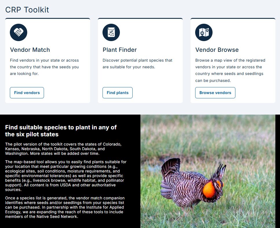
The map-based Plant Finder tool allows you to easily find plants suitable for your location that meet particular growing conditions (e.g., ecological sites, soil conditions, moisture requirements, and specific environmental tolerances) as well as provide specific benefits (e.g., livestock browse, wildlife habitat, and pollinator support). Once a species list is generated, the Vendor Match tool identifies where seeds and/or seedlings from your species list can be purchased. The Vendor Browse tool allows you to easily browse a map view of the registered vendors in your state or across the country where seeds and seedlings can be purchased.
All data content is from authoritative sources, including NRCS state resources, NRCS Ecological Site program, and the USDA PLANTS database.
The vendor match and browse tools have been updated in partnership with the Institute for Applied Ecology (IAE)for the Native Seed Network. Note that IAE uses its legacy name `Seed Finder tool’ for what is essentially the same as the USDA Plant and Vendor finder tool.
Tutorial Videos
Southern California’s montane conifer forests are primarily restricted to the “sky islands” of the San Jacinto, San Bernardino, and San Gabriel Mountains. These unique ecosystems protect the upper watersheds of all of the region’s major rivers and provide ecosystem services critical to both human and ecosystem climate resilience. Managers are in a race to restore resilience to these forests, which are threatened with conversion to hardwood and shrub due to severe wildfires and regeneration failure.
This partnership between the US Forest Service, San Diego State University, and Conservation Biology Institute is applying the latest research on interactions between multiple disturbances specific to this ecoregion to plan effective conservation action.
The effort expands on research from the Connecting Wildlands and Communities project that developed a landscape-scale framework to map refugia from multiple stressors, and ongoing research projects at CBI developing dynamic wildfire and vegetation succession models for understanding the synergistic impacts of climate change, land use change, and different management scenarios.
The team will work with scientists and managers to build interactive spatial models using CBI’s Environmental Evaluation Modeling System (EEMS) with location-specific data to support the collaborative development of a conservation strategy customized to address the threats faced by southern California’s montane forests.
Secondary tropical forests provide critical hydrological services through modulating transpiration and soil infiltration of precipitation. However, vegetation studies establishing direct mechanistic linkages between stand transpiration, soil moisture and streamflow are significantly lacking in tropical montane forests (TMFs) in Himalaya. We quantified the impact of diel and seasonal transpiration on catchment water balance and lean season streamflow in a broad-leaved evergreen secondary TMF in Eastern Himalaya. Stand transpiration (T) and streamflow (Q) were measured concurrently at one of the wettest (4500 mm yr−1) and highest elevation (2100 m) sites worldwide to date. The observed daily transpiration rates (1.29±0.99 mm d − 1) were double the reported values from TMFs in relatively drier Central Himalaya but at the lower bound of TMFs globally. Moderate precipitation pulses (10–25 mm volume) followed by clear skies significantly increased stand transpiration. The proportional contribution of evaporative losses (50–77%) and stand transpiration (2–13%) to catchment water balance increased with the progression of the wet season. The phase lags between T, soil moisture (S) and Q were confounded by significant pre-dawn sap flux movement and the presence of secondary diel peaks. Transpiration was a significant predictor of streamflow in the dry season and, to a lesser extent, in the wet season. Thus, changes in vegetation cover and precipitation patterns will likely impact hydrological services from the regenerating secondary TMFs and the regional water security in the Eastern Himalaya.
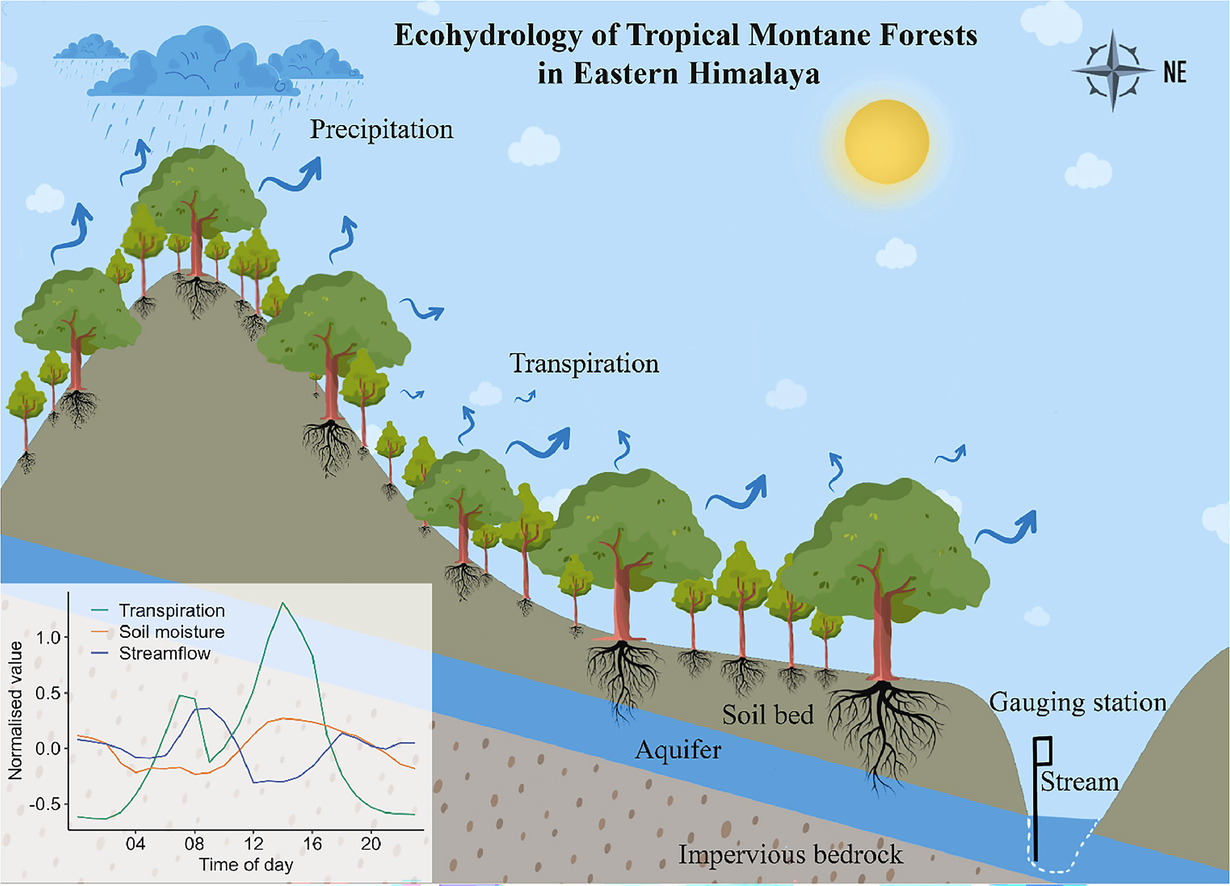
Abstract
Improving geo-information decision evaluation is an important part of geospatial decision support research, particularly when considering vulnerability, risk, resilience, and sustainability (V-R-R-S) of urban land–water systems (ULWSs). Previous research enumerated a collection of V-R-R-S conceptual component commonalties and differences resulting in a synthesis concept called VRRSability. As a single concept, VRRSability enhances our understanding of the relationships within and among V-R-R-S. This paper reports research that extends and deepens the VRRSability synthesis by elucidating relationships among the V-R-R-S concepts, and organizes them into a VRRSability conceptual framework meant to guide operationalization within decision support systems. The core relationship within the VRRSability framework is ‘functional performance’, which couples land and water concerns within complex ULWS. Using functional performance, we elucidate other significant conceptual relationships, e.g., scale, scenarios and social knowledge, among others. A narrative about the functional performance of green stormwater infrastructure as part of a ULWS offers a practical application of the conceptual framework. VRRSability decision evaluation trade-offs among land and water emerge through the narrative, particularly how land cover influences water flow, which in turn influences water quality. The discussion includes trade-offs along risk–resilience and vulnerability–sustainability dimensions as key aspects of functional performance. Conclusions include knowledge contributions about a VRRSability conceptual framework and the next steps for operationalization within decision support systems using artificial intelligence.
The Giant Sequoia Lands Coalition (GSLC) is a collaboration of public and non-governmental organizations committed to the conservation of giant sequoia grove ecosystems. CBI is supporting the GSLC’s Sequoia Grove Protection and Resiliency Project with tools and assistance that will enable GSLC partners and stakeholders to work collaboratively to protect the species from the impacts of drought, beetles, and wildfire made more intense by climate change.
CBI is using its Data Basin platform (databasin.org) to host the Giant Sequoia Data Portal. The portal will be populated with custom maps of the sequoia groves linked to standard metrics and data for assessing grove condition, fuel treatments, and other range-wide information. To inform this giant sequoia management “dashboard” CBI is working with the GSLC to catalog an extensive collection of assessment, monitoring, and remote sensing datasets created by different agencies and projects over many decades of forest management and research. CBI will train and support the GSLC partners in their use of the Giant Sequoia Data Portal for promoting coordinated scientific research, monitoring, long-term species conservation, and continuing to share new data as it becomes available.

This study addresses two main questions in an East Himalayan broad-leaved wet evergreen TMF: (A) How do the sap flow patterns differ between co-occurring pioneer and late-successional species in a secondary forest? and (B) What are the environmental and ecophysiological drivers of variability in sap flow responses? We hypothesize that the plant water use by the pioneer species would be high but equally likely to be highly sensitive to environmental extremes, whereas late-successional species will have relatively stable water-use patterns. We also predict that, unlike other TMFs, the ecosystem productivity is more likely to be limited by energy availability than water in the wet East Himalayan eco-climate.
Abstract: Spatial conservation prioritization does not necessarily lead to effective conservation plans,
and good plans do not necessarily lead to action. These “science-action” gaps are pernicious and need
to be narrowed, especially if the international goal of conserving 30% of the planet by 2030 is to be
realized. We present the Earthwise Framework, a flexible and customizable spatial decision support
system (SDSS) architecture and social process to address the challenges of these science-action gaps.
Utilizing case study experience from regions within California, South Africa, and British Columbia,
we outline the framework and provide the Little Karoo, South Africa SDSS data, code and results to
illustrate five design strategies of the framework. The first is to employ an “open science” strategy
for collaborative conservation planning and action. Another is that marginal value functions allow
for the continuous accounting of element (e.g., habitat) representation in prioritization algorithms,
allowing for an SDSS that is more automated and saves valuable time for stakeholders and scientists.
Thirdly, we program connectivity modeling integrated within the SDSS, with an algorithm that not
only automatically calculates all the least cost corridors of a region, but prioritizes among them and
removes the ones that do not make ecological sense. Fourth, we highlight innovations in multi-criteria
decision analysis that allow for both cost-efficient plan development, like representative solution
sets, but also land-use planning requirements, like site specific valuation, in what appears to be a
more transparent, understandable, and usable manner than traditional approaches. Finally, strategic
attention to communicating uncertainty is also advocated. The Earthwise Framework is an open
science endeavor that can be implemented via a variety of software tools and languages, has several
frontiers for further research and development, and shows promise in finding a better way to meet
the needs of both humans and biodiversity.
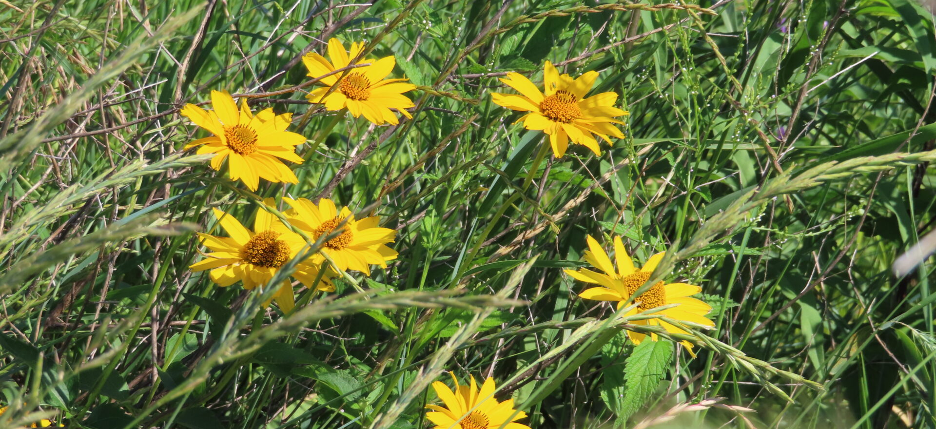
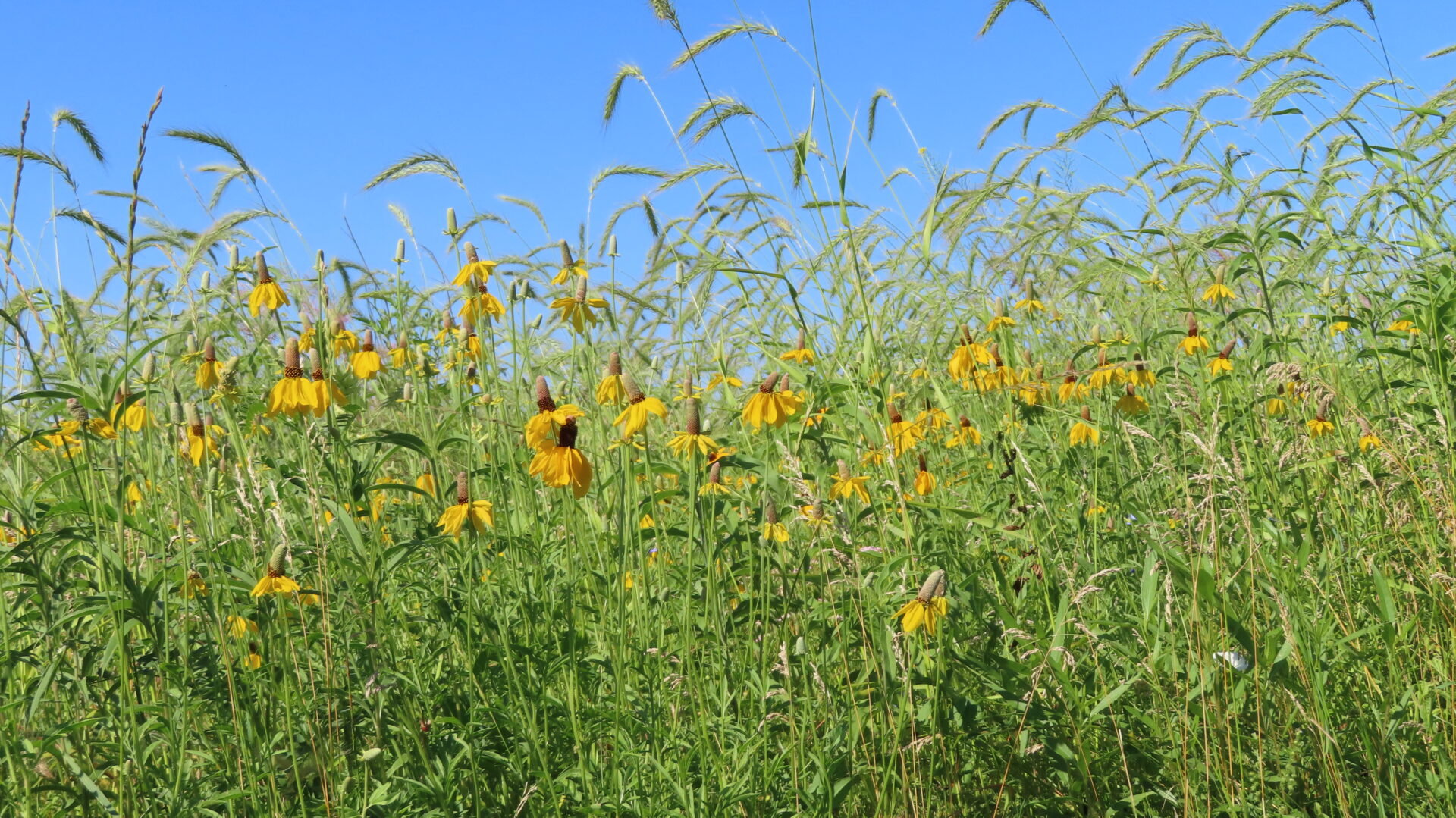
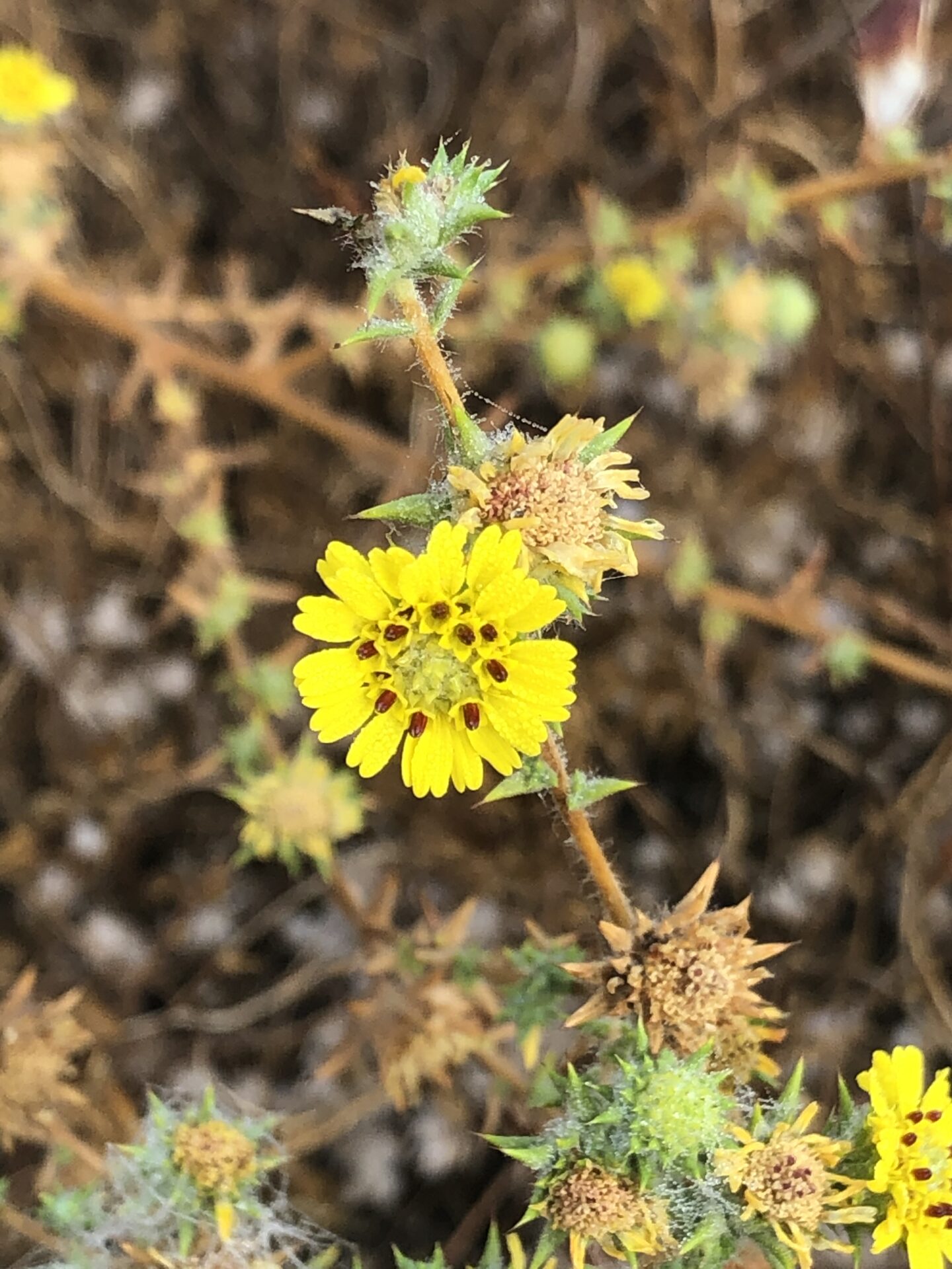
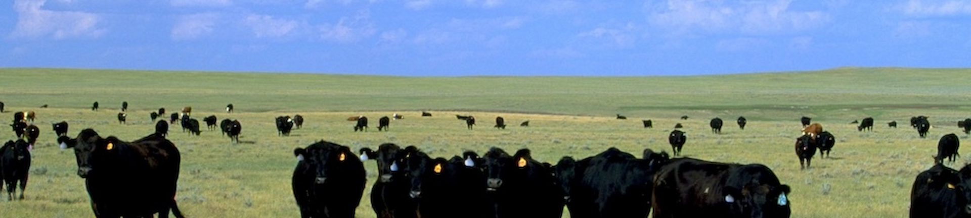
The USDA Conservation Reserve Program (CRP) works with private landowners to advance conservation on their lands. This voluntary program currently comprises over 23 million acres making it an extremely important component of conservation in America, particularly in locations with limited public conservation lands. Management actions taken on enrolled lands include augmenting native vegetation for pollinators, providing habitat for grassland plants and animals, increasing biodiversity, reducing soil erosion, and improving water quality.
CBI is working with USDA to improve the effectiveness and efficiency of the program as it strives to expand enrollment in the coming years. Working in several pilot states (Mississippi, Kansas, Colorado, Washington, Nebraska, and the Dakotas), CBI is focusing on the following tasks:
- Create an online service open to the public that assists landowners to identify plant mixes most appropriate for their locations and management goals and vendors where seeds/seedlings can be acquired.
- For agency and CRP contract holders, create an online service that helps manage emergency haying/grazing requests.
- Develop and implement technology and protocols (e.g., phone field assessment app) that will involve contract holders more in the implementation of their agreements, which will provide important monitoring for improved program evaluation.
- Improve mapping and monitoring of forests and grasslands as they relate to CRP goals and objectives using the latest remote sensing technology, machine learning, and high-end processing resources.
- Conduct spatial analyses to help the program prioritize areas for more targeted enrollment.
- For agency users, provide an online service that allows for rapid and meaningful assessments of conservation management outcomes on CRP lands.
CBI Takes a Field Trip!
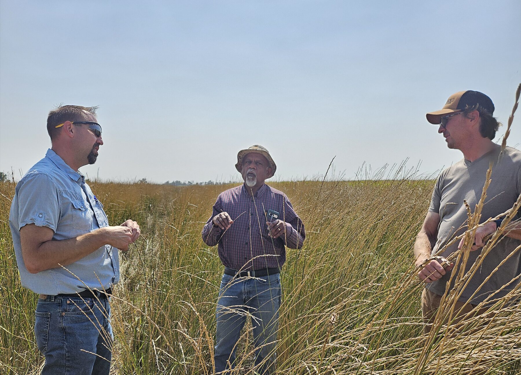
CBI headed to Jamestown, North Dakota, to speak with producers and USDA county staff regarding the USDA Mobile App, a tool designed for self-reporting, assessment, and communication surrounding CRP fields. We tested the app on over 35 fields to incorporate feedback from on-the-ground users, train remote sensing data, and test the effectiveness and ease-of-use of the tool. We coordinated with USGS, as well, testing this app on several of their pollinator plots, in conjunction with another CBI project.
Additionally, CBI traveled to Bismark and spoke with state NRCS staff, in order to hone and edit management questions and expand the usefulness of the app for reporting requirements and data gathering. Our experience was invaluable, as truthful reactions and deliberate responses from those who will eventually be using the tool, are critical in creating something that will be utilized and, ultimately, successful.
A Framework Resource Management Plan (F-RMP) for the Montecito Ranch Preserve was developed jointly by Jessie Vinje, CBI, Michael White, Endangered Habitats Conservancy (EHC), Steve Montgomery, ECORP Consulting, Inc., and the San Diego Management and Monitoring Program (SDMMP) in coordination with the United States Fish and Wildlife Service (USFWS), California Department of Fish and Wildlife (CDFW), and the U.S. Department of Defense. The F-RMP aligns preserve-level management and monitoring with the regional Management and Monitoring Strategic Plan (MSP Roadmap) for conserved lands in western San Diego County (SDMMP and TNC 2017). The MSP Roadmap provides regional and preserve-level goals and objectives for prioritized species, vegetation communities, and threats, and includes recommendations from regional planning documents. Together with its partners, CBI developed the F-RMP over 2.5-years by compiling and reviewing existing documents, literature, and spatial datasets, conducting rapid assessment surveys for biological resources, and meeting with species and regional experts.
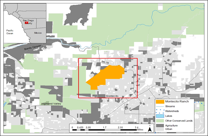
The Preserve is a 955-acre perpetually conserved property located in west-central San Diego County near the town of Ramona. The Preserve is contiguous with the County of San Diego’s Ramona Grasslands County Preserve (Ramona Grasslands) and is located within the original Rancho Valle de Pamo (also called Rancho Santa Maria) Spanish land grant and on historical Kumeyaay land.
Montecito Ranch lies within the North County Multiple Species Conservation Plan (NCMSCP), a draft NCCP area, but was originally slated for development. EHC acquired the 955-acre ranch on June 10,2020, with funding from Section 6 of the Federal Endangered Species Act (ESA) of 1973, as amended. Specifically, two habitat conservation plan land acquisition grants associated with the County of San Diego Multiple Species Conservation Program (MSCP) were awarded funding for the acquisition of land that complements the MSCP and benefits covered listed and unlisted species. The California Wildlife Conservation Board (WCB) provided funding including the requisite non-federal matching funds for Section 6 grants and the U.S. Department of Defense provided 50% of the acquisition cost through its Readiness and Environmental Protection Integration (REPI) program, leveraged additional acquisition funding.
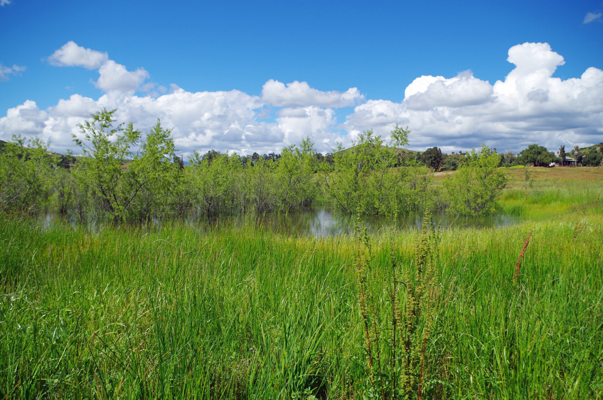
Montecito Ranch supports the federally threatened coastal California gnatcatcher (Polioptila californica californica), federally endangered San Diego fairy shrimp (Branchinecta sandiegoensis) and federally endangered Stephens’ kangaroo rat (Dipodomys stephensi) in addition to providing foraging and wintering habitat for raptors including golden eagle (Aquila chrysaetos canadensis) and other birds, and habitat for reptiles, amphibians, and mammals including American badger (Taxidea taxus). The Preserve supports vernal pools including the rare southern tarplant (Centromadia parryi subsp. australis), oak woodlands including the rare Engelmann oak (Quercus engelmannii), grasslands, coastal sage scrub, and chaparral habitats.
Helping dairy farmers choose climate-smart manure management systems for potential funding from the California Depart of Food and Agriculture through their Alternate Manure Management Program (AMMP)
The CDFA AMMP Project Planning Tool provides California dairy and livestock operators an opportunity to easily visualize an alternative manure management practice that reduces carbon emissions, using simple ways of mapping proposed operations on the farm. The Tool increases access for potential applicants to create maps describing their current and proposed manure management, thus improving their AMMP grant applications, and our ability to review projects efficiently. The CBI team did an amazing job communicating with us regularly, offering suggestions, and helping put our ideas and the rather complex elements of our grant program together into a really beautiful and user-friendly tool.
Alyssa Louie – Senior Environmental Scientist, California Department of Food and Agriculture