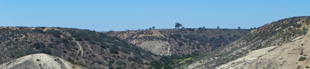
The mission of the Volcan Mountain Preserve Foundation (VMPF) is conservation and stewardship of the majestic 15-mile long Volcan Mountains complex, situated within the Peninsular Ranges of Southern California (Figure 1). The emphasis of VMPF is conserving natural habitats and the species they support, maintaining wilderness values and connections to adjacent open space, preserving archaeological sites, and encouraging natural history-based research and education.
Land conservation in the Volcan Mountains began in 1989; since that time, over 9,000 acres of the former Rutherford Ranch on Volcan Mountain have been acquired by public agencies and non-governmental organizations as protected open space, complemented by conservation of tens of thousands of acres of surrounding lands (Figure 2). However, approximately 1,800 acres of Rutherford Ranch in the heart of the range, between these conserved lands and the Santa Ysabel Indian Reservation on the western flank of the mountain, lie unprotected and are currently threatened with development of estate lots.
VMPF requested that The Nature Conservancy (TNC) and Conservation Biology Institute (CBI) prepare a brief case statement that would provide the basis from which it can develop a focused conservation strategic plan. This case statement describes the landscape that is the inspiration for the VMPF, with a focus on the privately held portions of Rutherford Ranch, by identifying regional conservation values and potential partners for conservation of these values within the context of existing opportunities.
The Sierra Nevada, John Muir’s Range of Light, is a state and national treasure, valued for its scenic beauty, rich biodiversity, ancient forests, unparalleled recreational opportunities, and commercial timber and water resources. The Sierra Nevada supports over 60% of California’s vertebrate species and over half of its plant species. For its size, it is the most floristically diverse area in North America. The Sierra supports 50 million recreational visitor days each year, and its watersheds deliver 65% of the water supply for California residents.
The Peninsular Ranges extend 1,500 km (900 mi) from Southern California to the southern tip of the Baja California peninsula, forming a granitic spine near the western edge of the North American continent. They comprise an intact and rugged wilderness area connecting two countries and some of the richest montane and desert ecosystems in the world that support wideranging, iconic species, including mountain lion, California condor, and bighorn sheep. Connectivity at this continental scale is critical to maintaining ecosystem processes, biodiversity, wildlife movement, and habitat values of existing conservation investments in both countries.
This study was undertaken as part of a larger effort to conserve the integrity of this landscape linkage, in the face of increasing sprawl of development inland from the coast, escalating border security infrastructure, and other competing uses for the land. It focuses on the border region of California and Baja California, where the long-term connectivity between federally endangered bighorn sheep in Peninsular Ranges of Southern California and bighorn sheep in Baja California is threatened. The current level of connectivity and the possibilities for maintaining this connectivity in the future are not well understood. This preliminary study assesses the distribution and habitats of bighorn sheep in the Sierra Juárez in Baja California, just south of the international border, the potential threats to bighorn sheep there, and the threats to this landscape linkage, so as to inform conservation and management strategies for linking protected parklands in both countries.
The Global 200 Strategy amitiously seeks to conserve the variety of species, ecosystems, and ecological and evolutionary processes that sustain life on earth. Toward this end, the World Wildlife Fund hs identified over 200 ecoregions (Global 200) recognized for their high conservation priority, and calls for concentrated conservation planning in these regions. Not surprisingly, of the wide array of ecosystem types included in the Global 200, forest ecosystems constitute the majority. In fact, 87 of the 136 terrestrial ecoregions fall into one of five Major Habitat Types – Tropical and Subtropical Moist Brodleaf Forests, Tropical Dry Forests, Tropical and Sustropical Conifer Forests, Temperate Conifer and Broadleaf Forests, and Boreal Forests and Taiga.
The purpose of this report is threefold: (1) discuss the concept of forest restoration from a conservation biology perspective; (2) outline the ecological characteristics, technical constraints, socio-political and economic influences, and overall restoration principles relevant to the Global 200 major habitat types and associated realms; and (3) place forest restoration within the larger context of worldwide forest conservation.
The critically endangered Pacific pocket mouse (Perognathus longimembris pacificus), feared extinct for over 20 years, was “rediscovered” in 1993 and is now documented at four sites in Orange and San Diego Counties, California. Only one of these sites is considered large enough to be potentially self-sustaining without active intervention. In 1998, I gathered a team of biologists to initiate several research tasks in support of recovery planning for the species. The PPM Studies Team quickly determined that species recovery would require active translocations or reintroductions to establish new populations, but that we knew too little about the biology of P. l. pacificus and the availability of translocation receiver sites to design such a program. Recovery research from 1998 to 2000 therefore focused on (1) a systematic search for potential translocation receiver sites; (2) laboratory and field studies on non-listed, surrogate subspecies (P. l. longimembris and P. l. bangsi) to gain biological insights and perfect study methods; (3) studies on the historic and extant genetic diversity of P. l. pacificus; and (4) experimental habitat manipulations to increase P. l. pacificus populations. Using existing geographic information system (GIS) data, we identified sites throughout the historic range that might have appropriate soils and vegetation to support translocated P. l. pacificus. Reconnaissance surveys of habitat value were completed in all large areas of potential habitat identified by the model. Those sites having the highest habitat potential are being studied with more detailed and quantitative field analyses. The surrogate studies helped us design individual marking and monitoring methods and will be used to test translocation methods before applying them to P. l. pacificus. Genetic results suggest that P. l. pacificus populations were naturally fairly isolated from one another prior to modern development, that genetic diversity will continue to erode in the small populations that remain, and that individuals from extant populations could probably be mixed if maximizing genetic diversity in any newly established populations is an important recovery goal. Local populations should be increased in situ before they can supply donor animals for translocations. Experimental habitat management (shrub thinning) at one occupied site yielded a short-term, positive, behavioral response of mice to thinned habitat plots. However, the overall population seems to be in decline, and long-term population responses to habitat manipulations are not yet evident. The approach of the PPM Study Team has been to proceed cautiously and scientifically to obtain critical information and to design a translocation program, but we are prepared to recommend swift action to prevent extinction despite “insufficient data.” At this point, political and economic obstacles to species recovery seem larger than obstacles presented by scientific uncertainty.
Spencer, W.D. 2005. Recovery research for the endangered Pacific pocket mouse: An overview of collaborative studies. In B.E. Kus and J.L. Beyers, technical coordinators. Planning for Biodiversity: Bringing Research and Management Together: Proceedings of a Symposium for the South Coast Ecoregion. Gen. Tech. Rep. PSW-GTR-195. Pacific Southwest Research Station, Forest Service, U.S. Department of Agriculture, Albany, CA: 274pp.
Tejon Ranch is one of California’s most precious natural areas—a haven for rare and endangered species, a sanctuary for the soul of ancient California, a treasure that, through the years, has not escaped the wonderment of ranchers, hunters, wildlife enthusiasts, and scientists. This is a place through which thousands of people drive daily, but few have really seen; where one can visualize the dramatic geologic processes that shaped California’s landscape and influenced the evolutionary history of California’s diverse flora and fauna. In this place, California condors still fly, centuries-old oaks still flourish, and streams are born. Perhaps most remarkably, virtues of this place have not yet been compromised by the urban sprawl that is rapidly devouring so much of California’s natural landscape.
Tejon Ranch, 270,000 acres of southern Kern and northern Los Angeles counties, is the largest, contiguous, privately owned property in California. Owners of the Ranch are currently planning large-scale residential and industrial developments in what is now a largely undeveloped and natural landscape. Concerned that these development plans might severely compromise the Ranch’s ecological integrity before the public has had an opportunity to understand its significance, Environment Now and a coalition of environmental groups commissioned the Conservation Biology Institute to assess the regional and statewide value of Tejon Ranch for conservation of biological diversity. Through the course of this assessment, we have come to recognize what others have already suggested—that Tejon Ranch is truly one of California’s most priceless natural areas, unparalleled in its diversity of natural resources and its importance to conservation, and meeting all of the State’s criteria for a priority conservation target.
This report shares our synthesis of publicly available information—documenting the biogeographic importance of the Tejon Ranch region, revealing the values of the region’s natural resources, and identifying factors that threaten these values. This report does not advocate any specific open space design, but rather it illuminates the extraordinary values and regionally under-protected resources of the Ranch so that the public and decision-makers are fully aware of their importance in future land planning decisions. We hope that this information will be used as a basis for comprehensive, rather than piecemeal, land use planning of Tejon Ranch.
Tejon Ranch supports a multitude of irreplaceable biological resources, and the melding of these resources in one large, intact landscape makes the Ranch a regionally significant conservation target. This report evaluates the distribution of conservation values on Tejon Ranch, as an incremental step towards developing a regional reserve design.
We used publicly available data and science-based conservation principles to describe and map selected conservation values for Tejon Ranch. Our assessment demonstrates that, although different areas of the Ranch support different sets of conservation values, virtually all areas of the Ranch support one or more sets of values. To spatially describe the distribution of these values on Tejon Ranch, we identified four landscape units that differentially support the conservation values considered in our analysis:
- Lowland grasslands and oak savannas of the San Joaquin Valley (108,244 acres)
- Closed-canopy oak woodland, montane hardwood, and montane hardwood-conifer communities on the northwest slope of the Tehachapi Mountains (81,836 acres)
- Oak woodland, chaparral, and pinyon-juniper communities on the southeast slope of the Tehachapi Mountains (26,518 acres)
- Lowland Joshua tree woodland, grassland, and desert scrub communities of the Mojave Desert (53,613 acres)
Reserve designs for Tejon Ranch must, at a minimum, capture these values while ensuring the maintenance and management of ecological processes within and between landscape units. Similarly, conservation planning must ensure integration and connection of these landscape units with others in the region, along with a regional plan for long-term management and biological monitoring. Without careful and comprehensive consideration, land use plans for Tejon Ranch could irretrievably alter the biological functions and values of this keystone landscape.
The 270,750-acre Tejon Ranch is the largest contiguous tract of privately owned land in California. In addition to its outstanding core biological resource values, the Ranch represents a biogeographic crossroads of many Californias—the Sierra Nevada, the PacificCoast, the Mojave Desert, and the Great Central Valley. It represents the last intact connection among these ecoregions for numerous plants and animals that cannot cross water, intensive agriculture, or urban development. Unfortunately, it is also currently subject to development proposals that threaten to destroy the ecological integrity of this remarkable legacy.
Given the size, integrity, and geographic context of Tejon Ranch, and the regional significance of its resources, virtually all of Tejon Ranch merits protection for future generations.Therefore, we strongly urge a regional conservation solution for Tejon Ranch that is worthy of its irreplaceable resource values, cultural significance, and heritage of the citizens of California. It is in this spirit that we propose a wildland reserve design for the Ranch that captures the broad array of landscape functions and conservation values that it supports.
Bahía de San Quintín is the largest and only intact coastal lagoon system in the entire Mediterranean zone of North America. It is among the richest, most diverse, and most imperiled ecosystems on the planet, supporting dozens of species designated as Threatened or Endangered. Hidden in the fog on the windy Pacific Coast of Baja California, this sequestered spot is recognized worldwide for its biodiversity and its hemispheric importance to fisheries, waterfowl, migratory birds, and other coastal resources. The pristine condition of these ecosystems resembles that of Southern California more than 100 years ago, before their destruction and degradation due to population growth.
The survival of this remarkable landscape, however, is threatened by development pressures from a growing population and the thrust of tourism southward from the U.S. border. Like much of Baja California, the area does not have the infrastructure in place to support this growth or a complete recognition of its consequences on natural resources and the local economy. Sustainable use of the area’s rich natural resources is vital to continued agriculture and aquaculture operations, tourism, and community growth. This document presents a vision for addressing these conservation and socioeconomic challenges through new partnerships and an integrative approach to conservation and management of natural resources within a sustainable human community.
This document provides an introduction to the intersecting cultural and biological conservation values of Rancho Guejito—its cultural history, rare biological resources, its ecological functions within surrounding conserved areas, its significance to past, present, and future generations of Californians—and a plea for conservation of the irreplaceable values it supports, the loss of which cannot be mitigated elsewhere:
- Rancho Guejito represents a geographical and cultural bridge between the coastal and mountain settlement patterns of Indians. The oaks and grasslands represented on the hills and valleys of Rancho Guejito provided sufficient resources to support large populations of different Indian groups.
- The cultural legacy of Rancho Guejito, and the natural resources that are intertwined in this legacy, are preserved to a remarkable degree, undisturbed in their original natural setting and context, providing significant research and interpretive opportunities, as well as a captivating story of our past.
- Rancho Guejito is the last remaining intact Mexican land grant and retains a historical landscape representing the earliest ranching in Southern California. The historic features and sites remain relatively untouched and still within their original setting, providing a once-in-a-lifetime opportunity for research, education, and interpretation.
- Nestled in the foothills of the Peninsular Ranges, Rancho Guejito is an ecological gateway to the high elevation habitats of the Cleveland National Forest—representing both a linkage to lower elevation coastal habitats and a landscape critical to supporting ecosystem functions and wilderness values of existing conservation investments.
- Rancho Guejito is part of a large ecological core area, whose integrity is essential to maintaining ecological processes that vegetation and wildlife communities depend on, such as natural hydrological and fire regimes, which require large landscapes to function.
- High integrity watersheds on Rancho Guejito support intact hydrologic processes and high water quality, which are crucial to the long-term viability of existing conservation investments in the San Pasqual Valley. Guejito Creek on the property supports designated Critical Habitat for a population of the endangered arroyo toad.
- Ranch Guejito supports a diverse assemblage of over 20 vegetation communities, including many communities not well protected in the ecoregion, such as oak savannas, grasslands, alkali meadows, and vernal pools, and some of the largest individual trees and largest stands of Engelmann oak woodlands in San Diego County.
- The large expanse of rolling grasslands on Rancho Guejito supports at least 16 different raptor species and one of the largest remaining populations of the endangered Stephens’ kangaroo rat. Rancho Guejito could play a critical role in the persistence and recovery of this imperiled species, because its population represents a unique genetic legacy.
- In its location at the urban-wildland interface, Rancho Guejito provides unique aesthetic recreational, educational, and spiritual opportunities for millions of people living in Southern California and represents an opportunity to protect quality of life in the face of rapid land use changes. These values have already been lost in much of Southern California and western San Diego County and can never be restored.