
Abstract
An increasing amount of California’s landscape has burned in wildfires in recent decades, in conjunction with increasing temperatures and vapor pressure deficit due to climate change. As the wildland–urban interface expands, more people are exposed to and harmed by these extensive wildfires, which are also eroding the resilience of terrestrial ecosystems. With future wildfire activity expected to increase, there is an urgent demand for solutions that sustain healthy ecosystems and wildfire-resilient human communities. Those who manage disaster response, landscapes, and biodiversity rely on mapped projections of how fire activity may respond to climate change and other human factors. California wildfire is complex, however, and climate–fire relationships vary across the state. Given known geographical variability in drivers of fire activity, we asked whether the geographical extent of fire models used to create these projections may alter the interpretation of predictions. We compared models of fire occurrence spanning the entire state of California to models developed for individual ecoregions and then projected end-of-century future fire patterns under climate change scenarios. We trained a Maximum Entropy model with fire records and hydroclimatological variables from recent decades (1981 to 2010) as well as topographic and human infrastructure predictors. Results showed substantial variation in predictors of fire probability and mapped future projections of fire depending upon geographical extents of model boundaries. Only the ecoregion models, accounting for the unique patterns of vegetation, climate, and human infrastructure, projected an increase in fire in most forested regions of the state, congruent with predictions from other studies.
By disrupting wildfire regimes, climate and land use change transform ecosystems, alter carbon budgets, and drive socio-economic impacts in California. We propose to quantify how projected peri-urban growth in the wildland urban interface, climate change, and local management actions influence wildfire activity and downstream effects on vegetation transitions, carbon release, biodiversity, and vulnerable human communities.
We will model wildfire risk as a function of a limited set of stakeholder-guided, realistic future scenarios, using the LANDIS-II simulation model. Past studies have shown the importance of human ignition location and timing on wildfire activity in Southern California, a mechanism we will explore using different land use change scenarios.
We will also model and analyze the potential influence of increasing atmospheric aridity on fire size and severity in forests and compare these effects to adjacent shrubland plant communities.
Taken together, climate, land use, and other environmental variables can lead to fire-driven vegetation type conversion, which can influence carbon sequestration, biodiversity, and even future fire risk to human communities.
Finally, we will explicitly evaluate how different modeled management actions influence wildfire, plant succession, and carbon sequestration. The resulting maps and spatial products will help managers prioritize locations for conservation and management actions. Overlaying maps of vulnerable human communities and biodiversity hotspots with future wildfire change and downstream impacts can better define locations for priority action to facilitate co-benefits to human and natural resources. This research will contribute to scientific publications and be directly relevant to managers, including the Southern California Montane Forests Project.
The San Diego Zoo Wildlife Alliance (SDZWA) is a world-renowned conservation organization with a 1800-acre zoo, the Safari Park, that houses more than 2600 animal and 3500 plant species. Located in Escondido (northern San Diego County), the Safari Park also includes a 800-acre biodiversity preserve with some of the most well-preserved, California-endemic coastal sage habitat.
In 2007, the Witch fire burned through 600 acres of the biodiversity reserve and stopped just outside the Safari Park borders. Since then, the SDZWA has transformed their in-house wildfire preparedness program, including hiring a team of dedicated wildfire suppression staff, fire suppression equipment boxes scattered throughout the park, an infrared and visible spectrum camera array for early ignition detection, and a 8500-gallon water tank for aerial suppression by local first responders.
While these investments in wildfire readiness are important for protecting the Safari Park grounds, landscape-scale risk analyses are needed to determine where fires may start and spread outside of park boundaries and which additional management activities could mitigate risk from fires originating beyond Park borders. Conservation Biology Institute (CBI) and Dudek have proposed to co-create the needed wildfire risk analysis for the SDZWA Safari Park.
At the core of the risk analysis is a fusion and comparison between two commonly employed modeling efforts used in
Roads Drive Tropical Forest Biodiversity Loss
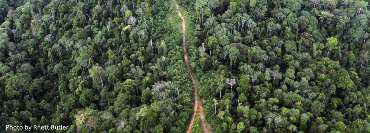
There are around 40 million miles of roads in the world with another 15.5 million miles projected to be added by 2050, which is the fastest expansion rate of road building in history. Roads continue to be constructed around the world including the U.S., which leads the world in the number of linear miles (>7 million miles), but the most recent concentration of new road building is in the tropical nations. Even more troubling is that many roads are being constructed informally or illegally and, therefore, do not appear on any map. These are sometimes referred to as “ghost roads”.
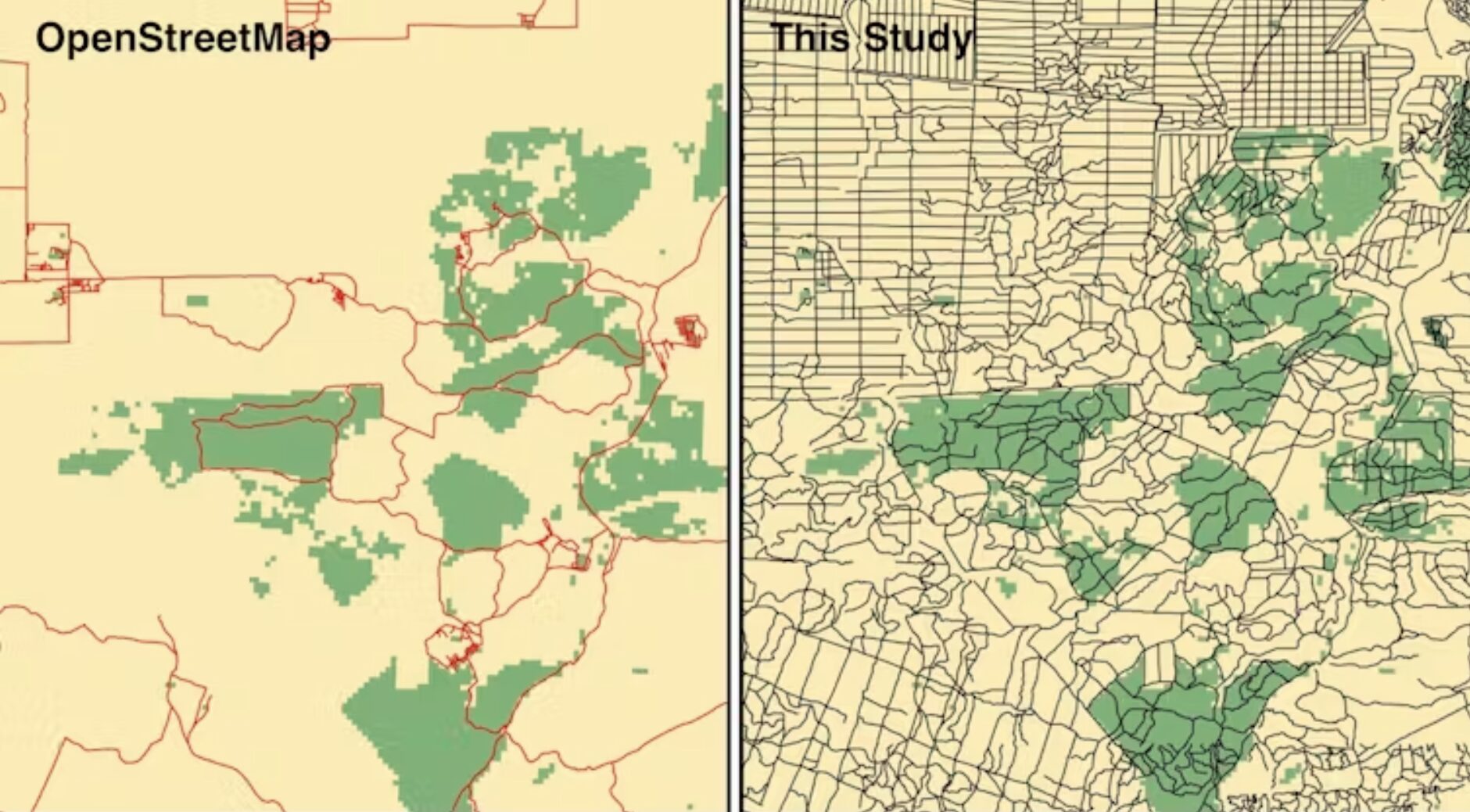
In a recent article in Nature, the authors conducted a study on roads in the Asia-Pacific region and found 3.0 to 6.6 times more roads exist than are shown in any leading roads dataset. These ghost roads are being built to gain access to pristine tropical forest areas for various purposes: agriculture expansion, logging, mining, poaching, and land speculators – all with serious ecological consequences. Roads were shown to be the strongest correlate to deforestation out of 38 potential variables. The authors conclude that “ghost roads are among the gravest of all direct threats to tropical forests.”
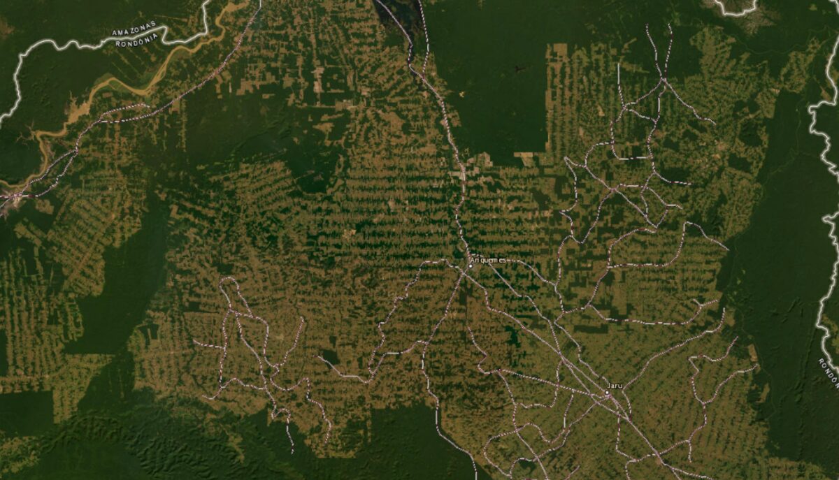
Unfortunately, the Asia-Pacific Region is not alone. The same issue has been recorded in many other parts of the world (e.g., the Amazon region and Congo Basin).
Of course, roads are a vital infrastructure for modern societies, so where should they go? An article by Distinguished Research Professor Bill Laurance, published in The Conversation, describes a global strategy for road building. Bill and his coauthors intersected areas of relative environmental value with areas of relative agricultural potential identifying priority areas for both and where in the world these two uses are in conflict.
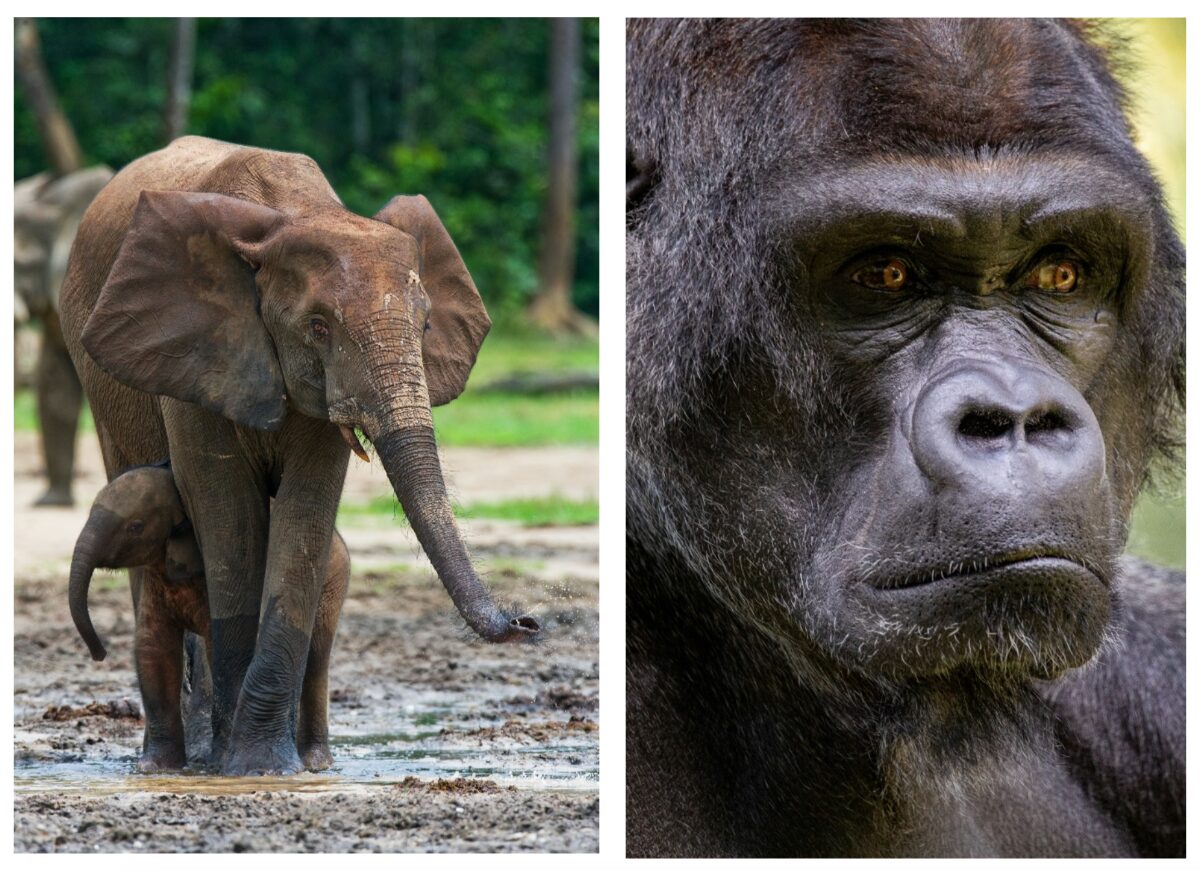
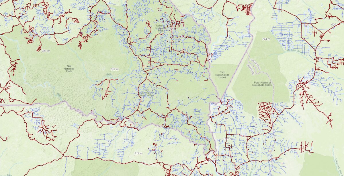
Improving road networks in areas of high agricultural potential and low environmental value are good candidates as they have immediate value to local people. In the high environmental value areas, especially in direct conflict with potential new agricultural land, it would be wise to avoid the first cut into these areas as once there is an initial access road constructed many more roads rapidly follow with serious consequences to the local biodiversity. For example, in the Congo region of Africa, 60 percent of the forest elephant population has been lost over the last decade and the critically endangered eastern lowland gorilla (Grauer’s Gorilla) population is estimated to be 6,800 individuals.
New Publication: Chile’s Valparaíso hills on fire
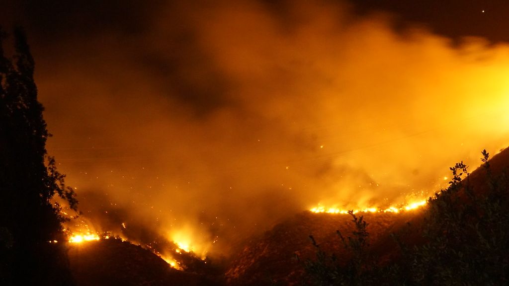
Our Senior Research Scientist, Alexandra Syphard, is a co-author of the paper in Science, Chile’s Valparaíso hills on fire, which highlights human-caused ignitions, flammable plantations, and prolonged droughts making Chile one of the most fire-prone places in the world. A record-breaking Chile wildfire in February destroyed thousands of homes, caused 133 human fatalities, and burned thousands of hectares of stressed vegetation. Wildfire mitigation in Chile will require many steps, including (1) governance and land-use planning, (2) restoring and managing native forest vegetation, (3) removing highly flammable forest plantations, (4) prohibiting the conversion of recently burned native forests into exotic forest plantations or new urban developments, and (5) strengthening fire prevention programs in Chile helping reduce human-caused ignitions.
The Central Oregon Forest Stewardship Foundation (COFSF) mission is to increase quality and quantity of forest restoration and stewardship in Central Oregon. As part of this effort, we have created a geospatial gateway with a rich amount of information on forests, wildlife, wildfire, and climate in the area. The gateway is a customized portal that allows users exclusive access to CBI’s Data Basin and is being used for planning, implementing, and monitoring science-driven forest restoration and stewardship activities by a diverse group of partners.
COFSF embraces Shared Stewardship for Central Oregon which “challenges groups to engage in proactive planning and, in so doing, to identify a broader range of potential partners and to consider a wider array of conservation concerns. Partners work together to make decisions about priority projects and design, implement, and monitor work among multiple partners, across multiple jurisdictions, and address a wider array of conservation issues.”

Data Basin is a key enabler of this shared stewardship by providing an open and freely accessible platform to enable many siloed restoration projects to address the larger ecosystem needs and priorities. It empowers diverse stakeholders to collaborate and communicate with each other enabling multiple and durable benefits across the landscape.
The Giant Sequoia Lands Coalition (GSLC) is a collaboration of public and non-governmental organizations committed to the conservation of giant sequoia grove ecosystems. CBI is supporting the GSLC’s Sequoia Grove Protection and Resiliency Project with tools and assistance that will enable GSLC partners and stakeholders to work collaboratively to protect the species from the impacts of drought, beetles, and wildfire made more intense by climate change.
CBI is using its Data Basin platform (databasin.org) to host the Giant Sequoia Data Portal. The portal will be populated with custom maps of the sequoia groves linked to standard metrics and data for assessing grove condition, fuel treatments, and other range-wide information. To inform this giant sequoia management “dashboard” CBI is working with the GSLC to catalog an extensive collection of assessment, monitoring, and remote sensing datasets created by different agencies and projects over many decades of forest management and research. CBI will train and support the GSLC partners in their use of the Giant Sequoia Data Portal for promoting coordinated scientific research, monitoring, long-term species conservation, and continuing to share new data as it becomes available.

Abstract:
Many plant species are likely to face population decline or even extinction in the coming century, especially those with a limited distribution and inadequate dispersal relative to the projected rates of climate change. The obligate seeding California endemic, Ceanothus perplexans is especially at risk, and depending on how climate change interacts with altered fire regimes in Southern California, certain populations are likely to be more at risk than others. To identify which areas within the species’ range might need conservation intervention, we modeled population dynamics of C. perplexans under various climate and fire regime change scenarios, focusing on spatially explicit patterns in fire frequency. We used a species distribution model to predict the initial range and potential future habitat, while adapting a density-dependent, stage-structured population model to simulate population dynamics. As a fire-adapted obligate seeder, simulated fire events caused C. perplexans seeds to germinate, but also killed all adults in the population. Our simulations showed that the total population would likely decline under any combination of climate change and fire scenario, with the species faring best at an intermediate fire return interval of around 30–50 years. Nevertheless, while the total population declines least with a 30–50 year fire return interval, the effect of individual subpopulations varies depending on spatially explicit patterns in fire simulations. Though climate change is a greater threat to most subpopulations, increased fire frequencies particularly threatened populations in the northwest of the species’ range closest to human development. Subpopulations in the mountainous southern end of the range are likely to face the sharpest declines regardless of fire. Through a combination of species distribution modeling, fire modeling, and spatially explicit demographic simulations, we can better prepare for targeted conservation management of vulnerable species affected by global change.
Abstract:
Large-scale, abrupt ecosystem change in direct response to climate extremes is a critical but poorly documented phenomenon1. Yet, recent increases in climate-induced tree mortality raise concern that some forest ecosystems are on the brink of collapse across wide environmental gradients. Here we assessed climatic and productivity trends across the world’s five Mediterranean forest ecosystems from 2000 to 2021 and detected a large-scale, abrupt forest browning and productivity decline in Chile (>90% of the forest in <100 days), responding to a sustained, acute drought. The extreme dry and warm conditions in Chile, unprecedented in the recent history of all Mediterranean-type ecosystems, are akin to those projected to arise in the second half of the century4. Long-term recovery of this forest is uncertain given an ongoing decline in regional water balance. This dramatic plummet of forest productivity may be a spyglass to the future for other Mediterranean ecosystems.
Abstract:
Wildfires can be devastating for social and ecological systems, but the recovery period after wildfire presents opportunities to reduce future risk through adaptation. We use a collective case study approach to systematically compare social and ecological recovery following four major fire events in Australia and the United States: the 1998 wildfires in northeastern Florida; the 2003 Cedar fire in southern California; the 2009 Black Saturday bushfires in Victoria, southeastern Australia; and the 2011 Bastrop fires in Texas. Fires spurred similar policy changes, with an emphasis on education, land use planning, suppression/emergency response, and vegetation management. However, there was little information available in peer-reviewed literature about social recovery, ecological recovery was mostly studied short term, and feedbacks between social and ecological outcomes went largely unconsidered. Strategic and holistic approaches to wildfire recovery that consider linkages within and between social–ecological systems will be increasingly critical to determine if recovery leads to adaptation or recreates vulnerability.
Abstract:
There are growing concerns about increases in the size, frequency, and destructiveness of wildfire events. One commonly used mitigation strategy is the creation and maintenance of defensible space, a zone around buildings where vegetation is managed to increase potential for structures to survive during wildfires. Despite widespread acceptance and advocacy of defensible space, few studies provide empirical evidence documenting the efficacy of different fuel modification practices under real wildfire conditions. The 2018 Woolsey Fire in Los Angeles County, California, occurred a short time after high-resolution (0.07 m2) land cover data were created, providing a unique opportunity to quantify vegetation before the fire. We integrated measurements from this high-resolution land cover data with parcel data, building attributes, and environmental context. We then used Random Forests models to analyze the extent to which these factors predicted structure loss in the wildfire. Variable importance scores showed vegetation around buildings was not a strong predictor of building-level damage outcomes compared to building materials and landscape features such as paved land cover per parcel, elevation, building density, and distance to road networks. Among building materials, multi-paned windows and enclosed eaves were most highly associated with building survival. These results are consistent with other studies that conclude building materials and environmental context are more related to survivorship than defensible space.