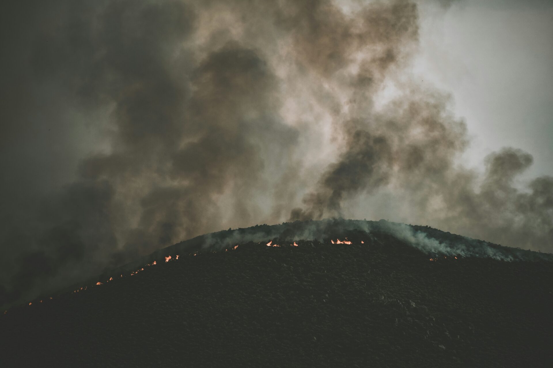
Wildfire is globally an important ecological disturbance affecting biochemical cycles and vegetation composition, but also puts people and their homes at risk. Suppressing wildfires has detrimental ecological effects and can promote larger and more intense wildfires when fuels accumulate, which increases the threat to buildings in the wildland–urban interface (WUI). Yet, when wildfires occur, typically only a small proportion of the buildings within the fire perimeter are lost, and the question is what determines which buildings burn. Our goal was to examine which factors are related to building loss when awildfire occurs throughout the United States. We were particularly interested in the relative roles of vegetation, topography, and the spatial arrangement of buildings, and how their respective roles vary among ecoregions. We analyzed all fires that occurred within the conterminous United States from 2000 to 2010 and digitized which buildings were lost and which survived according to Google Earth historical imagery. We modeled the occurrence as well as the percentage of buildings lost within clusters using logistic and linear regression. Overall, variables related to topography and the spatial arrangement of buildings were more frequently present in the best 20 regression models than vegetation-related variables. In other words, specific locations in the landscape have a higher fire risk, and certain development patterns can exacerbate that risk. Fire policies and prevention efforts focused on vegetation management are important, but insufficient to solve current wildfire problems. Furthermore, the factors associated with building loss varied considerably among ecoregions suggesting that fire policy applied uniformly across the United States will not work equally well in all regions and that efforts to adapt communities to wildfires must be regionally tailored.
Although wildfire plays an important role in maintaining biodiversity in many ecosystems, fire management to protect human assets is often carried out by different agencies than those tasked for conserving biodiversity. In fact, fire risk reduction and biodiversity conservation are often viewed as competing objectives. Here we explored the role of management through private land conservation and asked whether we could identify private land acquisition strategies that fulfill the mutual objectives of biodiversity conservation and fire risk reduction, or whether the maximization of one objective comes at a detriment to the other. Using a fixed budget and number of homes slated for development, we simulated 20 years of housing growth under alternative conservation selection strategies, and then projected the mean risk of fires destroying structures and the area and configuration of important habitat types in San Diego County, California, USA. We found clear differences in both fire risk projections and biodiversity impacts based on the way conservation lands are prioritized for selection, but these differences were split between two distinct groupings. If no conservation lands were purchased, or if purchases were prioritized based on cost or likelihood of development, both the projected fire risk and biodiversity impacts were much higher than if conservation lands were purchased in areas with high fire hazard or high species richness. Thus, conserving land focused on either of the two objectives resulted in nearly equivalent mutual benefits for both. These benefits not only resulted from preventing development in sensitive areas, but they were also due to the different housing patterns and arrangements that occurred as development was displaced from those areas. Although biodiversity conflicts may still arise using other fire management strategies, this study shows that mutual objectives can be attained through land-use planning in this region. These results likely generalize to any place where high species richness overlaps with hazardous wildland vegetation.
Historical data are essential for understanding how fire activity responds to different drivers. It is important that the source of data is commensurate with the spatial and temporal scale of the question addressed, but fire history databases are derived from different sources with different restrictions. In California, a frequently used fire history datase is the State of California Fire and Resource Assessment Program (FRAP) fire history database, which circumscribes fire perimeters at a relatively fine scale. It includes large fires on both state and federal lands but only covers fires that were mapped or had other spatially explicit data. A different database is the state and federal governments’ annual reports of all fires. They are more complete than the FRAP database but are only spatially explicit to the level of county (California Department of Forestry and Fire Protection – Cal Fire) or forest (United States Forest Service – USFS). We found substantial differences between the FRAP database and the annual summaries, with the largest and most consistent discrepancy being in fire frequency. The FRAP database missed the majority of fires and is thus a poor indicator of fire frequency or indicators of ignition sources. The FRAP database is also deficient in area burned, especially before 1950. Even in contemporary records, the huge number of smaller fires not included in the FRAP database account for substantial cumulative differences in area burned. Wildfires in California account for nearly half of the western United States fire suppression budget. Therefore, the conclusions about data discrepancies and the implications for fire research are of broad importance.
The purchase of private land for conservation purposes is a common way to prevent the exploitationvof sensitive ecological areas. However, private land conservation can also provide other benefits, one of these being natural hazard reduction. Here, we investigated the impacts of private land conservation on fire risk to homes in San Diego County, California. We coupled an econometric land use change model with a model that estimates the probability of house loss due to fire in order to compare fire risk at the county and municipality scale under alternative private land purchasing schemes and over a 20 year time horizon. We found that conservation purchases could reduce fire risk on this landscape, and the amount of risk reduction was related to the targeting approach used to choose which parcels were conserved. Conservation land purchases thattargeted parcels designated as high fire hazard resulted in lower fire risk to homes than purchases that targeted low costs or high likelihood to subdivide. This result was driven by (1) preventing home placementin fire prone areas and (2)taking land offthe market, and hence increasing development densities in other areas. These results raise the possibility that resource conservation and fire hazard reduction may benefit from combining efforts. With adequate planning, future conservation purchases could have synergistic effects beyond just protecting ecologically sensitive areas.
Chapter 7 of The Ecological Importance of Mixed-Severity Fires: Nature’s Phoenix, edited by Dominick A. DellaSala and Chad T. Hanson
The dynamic global vegetation model (DGVM) MC2 was run over the conterminous US at 30arc sec (~800m) to simulate the impacts of nine climate futures generated by 3GCMs (CSIRO, MIROC and CGCM3) using 3 emission scenarios (A2, A1B, B1) in the context of the LandCarbon national carbon sequestration assessment. It first simulated potential vegetation dynamics from coast to coast assuming no human impacts and naturally occurring wildfires. A moderate effect of increased atmospheric CO2 on water use efficiency and growth enhanced carbon sequestration but did not greatly influence woody encroachment. The wildfires maintained prairie-forest ecotones in the Great Plains. With simulated fire suppression, the number and impacts of wildfires was reduced since only catastrophic fires were allowed to escape. This greatly increased the expansion of forests and woodlands across the western US and some of the ecotones disappeared. However, when fires did occur their impacts (both extent and biomass consumed) were very large. We also evaluated the relative influence of human land use including forest and crop harvest by running the DGVM with land use (and fire suppression) and simple land management rules. From 2041 through 2060, carbon stocks (live biomass, soil and dead biomass) of US terrestrial ecosystems varied between 155 and 162 Pg C across the three emission scenarios when potential natural vegetation was simulated. With land use, periodic harvest of croplands and timberlands as well as the prevention of woody expansion across the West reduced carbon stocks to a range of 122-126 Pg C while effective fire suppression reduced fire emissions by about 50%. Despite the simplicity of our approach, the differences between the size of the carbon stocks confirm other reports of the importance of land use on the carbon cycle over climate change.
Climate change adaptation and mitigation require understanding of vegetation response to climate change. Using the MC2 dynamic global vegetation model (DGVM) we simulate vegetation for the Northwest United States using results from 20 different Climate Model Intercomparison Project Phase 5 (CMIP5) models downscaled using the MACA algorithm. Results were generated for representative concentration pathways (RCPs) 4.5 and 8.5 under vegetation modeling scenarios with and without fire suppression for a total of 80 model runs for future projections. For analysis, results were aggregated by three subregions: the Western Northwest (WNW), from the crest of the Cascade Mountains west; Northwest Plains and Plateau (NWPP), the non-mountainous areas east of the Cascade Mountains; and Eastern Northwest Mountains (ENWM), the mountainous areas east of the Cascade Mountains. In the WNW, mean fire interval (MFI) averaged over all climate projections decreases by up to 48%, and potential vegetation shifts from conifer to mixed forest under RCP 4.5 and 8.5 with and without fire suppression. In the NWPP MFI averaged over all climate projections decreases by up to 82% without fire suppression and increases by up to 14% with fire suppression resulting in woodier vegetation cover. In the ENWM, MFI averaged across all climate projections decreases by up to 81%, subalpine communities are lost, but conifer forests continue to dominate the subregion in the future.
Context
Wildfires destroy thousands of buildings every year in the wildland urban interface. However, fire typically only destroys a fraction of the buildings within a given fire perimeter, suggesting more could be done to mitigate risk if we understood how to configure residential landscapes so that both people and buildings could survive fire.
Objectives
Our goal was to understand the relative importance of vegetation, topography and spatial arrangement of buildings on building loss, within the fire’s landscape context.
Methods
We analyzed two fires: one in San Diego, CA and another in Boulder, CO. We analyzed Google Earth historical imagery to digitize buildings exposed to the fires, a geographic information system to measure some of the explanatory variables, and FRAGSTATS to quantify landscape metrics. Using logistic regression we conducted an exhaustive model search to select the best models.
Results
The type of variables that were important varied across communities. We found complex spatial effects and no single model explained building loss everywhere, but topography and the spatial arrangement of buildings explained most of the variability in building losses. Vegetation connectivity was more important than vegetation type.
Conclusions
Location and spatial arrangement of buildings affect which buildings burn in a wildfire, which is important for urban planning, building siting, landscape design of future development, and to target fire prevention, fuel reduction, and homeowner education efforts in existing communities. Landscape context of buildings and communities is an important aspect of building loss, and if taken into consideration, could help communities adapt to fire.
With the potential for worsening fire conditions, discussion is escalating over how to best reduce effects on urban communities. A widely supported strategy is the creation of defensible space immediately surrounding homes and other structures. Although state and local governments publish specific guidelines and requirements, there is little empirical evidence to suggest how much vegetation modification is needed to provide significant benefits. We analysed the role of defensible space by mapping and measuring a suite of variables on modern pre-fire aerial photography for 1000 destroyed and 1000 surviving structures for all fires where homes burned from 2001 to 2010 in San Diego County, CA, USA. Structures were more likely to survive a fire with defensible space immediately adjacent to them. The most effective treatment distance varied between 5 and 20 m (16–58 ft) from the structure, but distances larger than 30 m (100 ft) did not provide additional protection, even for structures located on steep slopes. The most effective actions were reducing woody cover up to 40% immediately adjacent to structures and ensuring that vegetation does not overhang or touch the structure. Multiple-regression models showed landscape-scale factors, including low housing density and distances to major roads, were more important in explaining structure destruction. The best long-term solution will involve a suite of prevention measures that include defensible space as well as building design approach, community education and proactive land use planning that limits exposure to fire.
The increasing extent of wildfires has prompted investigation into alternative fire management approaches to complement the traditional strategies of fire suppression and fuels manipulation. Wildfire prevention through ignition reduction is an approach with potential for success, but ignitions result from a variety of causes. If some ignition sources result in higher levels of area burned, then ignition prevention programmes could be optimised to target these distributions in space and time. We investigated the most common ignition causes in two southern California sub-regions, where humans are responsible for more than 95% of all fires, and asked whether these causes exhibited distinct spatial or intra-annual temporal patterns, or resulted in different extents of fire in 10–29-year periods, depending on sub-region. Different ignition causes had distinct spatial patterns and those that burned the most area tended to occur in autumn months. Both the number of fires and area burned varied according to cause of ignition, but the cause of the most numerous fires was not always the cause of the greatest area burned. In both sub-regions, power line ignitions were one of the top two causes of area burned: the other major causes were arson in one sub-region and power equipment in the other. Equipment use also caused the largest number of fires in both sub-regions. These results have important implications for understanding why, where and how ignitions are caused, and in turn, how to develop strategies to prioritise and focus fire prevention efforts. Fire extent has increased tremendously in southern California, and because most fires are caused by humans, ignition reduction offers a potentially powerful management strategy, especially if optimised to reflect the distinct spatial and temporal distributions in different ignition causes.