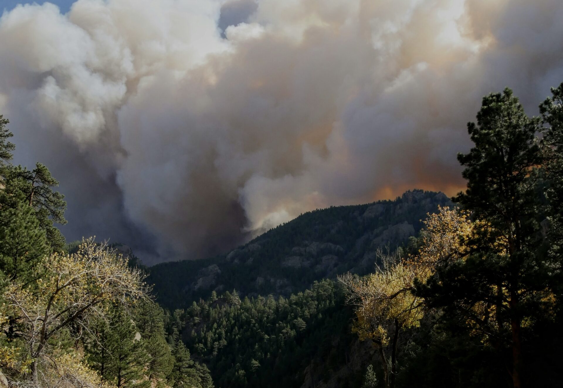
Fuel treatment of wildland vegetation is the primary approach advocated for mitigating fire risk at the wildland–urban interface (WUI), but little systematic research has been conducted to understand what role fuel treatments play in controlling large fires, which factors influence this role, or how the role of fuel treatments may vary over space and time. We assembled a spatial database of fuel breaks and fires from the last 30 years in four southern California national forests to better understand which factors are consistently important for fuel breaks in the control of large fires. We also explored which landscape features influence where fires and fuel breaks are most likely to intersect. The relative importance of significant factors explaining fuel break outcome and number of fire and fuel break intersections varied among the forests, which reflects high levels of regional landscape diversity. Nevertheless, several factors were consistently important across all the forests. In general, fuel breaks played an important role in controlling large fires only when they facilitated fire management, primarily by providing access for firefighting activities. Fire weather and fuel break maintenance were also consistently important. Models and maps predicting where fuel breaks and fires are most likely to intersect performed well in the regions where the models were developed, but these models did not extend well to other regions, reflecting how the environmental controls of fire regimes vary even within a single ecoregion. Nevertheless, similar mapping methods could be adopted in different landscapes to help with strategic location of fuel breaks. Strategic location of fuel breaks should also account for access points near communities, where fire protection is most important.
The diverse vegetation types and carbon pools of the U.S. Pacific Northwest (PNW) are tightly coupled to fire regimes that depend on climate and fire suppression. To realistically assess the effects of twenty first century climate change on PNW fire and carbon dynamics, we developed a new fire suppression rule for the MC1 dynamic general vegetation model that we ran under three climate change scenarios. Climate projections from the CSIRO Mk3, MIROC 3.2 medres, and Hadley CM3 general circulation models, forced by the A2 CO2 emissions scenario, were downscaled to a 30 arc?second (∼0.6 km2) grid. Future climates amplify the already strong seasonality of temperature and precipitation across the domain. Simulations displayed large increases in area burned (76%–310%) and burn severities (29%–41%) by the end of the twenty?first century. The relatively dry ecosystems east of the Cascades gain carbon in the future despite projections of more intense wildfires, while the mesic maritime forests lose up to 1.2 Pg C from increased burning. Simulated fire suppression causes overall carbon gains yet leaves ecosystems vulnerable to large future fires. Overall, our simulations suggest the Pacific Northwest has the potential to sequester ∼1 Pg C over the next century unless summer droughts severely intensify fire regimes.
Chaparral shrublands in southern California, US, exhibit significant biodiversity but are prone to large,intense wildfires. Debate exists regarding fuel reduction to prevent such fires in wildland areas, but the effects of these fires on fauna are not well understood. We studied whether fire severity and distance from unburned fire perimeter influenced recovery of the small-mammal community from 13 to 39 months after the large (1134.2 km2) Cedar fire in San Diego County. In general, neither factor influenced small-mammal recovery. However, vegetation characteristics, distance to riparian habitat and the prevalence of rocky substrate affected recovery in species-specific patterns. This indicates the effects of fire severity and immigration from outside the fire perimeter, if they occur, do so within 1 year, whereas longerterm recovery is largely driven by previously known relationships between small mammals and habitat structure. Our results, when combined with results from other studies in southern California, suggest where human lives or infrastructure are not at risk, efforts to preserve chaparral biodiversity should focus on maintaining the native plant community. Doing so may require novel management strategies in the face of an increasing human population, ignition sources and the spread of invasive exotic plants.
Surging wildfires across the globe are contributing to escalating residential losses and have major social, economic, and ecological consequences. The highest losses in the U.S. occur in southern California, where nearly 1000 homes per year have been destroyed by wildfires since 2000. Wildfire risk reduction efforts focus primarily on fuel reduction and, to a lesser degree, on house characteristics and homeowner responsibility. However, the extent to which land use planning could alleviate wildfire risk has been largely missing from the debate despite large numbers of homes being placed in the most hazardous parts of the landscape. Our goal was to examine how housing location and arrangement affects the likelihood that a home will be lost when a wildfire occurs. We developed an extensive geographic dataset of structure locations, including more than 5500 structures that were destroyed or damaged by wildfire since 2001, and identified the main contributors to property loss in two extensive, fire-prone regions in southern California. The arrangement and location of structures strongly affected their susceptibility to wildfire, with property loss most likely at low to intermediate structure densities and in areas with a history of frequent fire. Rates of structure loss were higher when structures were surrounded by wildland vegetation, but were generally higher in herbaceous fuel types than in higher fuel-volume woody types. Empirically based maps developed using housing pattern and location performed better in distinguishing hazardous from non-hazardous areas than maps based on fuel distribution. The strong importance of housing arrangement and location indicate that land use planning may be a critical tool for reducing fire risk, but it will require reliable delineations of the most hazardous locations.
As wildfires have increased in frequency and extent, so have the number of homes developed in the wildland–urban interface. In California, the predominant approach to mitigating fire risk is construction of fuel breaks, but there has been little empirical study of their role in controlling large fires. We constructed a spatial database of fuel breaks on the Los Padres National Forest in southern California to better understand characteristics of fuel breaks that affect the behaviour of large fires and to map where fires and fuel breaks most commonly intersect. We evaluated whether fires stopped or crossed over fuel breaks over a 28-year period and compared the outcomes with physical characteristics of the sites, weather and firefighting activities during the fire event. Many fuel breaks never intersected fires, but others intersected several, primarily in historically fire-prone areas. Fires stopped at fuel breaks 46% of the time, almost invariably owing to fire suppression activities. Firefighter access to treatments, smaller fires and longer fuel breaks were significant direct influences, and younger vegetation and fuel break maintenance indirectly improved the outcome by facilitating firefighter access. This study illustrates the importance of strategic location of fuel breaks because they have been most effective where they provided access for firefighting activities.
In many coniferous forests of the western United States, wildland fuel accumulation and projected climate conditions increase the likelihood that fires will become larger and more intense. Fuels treatments and prescribed fire are widely recommended, but there is uncertainty regarding their ability to reduce the severity of subsequent fires at a landscape scale. Our objective was to investigate the interactions among landscape-scale fire regimes, fuels treatments and fire weather in the southern Sierra Nevada, California. We used a spatially dynamic model of wildfire, succession and fuels management to simulate long-term (50 years), broad-scale (across 2.2 × 10⁶ ha) effects of fuels treatments. We simulated thin-from-below treatments followed by prescribed fire under current weather conditions and under more severe weather. Simulated fuels management minimised the mortality of large, old trees, maintained total landscape plant biomass and extended fire rotation, but effects varied based on elevation, type of treatment and fire regime. The simulated area treated had a greater effect than treatment intensity, and effects were strongest where more fires intersected treatments and when simulated weather conditions were more severe. In conclusion, fuels treatments in conifer forests potentially minimise the ecological effects of high-severity fire at a landscape scale provided that 8% of the landscape is treated every 5 years, especially if future fire weather conditions are more severe than those in recent years.
Natural resource managers are often challenged with balancing requirements to maintain wildlife populations and to reduce risks of catastrophic or dangerous wildfires. This challenge is exemplified in the Sierra Nevada of California, where proposals to thin vegetation to reduce wildfire risks have been highly controversial, in part because vegetation treatments could adversely affect an imperiled population of the fisher (Martes pennanti) located in the southern Sierra Nevada. The fisher is an uncommon forest carnivore associated with the types of dense, structurally complex forests often targeted for fuel reduction treatments. Vegetation thinning and removal of deadwood structures would reduce fisher habitat value and remove essential habitat elements used by fishers for resting and denning. However, crown-replacing wildfires also threaten the population’s habitat, potentially over much broader areas than the treatments intended to reduce wildfire risks. To investigate the potential relative risks of wildfires and fuels treatments on this isolated fisher population, we coupled three spatial models to simulate the stochastic and interacting effects of wildfires and fuels management on fisher habitat and population size: a spatially dynamic forest succession and disturbance model, a fisher habitat model, and a fisher metapopulation model, which assumed that fisher fecundity and survivorship correlate with habitat quality. We systematically varied fuel treatment rate, treatment intensity, and fire regime, and assessed their relative effects on the modeled fisher population over 60 years. After estimating the number of adult female fishers remaining at the end of each simulation scenario, we compared the immediate negative effects of fuel treatments to the longer-term positive effect of fuel treatment (via reduction of fire hazard) using structural equation modeling. Our simulations suggest that the direct, negative effects of fuel treatments on fisher population size are generally smaller than the indirect, positive effects of fuel treatments, because fuels treatments reduced the probability of large wildfires that can damage and fragment habitat over larger areas. The benefits of fuel treatments varied by elevation and treatment location with the highest net benefits to fisher found at higher elevations and within higher quality fisher habitat. Simulated fire regime also had a large effect with the largest net benefit of fuel treatments occurring when a more severe fire regime was simulated. However, there was large uncertainty in our projections due to stochastic spatial and temporal wildfires dynamic and fisher population dynamics. Our results demonstrate the difficulty of projecting future populations in systems characterized by large, infrequent, stochastic disturbances. Nevertheless, these coupled models offer a useful decision-support system for evaluating the relative effects of alternative management scenarios; and uncertainties can be reduced as additional data accumulate to refine and validate the models.
Fire simulation studies that use models such as FARSITE often assume that ignition locations are distributed randomly, because spatially explicit information about actual ignition locations are difficult to obtain. However, many studies show that the spatial distribution of ignition locations, whether humancaused or natural, is non-random. Thus, predictions from fire simulations based on random ignitions may be unrealistic. However, the extent to which the assumption of ignition location affects the predictions of fire simulation models has never been systematically explored. Our goal was to assess the difference in fire simulations that are based on random versus non-random ignition location patterns. We conducted four sets of 6000 FARSITE simulations for the Santa Monica Mountains in California to quantify the influence of random and non-random ignition locations and normal and extreme weather conditions on fire size distributions and spatial patterns of burn probability. Under extreme weather conditions, fires were significantly larger for non-random ignitions compared to random ignitions (mean area of 344.5 ha and 230.1 ha, respectively), but burn probability maps were highly correlated (r = 0.83). Under normal weather, random ignitions produced significantly larger fires than non-random ignitions (17.5 ha and 13.3 ha, respectively), and the spatial correlations between burn probability maps were not high (r = 0.54), though the difference in the average burn probability was small. The results of the study suggest that the location of ignitions used in fire simulation models may substantially influence the spatial predictions of fire spread patterns. However, the spatial bias introduced by using a random ignition location model may be minimized if the fire simulations are conducted under extreme weather conditions when fire spread is greatest.
Fire regimes result from reciprocal interactions between vegetation and fire that may be further affected by other disturbances, including climate, landform, and terrain. In this paper, we describe fire and fuel extensions for the forest landscape simulation model, LANDIS-II, that allow dynamic interactions among fire, vegetation, climate, and landscape structure, and incorporate realistic fire characteristics (shapes, distributions, and effects) that can vary within and between fire events. We demonstrate the capabilities of the new extensions using two case study examples with very different ecosystem characteristics: a boreal forest system from central Labrador, Canada, and a mixed conifer system from the Sierra Nevada Mountains (California, USA). In Labrador, comparison between the more complex dynamic fire extension and a classic fire simulator based on a simple fire size distribution showed little difference in terms of mean fire rotation and potential severity, but cumulative burn patterns created by the dynamic fire extension were more heterogeneous due to feedback between fuel types and fire behavior. Simulations in the Sierra Nevada indicated that burn patterns were responsive to topographic features, fuel types, and an extreme weather scenario, although the magnitude of responses depended on elevation. In both study areas, simulated fire size and resulting fire rotation intervals were moderately sensitive to parameters controlling the curvilinear response between fire spread and weather, as well as to the assumptions underlying the correlation between weather conditions and fire duration. Potential fire severity was more variable within the Sierra Nevada landscape and also was more sensitive to the correlation between weather conditions and fire duration. The fire modeling approach described here should be applicable to questions related to climate change and disturbance interactions, particularly within locations characterized by steep topography, where temporally or spatially dynamic vegetation significantly influences spread rates, where fire severity is variable, and where multiple disturbance types of varying severities are common.
Questions: To what extent do plant species traits, including life history, life form, and disturbance response characteristics, affect the degree to which species distributions are determined by physical environmental factors? Is the strength of the relationship between species distribution and environment stronger in some disturbance-response types than in others?
Location: California southwest ecoregion, USA.
Methods: We developed species distribution models (SDMs) for 45 plant species using three primary modeling methods (GLMs, GAMs, and Random Forests). Using AUC as a performance measure of prediction accuracy, and measure of the strength of species–environment correlations, we used regression analyses to compare the effects of fire disturbance response type, longevity, dispersal mechanism, range size, cover, species prevalence, and model type.
Results: Fire disturbance response type explained more variation in model performance than any other variable, but other species and range characteristics were also significant. Differences in prediction accuracy reflected variation in species life history, disturbance response, and rarity. AUC was significantly higher for longer-lived species, found at intermediate levels of abundance, and smaller range sizes. Models performed better for shrubs than sub-shrubs and perennial herbs. The disturbance response type with the highest SDM accuracy was obligate-seeding shrubs with ballistic dispersal that regenerate via fire-cued germination from a dormant seed bank.
Conclusions: The effect of species characteristics on predictability of species distributions overrides any differences in modeling technique. Prediction accuracy may be related to how a suite of species characteristics co-varies along environmental gradients. Including disturbance response was important because SDMs predict the realized niche. Classification of plant species into disturbance response types may provide a strong framework for evaluating performance of SDMs.