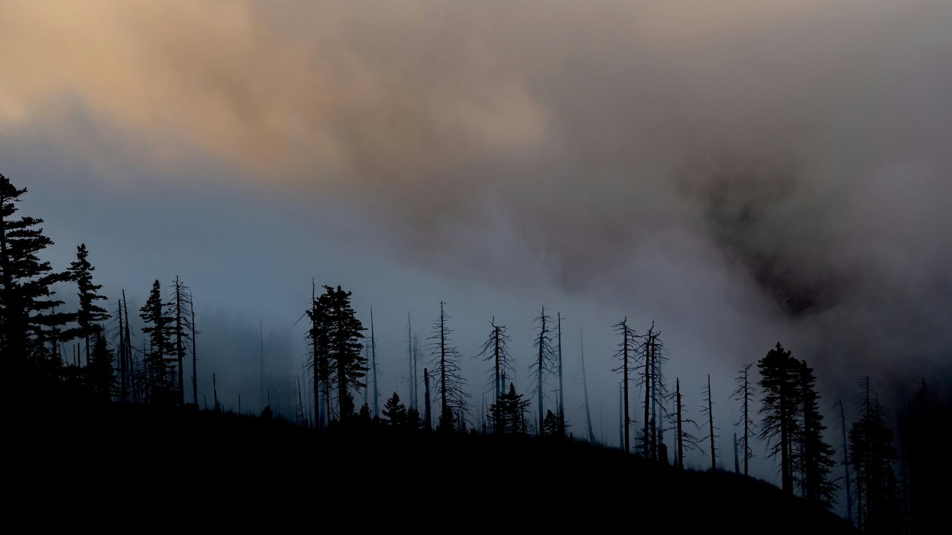
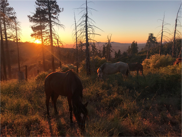
Wildfire is an important ecological process in California, where a diversity of fire regimes shape the structure and composition of plant and animal communities. Fire regimes are changing beyond their historical range of variability, however, due to several factors, including past fire management, invasive species, land use change, and climate change. These changes not only threaten the integrity and diversity of biological communities, but affect human communities, too, as residential losses to wildfire have skyrocketed in the last several decades. Two of these drivers, land use and climate, are expected to change dramatically in the coming century, raising substantial concern about their effects on fire regimes and subsequent impacts to human communities and biological diversity.
CBI has partnered with University of California, Berkeley to develop and implement a scenario-based integrated modeling framework to quantify the relative importance of climatic and land use factors on current and future projected fire patterns and risk of structure loss for three study areas in California. Select research questions driving this project include:
1) How do patterns of fire activity vary by land use change and climate?
2) How does structure loss vary by land use and climate change?
3) How do these relationships varyby geographic region?
4) Given these relationships, how are large fires and associated structure risk likely to change in the future?
Results of the assembled model output will be distributed to appropriate stakeholders and Data Basin will host the mapped output data.
Wildfires are becoming larger and more severe, causing negative impacts on our natural ecosystems. These post-fire impacts include invasions of exotic plants and an increase in the risk of mudslides, erosion, and siltation of important stream habitat. It is a daunting challenge for resource managers to determine where restoration can do the most good.
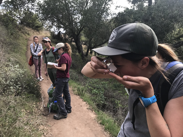
In this pilot project, CBI worked with the Santa Barbara Botanic Garden to develop and test online software coupled with a citizen-science process that helps resource managers identify the best candidate locations for restoration in the aftermath of the Thomas and Whittier Fires in Santa Barbara County.
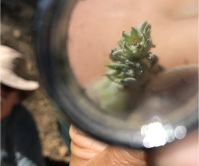
Spatial data about the landscape are combined in a model that provides a preliminary prioritization map, which is then refined using field observations of professionals and community scientists in the Spring following a fire. The sites can then be visited in person to make the final decision about where to focus restoration efforts to maximize the return on the investment.
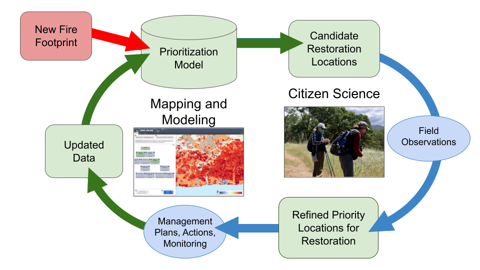
Figure 1. A flow chart displaying the steps involved in prioritizing areas for post-fire restoration
The community scientists used iNaturalist to record their observations and assist in identifications. You can see the more than 5,000 observations collected so far on iNaturalist here!
How You Can Learn More :
Watch this short video about the project.
View the model with prioritized restoration locations here.
Explore the restoration prioritization map together with other important data layers and photographs in Data Basin.
Read more technical details in this article.
Email john.gallo@consbio.org to be notified of community science opportunities when they arise.
Wildfires are a natural part of California ecosystems and play an important role in maintaining ecological structure and function. However, different fire regimes in the state have been altered due to past management practices, climate change, invasive species, and population growth and urban expansion. Given the potential for conflicts between fire management and conserving biodiversity and ecological functioning, solutions are needed to balance ecosystem health with human welfare and community safety.
CBI is partnering with Dr. Jon Keeley (USGS) and an international team of landscape ecologists, biologists, geographers and economists to study the factors that control wildfire activity in southern California, which experiences the largest number of housing losses to wildfire in the U.S. This work focuses on the role of different ignition sources, climate patterns, vegetation change, and housing location and arrangement in altering fire patterns and contributing to housing loss at the wildland-urban interface. Other topics of research include the effectiveness and effects of fuel treatments and prescribed fire in controlling large fire behavior; the role of homeowner practices, such as minimizing vegetation around homes and upgrading building construction materials to prevent house loss; and the relative importance of land planning decisions that could best minimize housing loss while preventing negative impacts to biodiversity.
While the research takes place primarily in southern California, the findings are applicable to other fire-prone non-forested ecosystems such as the Great Basin and the other Mediterranean-climate ecosystems across the world.
The results of this research are shared with management agencies like the National Park Service and U.S. Forest Service, in addition to local and state planners and policy makers, to identify the best strategies to increase community safety while minimizing effects on natural ecosystems.
nflicts between fire management and biodiversity conservation
Destructive wildfires are sudden, extreme events: In a matter of hours, both social and ecological communities are transformed by the loss of homes and lives, and change in natural vegetation. After such an event, residents take stock of their transformed landscape and environment, deciding to remain, rebuild, or move, while ecological communities restructure and regrow. These combined social and ecological responses to wildfire may present a ‘hot moment’ or ‘window of opportunity’ where governments, communities, and residents can take action to reduce the future exposure to disaster.
An interdisciplinary team of researchers, convened by CBI’s Dr. Alexandra Syphard, Dr. Miranda Mockrin from Northern Research Station, USDA Forest Service and Dr. Van Butsic, from the Department of Environmental Science, Policy, & Management at University of California, Berkeley, are examining the question “Do wildfires lead to transformative adaptation, reducing future wildfire risk or do they lead to entrenchment, as residents and institutions re-create hazard-prone environments?”
To examine this question, they will review national data of post-fire housing change (rebuilding, sales, new development, land subdivision) and investigate how social and ecological settings and impacts, as well as event characteristics, influence subsequent housing and ecological trends. They will also determine, at the household scale, how changes in housing patterns relate to the post-wildfire ecological setting and socioeconomic characteristics, determining adaptation or entrenchment.
CBI is producing a spatial decision support system (SDSS) for the Sonoma County Agricultural Preservation and Open Space District (“District”). The District works to conserve habitat, watersheds, and agriculture for people and wildlife in Sonoma County, CA, and is pursuing the development of an SDSS to help guide its land conservation strategies. First, the SDSS will support the development of a ten-year, comprehensive county-wide conservation plan through analysis of multiple conservation themes. It will also assist parcel-scale decisions relating to individual conservation easement projects. In addition, it will produce county-wide outputs (e.g., high priority habitat areas) that can be integrated with other open space planning and scenario-building processes (e.g., the County General Plan). Finally, the SDSS framework—its hierarchical data integration architecture—and supporting data will be published online as an interactive, Web-based program so that the public can explore and learn about the District’s prioritization methods and priority conservation areas.
On the technical end, the Sonoma County SDSS will use an expansion of CBI’s Environmental Evaluation Modeling System (EEMS) along with a new habitat representation algorithm and an expansion of the Linkage Mapper connectivity model (from circuitscape.org). Please contact John Gallo with any questions or comments.
As more people move into remote areas throughout western forests and rangelands, it is increasingly important for scientists, land managers, policy makers, and the public to understand the natural fire dynamics of these systems. Over the last decade, wildfires have burned on average approximately 4.2 million acres each year with lows of 2.3 million acres in 1993, 1995, and 1998 and a decadal high of 8.4 million acres in 2000 (NIFC 2004). There is growing concern about the number of severe fires throughout the West and their impact on human communities and local economies. Some argue that the buildup of fuels to unnatural levels is primarily the result of decades of fire suppression while others argue that prolonged and more frequent droughts are most responsible. While both positions are defensible, it is unwise to oversimplify the situation as natural fire regimes and the human impacts on these regimes can be quite complex and highly variable from place to place (Turner et al. 2003).
The purpose of this study was to develop an approach to mapping fire hazard at an intermediate spatial scale for the Oregon portion of the Illionis River Basin and to demonstrate how such an approach can be used to identify and prioritize fire management activities that would have the greatest chance of minimizing human losses from fire while protecting the many conservation values of the region. The Illinois River Basin was chosen because the rural communities in this basin were among the most threatened by the Biscuit fire of 2002.
Detailed information for the Biscuit Fire can be found at the official US Forest Service Biscuit Fire website.
This report was prepared to provide an independent examination of the post-fire management options being considered for the Biscuit Fire (2002) within the Siskiyou National Forest in southwestern Oregon. This report has three main objectives:
- summarize the ecological setting and impact of the Biscuit Fire
- review the scientific literature on post-fire management (including salvage logging)
- conduct a GIS-based mapping analysis that examines the ecological and administrative constraints to post-fire management of the Biscuit Fire
Detailed information for the Biscuit Fire can be found at the official US Forest Service Biscuit Fire website.
Marine Corps Base Camp Pendleton is committed to developing strategies to meet their stewardship responsibilities in support of their training requirements and to protect the base’s natural resources. CBI to helping them better understand the processes affecting the magnitude and extent of fires on the base, and the relationship between fires and natural resources. This understanding will help them minimize habitat conversion and provide the best operational support possible (increase training days).
The primary focus of this effort is to develop statistical models and analysis of variables associated with the fire regime on the Base and to conduct spatial analysis of ignition and fire frequency patterns. These analyses will be further used in the development of decision support tools that will identify optimum strategies for meeting specific management objectives.