
Event Details
CBI Host
Date
Related Resources
Tim Sheehan provides a introduction to decision support modeling with the Environmental Evaluation Modeling System (EEMS). The webinar covers the fuzzy logic concepts EEMS uses, an overview to EEMS in ArcGIS, and a demonstration of the EEMS Model Explorer. With the initial release of EEMS planned for the first half of 2014, users will get an early view of this powerful software framework.
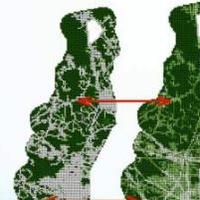
The Environmental Evaluation Modeling System (EEMS for short) is an easy to use software framework that allows users to create spatial decision support models. Like EMDS (Ecosystem Management Decision Support) framework, on which it is based, EEMS allows users to combine data of different types and from different numeric domains (for example road density, and species presence/absence) in a tree-based logic model to provide answers to management questions such as: What areas are most ecologically intact?, and What areas have the highest potential to support specific species of interest? EEMS works with Arc shapefiles and utilizes Arc ModelBuilder. To use EEMS, a user only needs to install an Arc Toolbox — no third party software is required. An EEMS Model Explorer has been implemented in Data Basin. When an EEMS model is uploaded along with its model data, a user can visually explore model layers and individual reporting units to determine what factors drive model results.