
East Carolina University’s GEOG 4250/6250 Environmental Impact Analysis – Building Projects at the Data Basin “Work Bench”
How can community-based projects be transformed into assets for real-world community stakeholders? How can student projects live well beyond the end of a semester? Dr. Laura Jean Palmer-Moloney of ECU’s Department of Geography, Planning, and Environment challenged her Environmental Impact Analysis students to find out!
Traditionally, an EIA is a structured way to think about the environment and development. It is a forward-looking instrument able to proactively advise decision-makers on what might happen if a proposed action is implemented. It has well-known steps: identify, assess, and offer ways to mitigate the potential impacts of proposed actions on human and biophysical environmental quality.
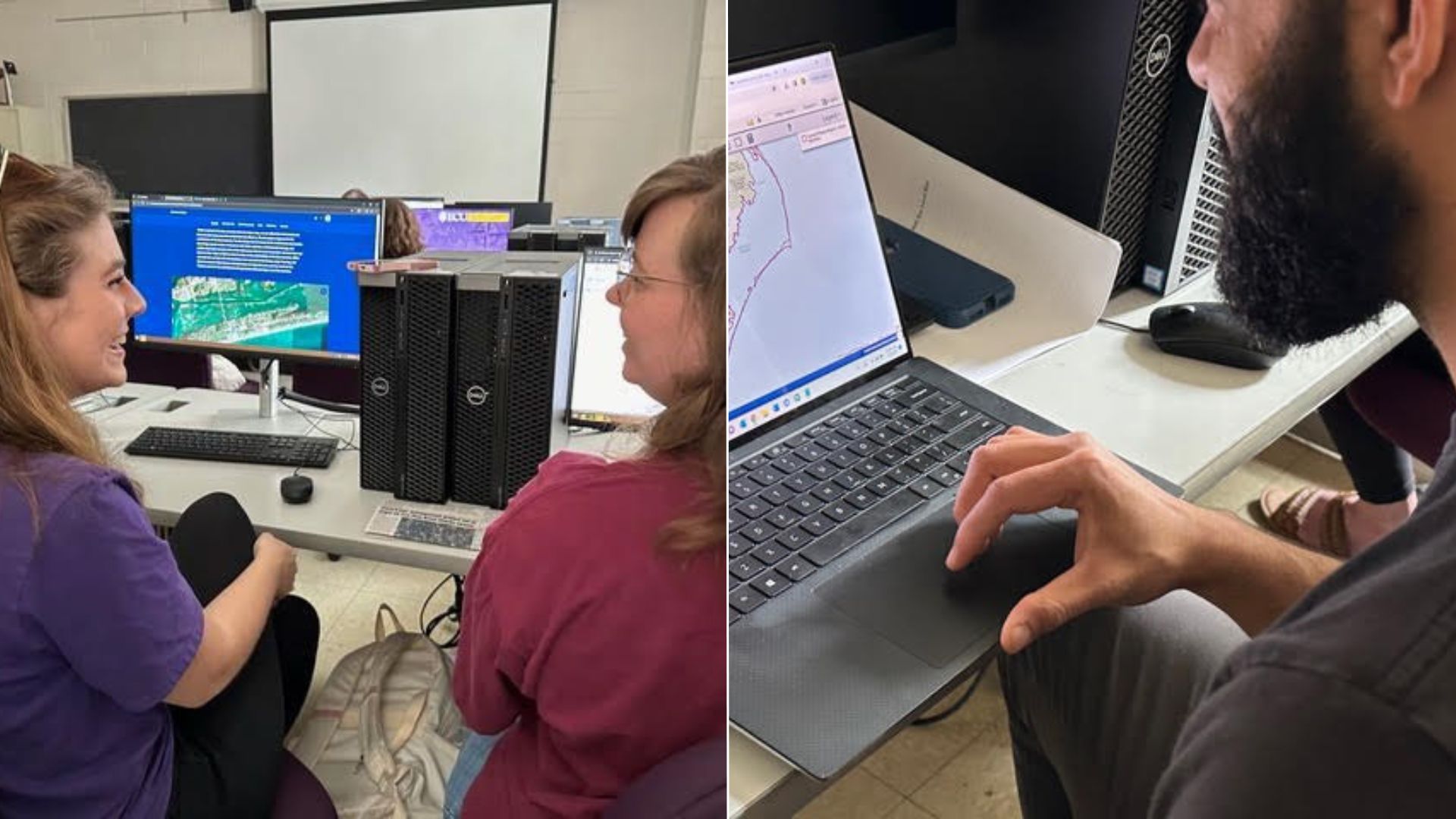
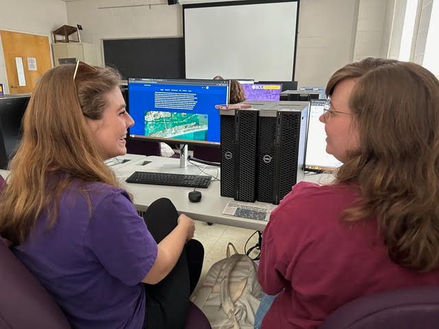
Students in GEOG 4250/6250 used geospatial tools to demonstrate ways the biophysical environmental quality in a project area might be impacted, and they took it a step further. They identified and assessed ways in which climate (e.g., hotter temperatures, sea level rise, increasing storm intensity, biodiversity loss, etc.) and anthropogenic stressors (e.g., development and land use/land cover change) may impact proposed development projects, giving the environment an active vs passive role!
The upper-level and graduate students generated Environmental Impact Analyses of specific proposed developments in Carteret County, NC (a.k.a “the Crystal Coast”). They captured key details from the EIAs to create GEONarratives–putting content into context and making connections so that decision-makers to see consequences, potential impacts, and alternatives.
The GEONarrative is a geospatial visualization used to show key relationships and dynamics and to make the EIA report come alive. Data visualization allows the presentation of key lessons/information to clients/audiences in digestible parts. GEONarratives and EIA Decision-Steps were built and shared with community stakeholders using Conservation Biology Institute’s Data Basin.
Environmental Justice Screen
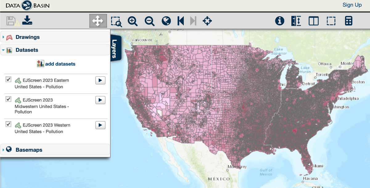
EJScreen (Environmental Justice Screen) is a map-based product published annually (2015-2023) by the U.S. Environmental Protection Agency combining demographic indicators with data on public health and the environment. These data are made available by the agency’s online tool. However, in order to make it easy for users to combine EJScreen data with other relevant datasets in Data Basin, we downloaded and processed the datasets regionally (eastern, midwestern, and western) for each of the years and split the attribute tables between population and poverty and pollution files to improve the user experience. All EJScreen datasets can be located in the Data Basin gallery called EJScreen 2015-2023.
Managing Your Data Basin Account
Not sure how to manage your Data Basin account? Don’t worry, we’re here to help!
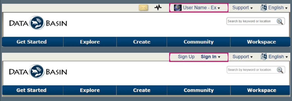
If you are logged in to Data Basin, you will see your User Name and profile image located at the top of the page. If you’re not logged in, you will see Sign Up and Sign In options.
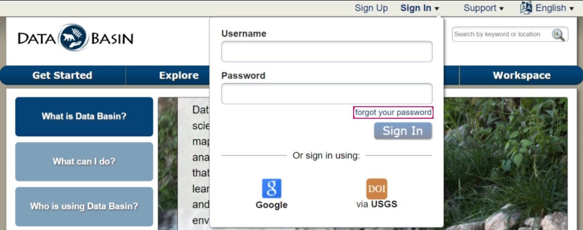
Forgot your password? That’s okay! Under the Sign In dropdown there is a forgot your password link.
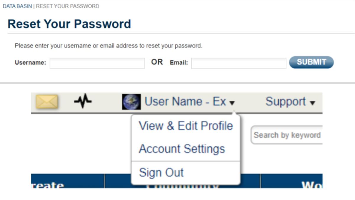
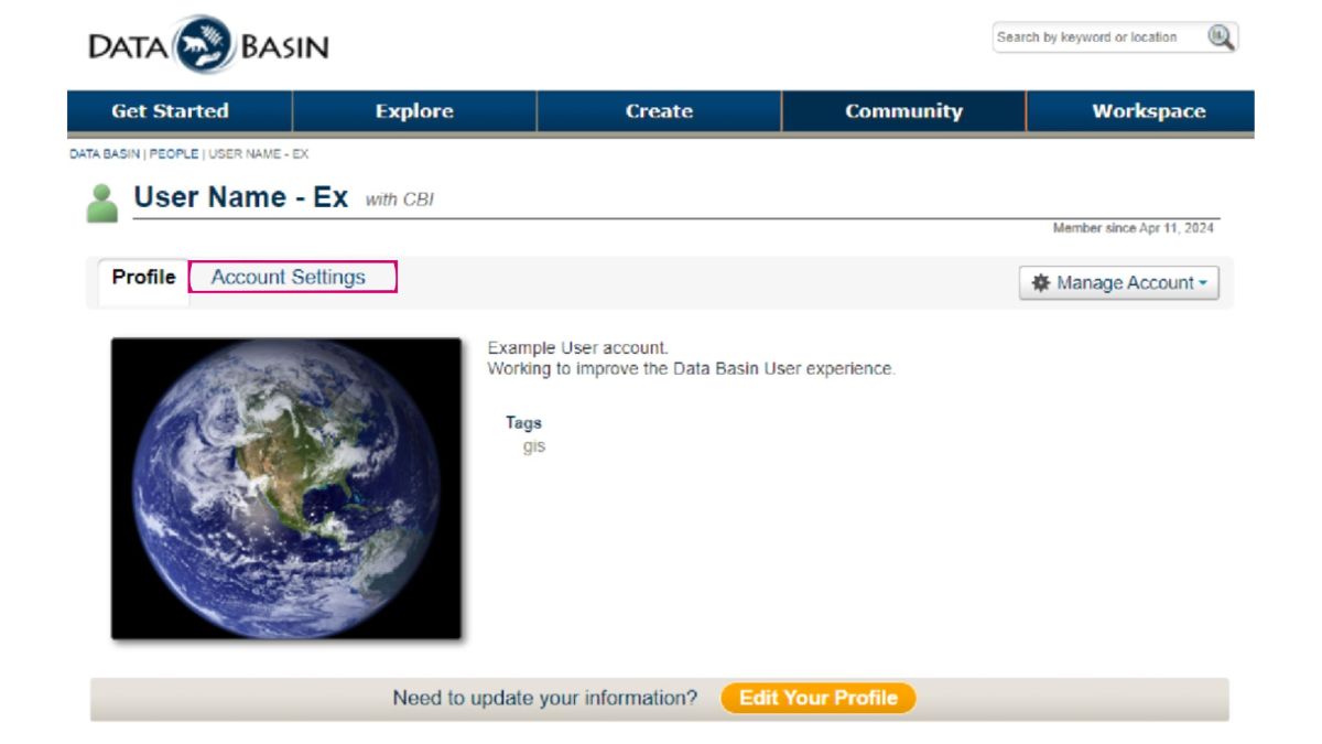
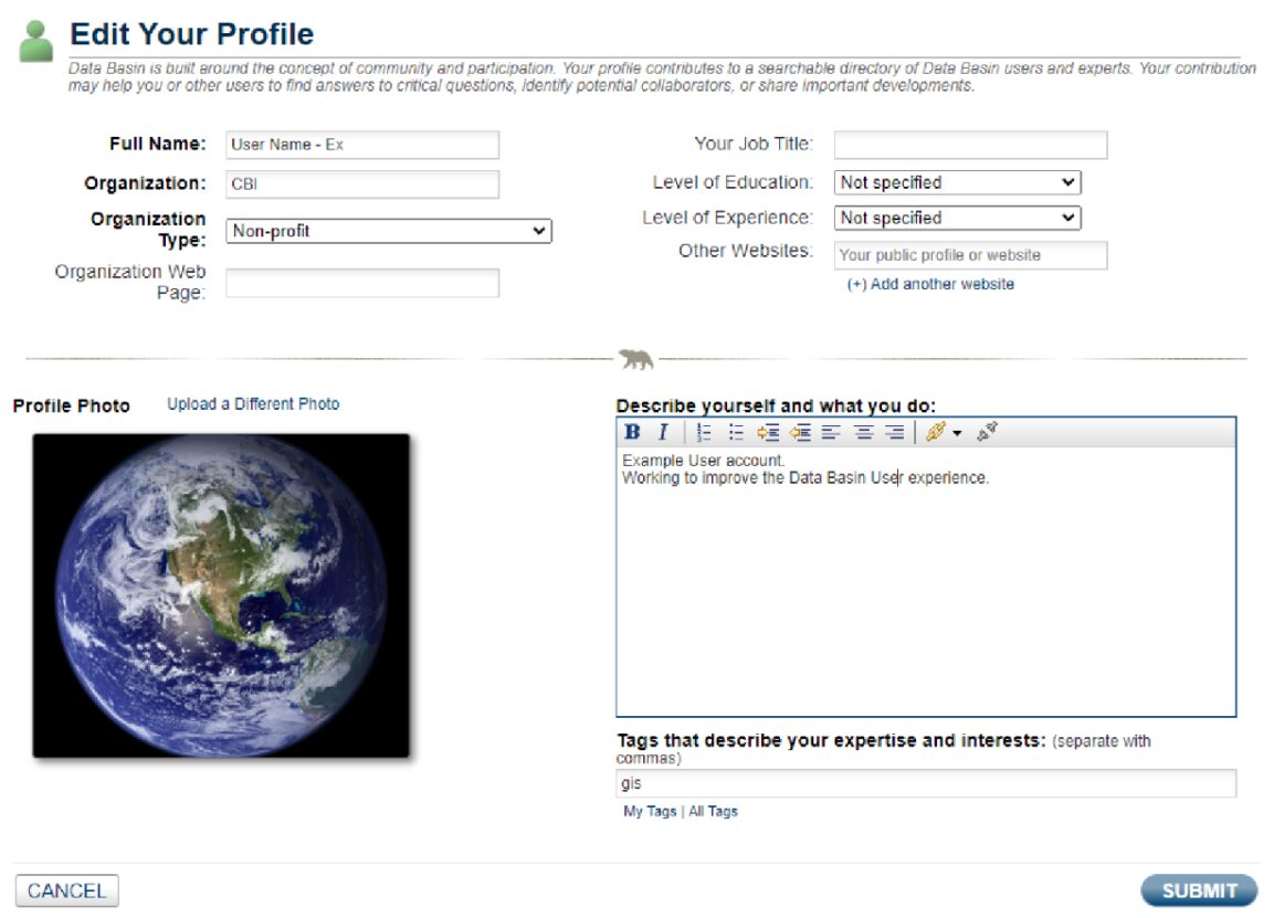
Once signed in, select your username, select View, then Edit Profile from the drop-down list. Account Settings is another option in the drop-down list and is also accessible from the Profile page.
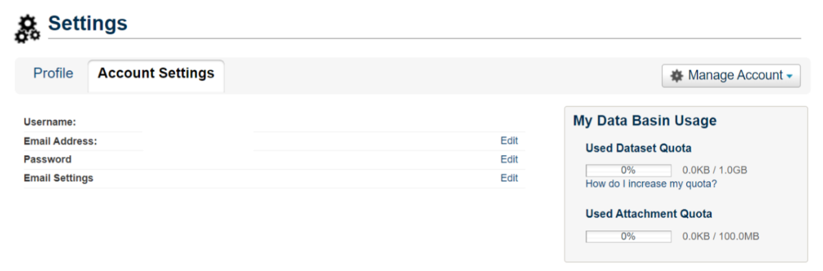
On the Account Settings page, you can edit your email address, password, and other email settings.
Email Settings include:
- Email me about news and events related to Data Basin.
- Email me when I receive a new message.
- Email mewhen someone requests to join a group I administer.
- Email me when I am added to a group.
- Email mewhen new content may need to be added to a gateway I administer.
Selecting Manage Account gives you options to Edit Profile or Delete Account. Selecting Edit Profile allows you to update and manage the details you wish to share on your profile.
If at any point you need assistance, you can connect with us using the Contact Us and Support Services links available along the bottom of any Data Basin page.
Happy Mapping!