New Data Basin YouTube Tutorial Videos
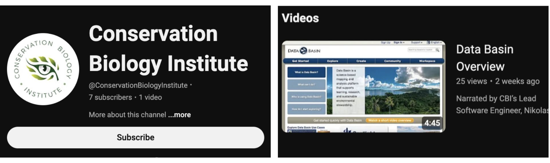
Exciting news, we’ve started our new Data Basin tutorial series! The first video, “Data Basin Overview“, explains why the platform was created, describes the main design principles, puts Data Basin in the context of other web mapping applications, and reviews how to create a free account. Subscribe to our YouTube channel to keep up on all of our new content!
Recent Wildfire and Air Quality Feeds
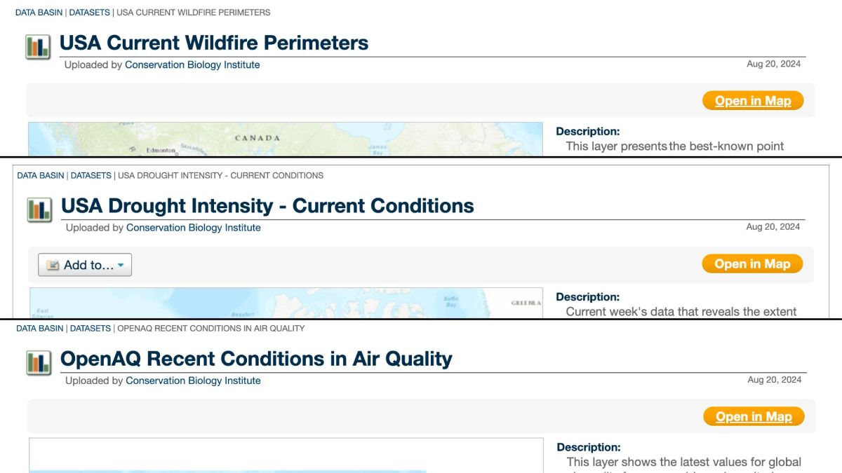
Wildfire season is in full swing in the United States! To support the mapping of current conditions, Data Basin now has three new map services you can use to access the most reliable, up-to-date data available; Wildfire Perimeters from the US Department of the Interior, Open AQ’s current air quality conditions, and current drought intensities from the National Drought Mitigation Center, University of Nebraska-Lincoln. These data are available for the conterminous United States and are updated regularly! Access these datasets anytime at Databasin.org.
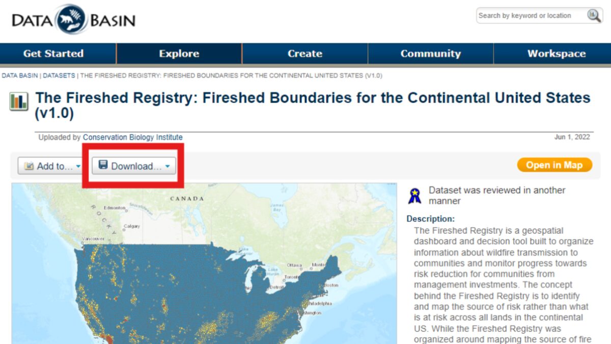
Data Download vs Map Export
Datasets and Maps are similar pages within Data Basin, but each has its own Download/Export functionality. Here, we will walk through the different ways to export data and maps for multiple uses!
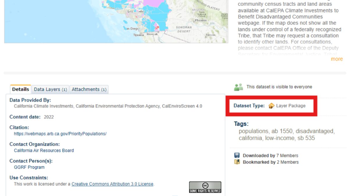
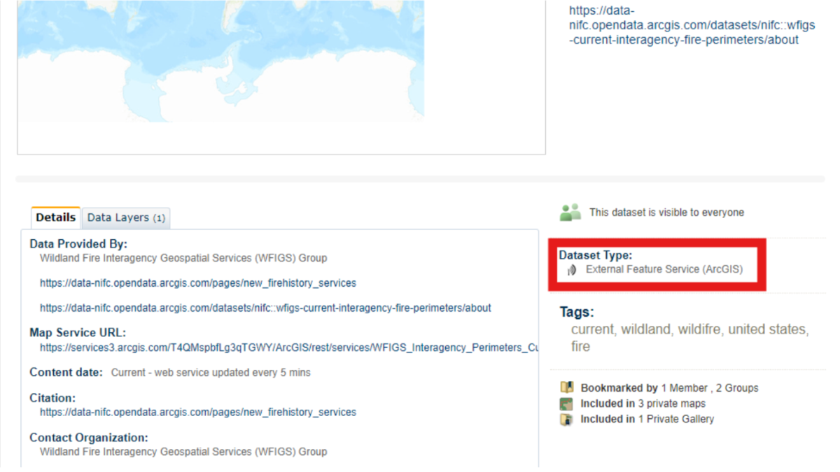
If you are looking for data to download and use for analysis in GIS software, you’ll want to Download the Dataset itself from its unique webpage. This allows you to download either an ArcGIS Layer Package or a Zip Archive of the dataset!
If you’re looking to download and use a Map image in your work, this can be done within the Map Interface. From here you can Export the current view in the Map to PDF, PNG, or PPT.
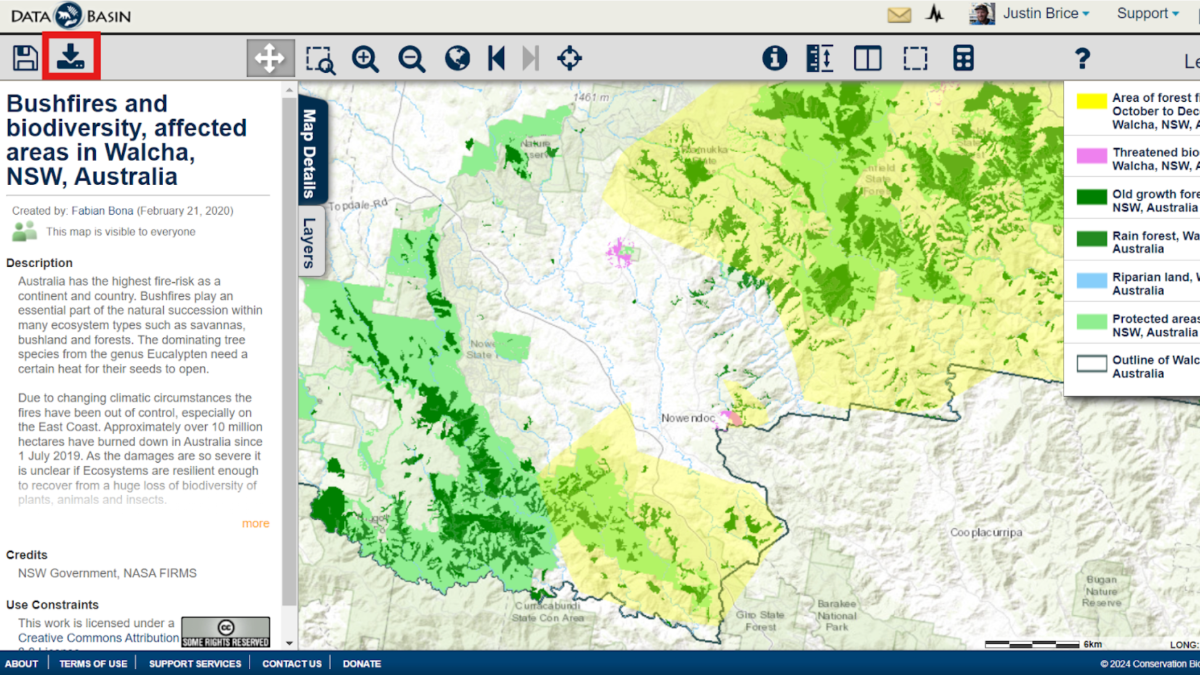
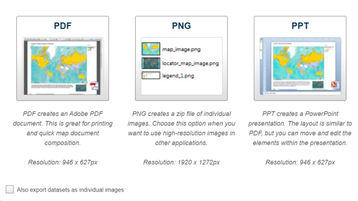
You can view the Map page by clicking on the Title of the Map (below the Download button):
Datasets in Data Basin may be (1) uploaded data or (2) a hosted web service/feature service (external to Data Basin). Web services imported to Data Basin will reflect the hosted data and any updates made by the hosting entity (outside of Data Basin).
Users may encounter an error when trying to view a web service dataset in the Map view. Oftentimes, these issues resolve themselves if you check back a few hours later, but if you encounter a web service outage, please notify the Data Basin team so we can look into it!
When using these Data Basin products, please credit DataBasin.org, the individual data providers, and include the link to your Map that includes the Datasets and the date it was exported.
Happy Mapping!