What We Accomplished in 2024
Conservation Biology Institute had an exceptionally productive 2024, with a broad array of projects carried out with partners old and new. As we move forward into the new year, we have paused to reflect upon our successes of the previous year and summarize some of the highlights for you below.
DATA BASIN
Data Basin continues to grow. Early in 2024, Data Basin reached another milestone of 50,000 registered members. The current number of members approaching 56,000 with the number of interactions with the platform is averaging 30,000 per month. Majority of the users are from the US, but users from almost every country in the world continue to visit the system routinely. Also, the content available in the platform continually grows and now provides access to over 35,000 individual datasets. Most importantly, members are successfully using Data Basin to address a wide range of topics, including conservation planning, renewable energy, climate resilience, sustainability, and species recovery.
CONSERVATION IN AGRICULTURE
Supporting USDA Conservation Reserve Program Lands
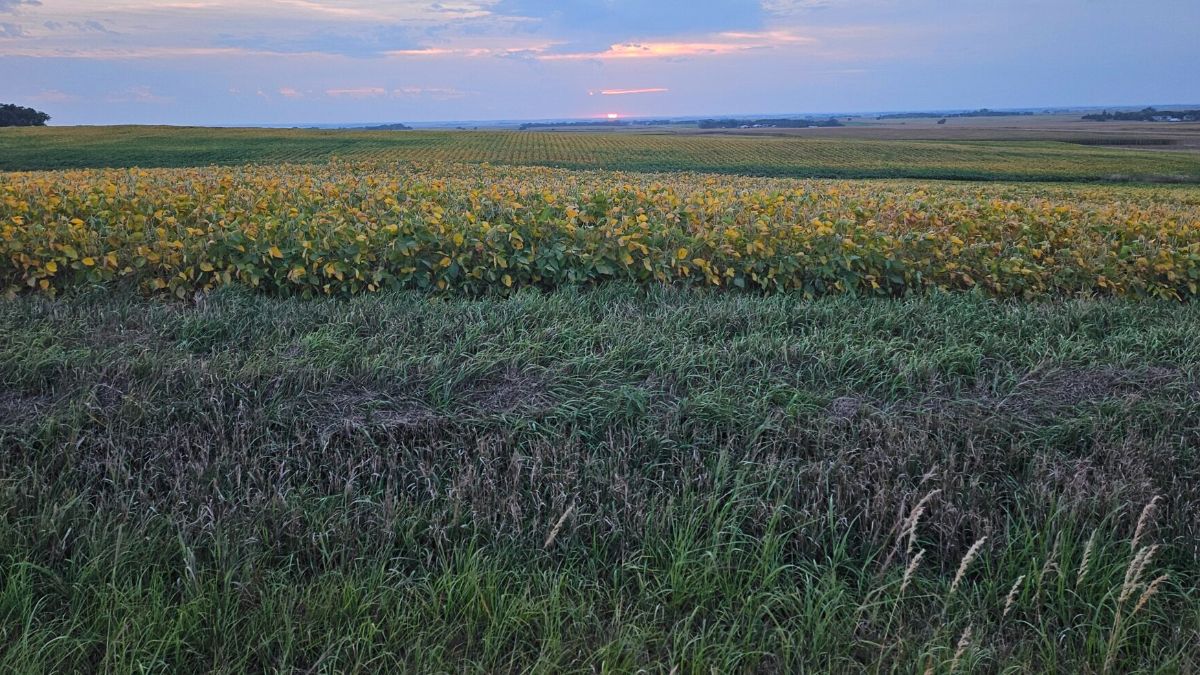
The Conservation Reserve Program (CRP) is a federally funded land conservation program administered by the USDA Farm Service Agency and currently manages over 25 million acres of private farmland in the US and is looking to expand. Through the integration of science, spatial modeling, and software development, CBI continues to provide support to significantly improve conservation outcomes and efficiency of program management.
California Healthy Soils Initiative and Alternative Manure Management Program Support
Working closely with the California Department of Food and Agriculture, CBI updated and made enhancements to two existing online tools that help process grant applications for farmer support programs aimed at reducing greenhouse gas emissions- one through enhancements to sequester more carbon through the promotion of soil health and the other through the improved management of farm animal manure.
OUTDOOR RECREATION
Recreation Conflicts with Tribal Rights

Outdoor recreation is an important component of conservation for many reasons; however, many locations are becoming overwhelmed by the numbers of users engaging in a growing list of activities. Furthermore, in some regions such as Washington state, Tribal people’s rights to the land and resources provided by long-standing treaty are becoming increasingly compromised by outdoor recreation activities. CBI has been engaged to work with Tribes and state agencies to find practical solutions to the growing number and intensity of recreation conflicts on finite natural resources.
Assessment Planning Tool for Oregon and Washington Trails
Based on a previous prototype for Deschutes County, Oregon, which resulted in the creation of a web-based decision support tool to improve the management of multi-use trails in the county, CBI has begun to expand this work to incorporate all trails in Oregon and Washington on U.S. Forest Service lands. Work will continue in 2025 with the goal to provide a user-friendly online dashboard, which will allow trail managers to plan and manage for trail sustainability throughout much of the Pacific Northwest.
RENEWABLE ENERGY & SUSTAINABILITY
Supporting Sustainable Offshore Wind Development in California
Marine offshore wind energy development presents an opportunity to help California achieve its 100% renewable energy goals. CBI continues to provide data and collaborative platform support using the California Offshore Wind Energy Modeling Platform for the ongoing planning activity.
CEQA Site Check Tool
Site Check is an online tool built to accelerate the production of housing (especially low-income housing) by identifying where existing streamlining options under the California Environmental Quality Act (CEQA) may apply. Site Check allows users to filter parcels based on specific CEQA provisions. The tool is actively being used to accelerate housing development in California while avoiding areas that are environmentally sensitive such as wetlands, rare natural habitats, locations of rare native species, key landscape connectivity corridors, and hazard zones.
Climate Smart Forest Restoration Tools
Seedlot Selection Tool
The Seedlot Selection Tool is a GIS mapping program designed to help forest managers match seedlots with planting sites based on changing climates. The tool, which covers the North American continent, is being actively used to more closely match seedlots with future growing conditions.
USFS Climate Analog Tool
The US Forest Service asked CBI to build upon the aforementioned Seedlot Selection Tool to help increase positive outcomes of their conservation and restoration efforts. The Climate Analog decision support tool will provide forest managers with access to climate-smart generalized seed transfer and vegetative information using 19 different climate variables to accommodate a spectrum of adaptive genetic variation among species to better inform restoration decisions.
WILDFIRE
Global Wildfire Collective
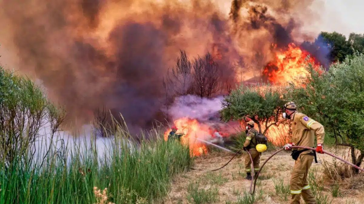
CBI has embarked on the development and launch of the Global Wildfire Collective, an online platform and community being established to facilitate easy access to and sharing of research, publications, data, models and tools among wildfire researchers and operational practitioners. The platform will support discussion, collaboration and knowledge-sharing across wildfire-related disciplines, ecosystems, and regions. When established, this will be the only global resource of its kind.
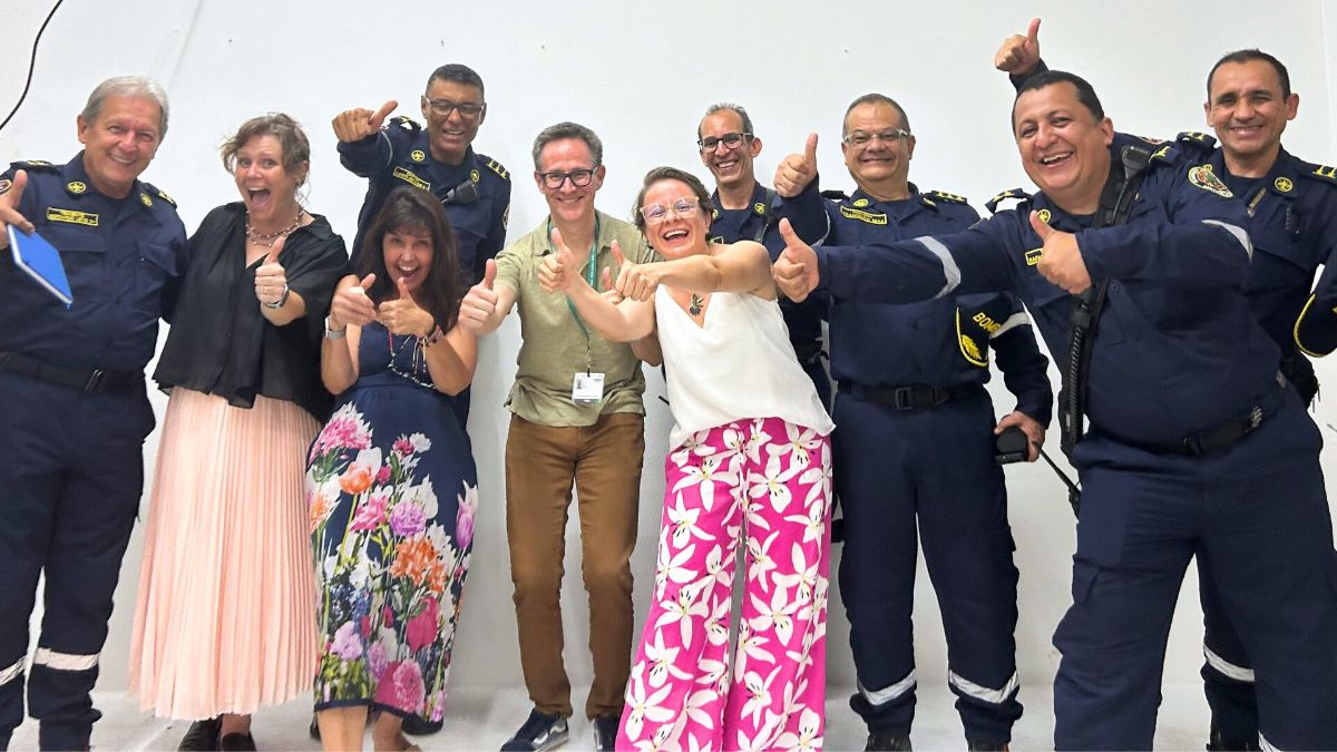
Centro de Conservación Biológica de Operaciones Forestales (CCBOF)
In partnership with the Academia Nacional de Bomberos de Colombia, CBI is embarking on the development of the Centro de Conservación Biológica de Operaciones Forestales (CCBOF), a wildfire research, collaboration and education center to increase regional capacity and expertise across the Americas. CCBOF will be built upon the Global Wildfire Collective to accelerate advancements in wildfire science and ecology in order to provide practical guidance for policy makers, insurers, community members, fire departments and land owners/managers. The Academia Nacional de Bomberos de Colombia serves as one of very few Latin America and Caribbean-regional centers for firefighter and community education, having trained firefighters from virtually every country across the LAC-region.
California Wildfire Projects
Sierra Nevada Forest Resilience Decision-Support
CBI completed a series of modeling exercises to assess and predict wildfire impacts in the Sierra Nevada in California. Unlike previous efforts that focused exclusively on the fuel component of the fire risk modeling, our work introduced the concept of fire-atmospheric coupling which integrates the all-important air component to fuels. Results demonstrate the importance of strategic forest thinning as thinning in some locations can actually make the risk of severe fire worse.
Giant Sequoia Lands Coalition Data Gateway
CBI partnered with Plumas Corporation to develop a new Data Basin Gateway, as a collaborative working space dedicated to sharing and discussing data relevant to the protection of Giant Sequoia groves in the Sierra Nevada that are threatened by climate change. The gateway is currently under review and expected to be publicly launched in 2025.
CALFIRE Impacts Study
Using a vegetation succession model, this project explores how climate change, management actions, and projected residential growth in the wildland urban interface may influence wildfire activity and downstream effects on vegetation type conversion, carbon release, and biodiversity in Southern California forests and shrublands. The resulting maps and spatial products will help managers prioritize locations for conservation action to protect co-benefits to humans and natural resources.

Tuolumne Wildfire Defense Planning
CBI partnered with EN2 Resources, Inc. and the Tuolumne Utilities District (TUD) to develop the TUD Wildfire Defense Plan, a roadmap for addressing wildfire risk to the county’s water system and water treatment facilities. The wildfire risk mitigation plan is meant to guide projects that aim to achieve fuels reduction, habitat enhancement, and recreation benefits in the region, while building resilience for the utility district infrastructure.
Resilience Planning for Southern California Montane Forests
CBI is partnering with the U.S. Forest Service and San Diego State University to apply the latest research on interactions between multiple disturbances specific to this ecoregion to plan more effective conservation action. The goal is to further develop an actionable strategy to address the many threat (especially wildfire) to these unique forest ecosystems.
SPECIES ASSESSMENT & PLANNING
Southern Sierra Nevada Fisher Conservation Assessment and Strategy 2.0
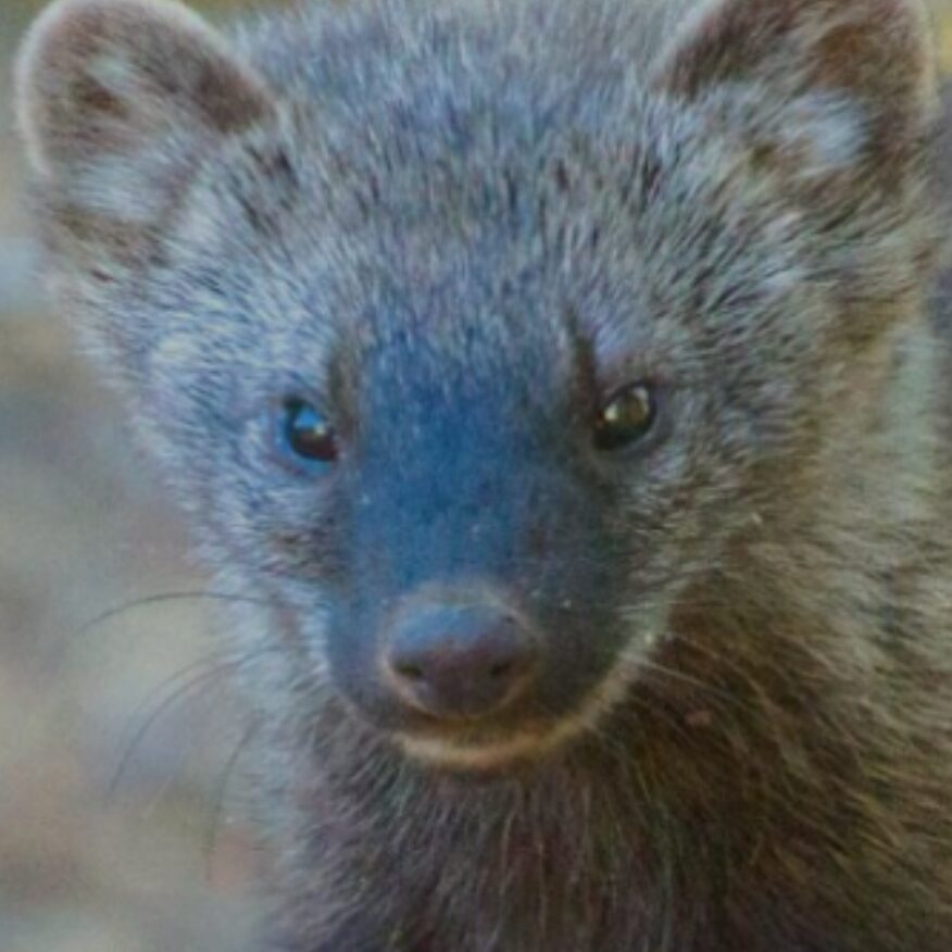
CBI has been engaged in assessing and planning for the conservation and recovery of Pacific fisher (Pekania pennanti) for many years in the Southern Sierra Nevada. The latest iteration of the work includes a major update on the conservation strategy for the species prompted by large landscape disturbances such as catastrophic wildfires over recent years that have negatively impacted the population resulting in the species being listed as endangered by the U.S. Fish and Wildlife Service.
Stephen’s Kangaroo Rat Monitoring
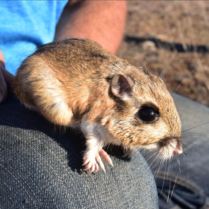
In year four of a close partnership with Riverside County Habitat Conservation Agency, Bureau of Land Management, U.S. Fish and Wildlife Service, and other researchers, CBI continued to lead the multi-year range-wide monitoring and management plan development for the endangered Stephens’ kangaroo rat (Dipodomys stephensi), a tiny rodent native to Southern California’s shrinking grasslands.
WDFW Bat and Moth Monitoring

A number of bat species such as Townsend’s big-eared bat (Corynorhinus townsendii) are in decline throughout Washington. This ongoing project uses acoustic monitoring and species identification software to assess the status bats across different landscapes to better understand what conditions correlate with high levels of bat occurrences and abundances. The project is also using sophisticated camera traps and new AI-driven technology to monitor moth populations, which make up the major prey base for many of the bat species.
Washington Wildlife Connectivity Mapping
CBI is a partner in producing a statewide wildlife connectivity ensemble model and the associated mapped data in support of a connectivity action plan for the state, which is still under development. The modeling aims to identify priority areas across the state in need of some form of mitigation to promote wildlife connectivity and reduce wildlife/vehicle collisions at the same time.
CBI ASSOCIATES PROGRAM
CBI Associates program was created to allow the organization to partner with researchers and scientists working in the fields of conservation and climate change, to further our reach and impact of science and technology in these fields. In 2024, CBI added two new partners to its Associates lineup. Dr. Chas Jones has been a trusted partner to Tribes & Indigenous Peoples for 25 years and is nationally recognized as an expert in matters of Tribal Climate Resilience. Dr. Sam Roy is the Creator and Founder of the Awesome Google Earth Engine Community Catalog and serves as the CEO of Spatial Bytes LLC specializing in geospatial data, workflows and analysis. He is currently working with CBI to develop remote sensing models in support of the USDA Conservation Reserve Program.
ALLIANCE OF WORLD SCIENTISTS

In 2024, CBI partnered with the Alliance of World Scientists, an international assembly of scientists who pool their knowledge, research and networks to raise awareness about the consequences of the climate crisis in order to help stem the continuing degradation of the planets life support systems. As stewards of human knowledge and champions of evidence-based decision making, the goal of the Alliance is to be an amplifying voice for scientists all over the world of these unprecedented threats.
COP16
In 2024, CBI was honored to be granted credentials to attend the 16th Conference of the Parties to the Convention on Biological Diversity (COP16) hosted in the city of Cali, Colombia. While in Cali, CBI co-hosted three well-attended panel discussion events, composed of international practitioners with deep experience in the fields of habitat connectivity and linear infrastructure development, renewable energy planning & development and wildfire research and mitigation. The relationships formed during the event are priceless, and CBI expects to collaborate with a number of the international research, government and NGO organization we met in Cali, to expand the reach of our knowledge, data and tools to other parts of the world.