Private Groups
Addressing diverse conservation issues sometimes requires various levels of privacy which is why there are several privacy controls within Data Basin. Currently, there are around 700 private working groups within the platform, and any member can create their own! But what are private groups used for?
On Data Basin, private groups are a great way to share, collaborate on, or securely create spatial data. These spaces allow members to control who can interact with their data and how they interact with it. Once a group has been created, group administrators have control over who can view, download, or comment on items in the group, such as datasets or maps. Below are a few examples of how private groups have been used by the Conservation Biology Institute (CBI) to promote conservation solutions around the world!
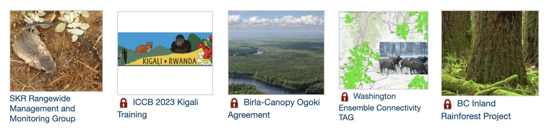
CBI has created private groups to manage sensitive monitoring programs, as is the case for a multi-agency project in southern California focused on monitoring the endangered Stephens’ Kangaroo Rat. This group has since been made public, allowing anyone to view the content! Other private groups have been created to support education and training for specific topics or regions. For example, the ICCB 2023 Kigali group was created to support sensitive data training for enrolled attendees at an internal conference in Africa. Members can also use groups to facilitate a negotiation, such as the Birla-Canopy Ogoki Agreement group, or to co-produce conservation solutions, as shown in the Washington Ensemble Connectivity TAG and the BC Inland Rainforest assessment groups, where scientists can work together in private but share results publicly.
Create Your First Map!
Once you’ve created your account, Users can Create a Map in Data Basin using existing datasets. Search among 22,000+ public datasets for data related to your question.
Some Map Tips:
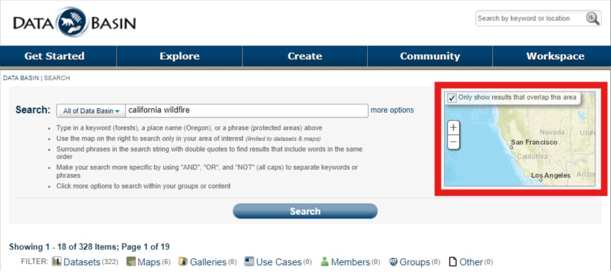
- Start by searching for Datasets related to your question (wildfire, forests, wildland-urban interface, WUI, etc) Use variations of names used to broaden your Search (fire, wildfire footprints/perimeters, etc) Use location names to help narrow your search (California).
- Use the Datasets filter after your first search to narrow the results to only Datasets
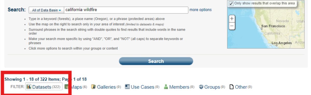
- You can limit your search results using the Map extent feature at the right of the page
- In your Search results list, click on the thumbnail image to select a Dataset.
- This opens a new toolbar, at the top of the page, with actions you can take with your selection
- You can select up to 5 Datasets to add to a new Map
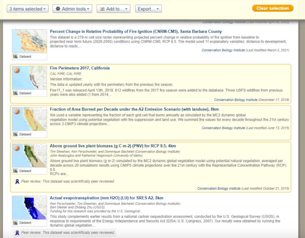
- Select “Add to”, then select “New map” to add these Datasets.
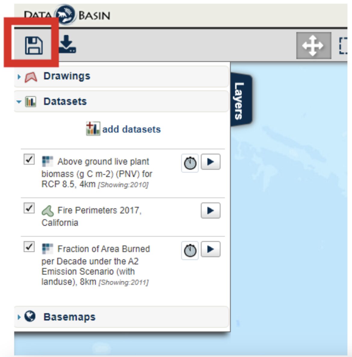
- Once they’ve loaded, save your map for future use.
Happy Mapping!
– The Data Basin Team