Stephens’ Kangaroo Rat Rangewide Management and Monitoring Plan for Southern California
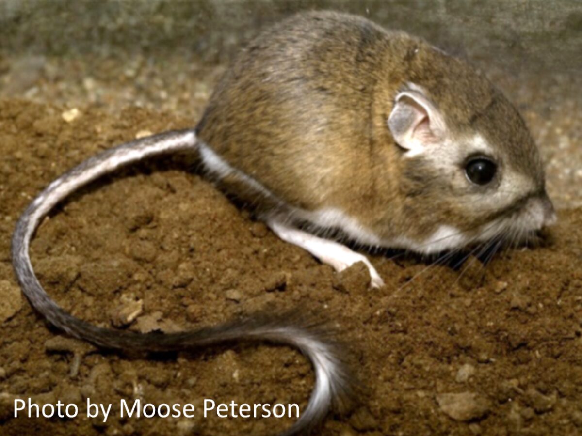
CBI’s Data Basin platform supports the Stephens’ Kangaroo Rat Rangewide Management and Monitoring Program, a collaborative effort to develop and implement a range-wide conservation plan for the Stephens’ kangaroo rat (Dipodomys stephensi, SKR), a remarkable kangaroo-like rodent endemic to southern California’s shrinking grassland habitats. Rangewide conservation actions are helping, as the SKR was recently down-listed from endangered to threatened under the US Endangered Species Act.
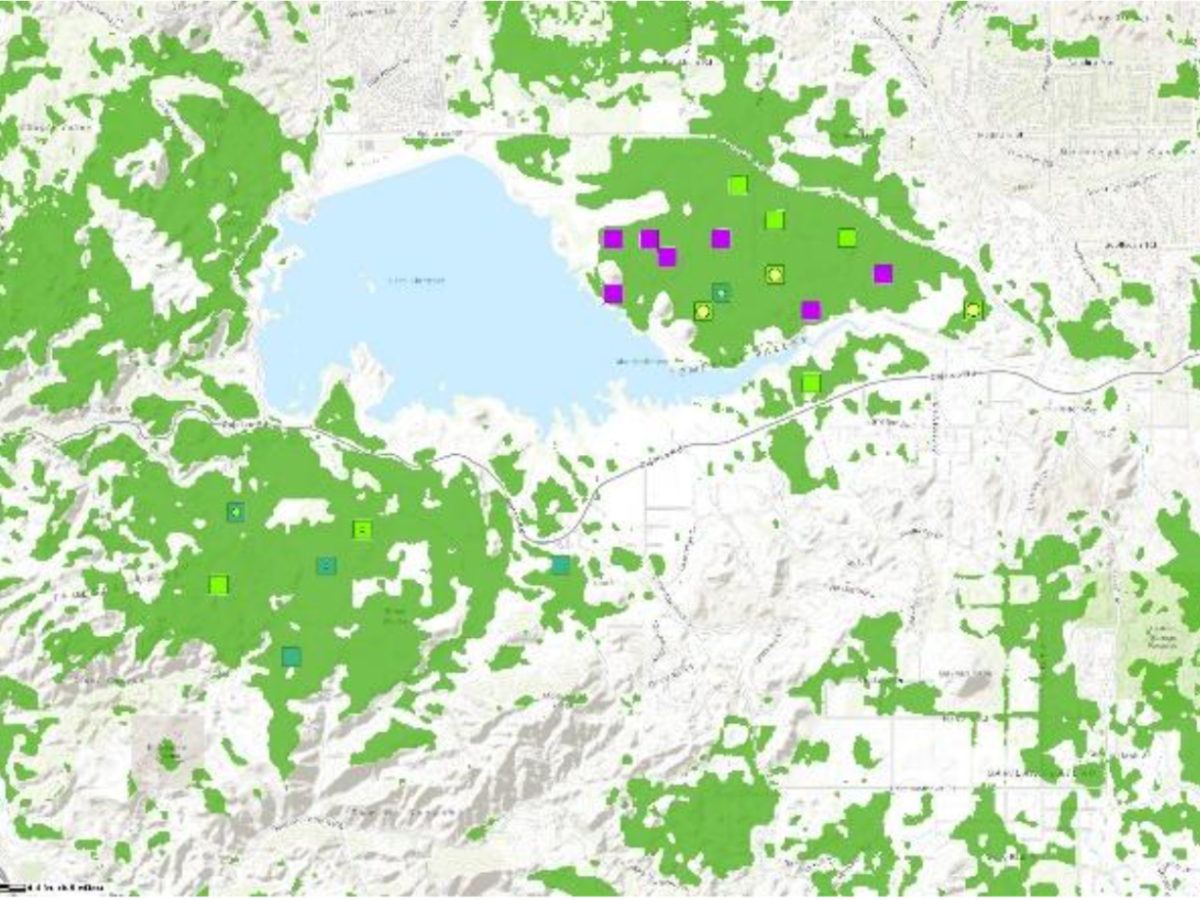
Data Basin’s collaborative mapping and data-sharing functions support the interdisciplinary decision-making that characterizes the effort. The SKR Team (CBI, Riverside County Habitat Conservation Agency, Bureau of Land Management, U.S. Fish and Wildlife Service, San Diego Zoo Wildlife Alliance Academy, and others) uses the SKR Rangewide Management & Monitoring Website to share the program’s key documents, population monitoring data, and conservation decisions. The Data Basin site provides interactive maps of SKR habitat quality, population distribution and abundance, conservation reserves, and other spatial data key to the team’s monitoring, research, and management actions.
Data Basin has empowered conservation practitioners and policymakers to advance the recovery of this rare and fascinating creature.
High-Resolution Map Export Option Added
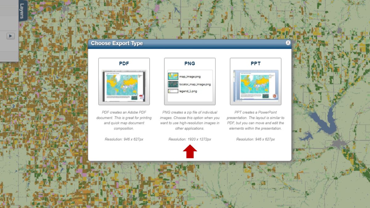
To generate sharper images (~600 dpi) of your maps, Data Basin now offers a high-resolution export option in PNG format. So, if you need a more visually crisp map for printing or publication, this is the way to go.
Dataset of the Month
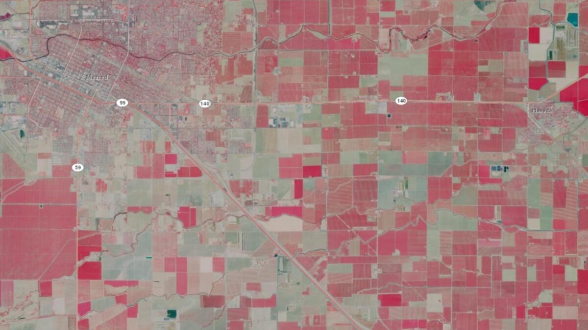
Data Basin screen capture showing the color-infrared image for the area of California between Merced and Planada. The red color depicts various intensities of agricultural crops.
Did you know you can link high-resolution airborne imagery from the National Agriculture Imagery Program (NAIP) into Data Basin? The California state composite is a compressed color-infrared image made available by the California Department of Fish and Wildlife as a map service.
Notice: The video content on our website is currently under construction, updates coming soon!