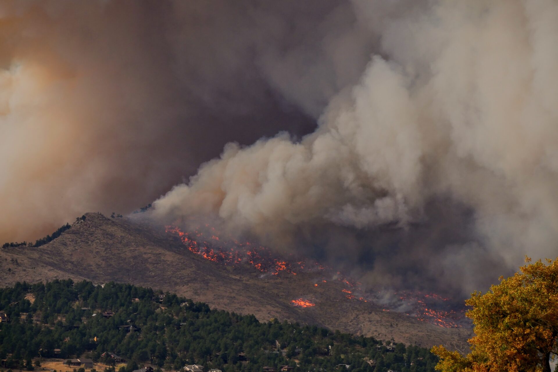
As the Sierra Nevada foothill communities of Paradise, Magalia, and Concow-Yankee Hill rebuild after the devastating Camp Fire of 2018, the community has an opportunity to incorporate strategies to increase its resilience to fire and climate change, enhance the safety and well-being of its residents, and successfully steward the surrounding natural areas that make it a beautiful place to live.
This project sought to establish whether there is there a scientific justification for a “defensible space” zone around a community – one that can provide both a boundary for urban growth to reduce habitat fragmentation and impacts and enable safer communities for people. In addition, this project used Paradise, CA as a case study to develop a model prioritization schema.
CBI, The Nature Conservancy, and the Paradise Recreation and Parks District partnered to explore community design elements with the intention to test the concept that a community can be protected from ignitions from wildland fires with the use of Wildfire Risk Reduction Buffers (WRRBs) between the urban area and the wildlands.
We defined WRRBs as zones comprised of green land uses or “greenbelts” of parkland, orchards, and other low ignition-risk land uses, combined with wildland properties managed for fire risk reduction.
We explored how WRRBs could reduce urban ignition risks while offering additional benefits, including open space for recreation, emergency refuges and staging areas for fire-fighting, and conservation benefits by decreasing edge effects of human settlements.
The project had three main activities:
- Review of the scientific and other published literature. The CBI team surveyed the relevant peer- reviewed scientific and other (mostly state and local government) literature concerning land use approaches to fire risk reduction. This report, delivered as a separate document, discusses information found in 129 publications covering the period 1973 to 2020.
- Wildfire Risk Reduction Buffer mapping and design. CBI facilitated seven online meetings with TNC and Paradise Recreation and Parks District staff to co-design WRRBs around the Paradise and Magalia urban areas. We used a combination of available data and local knowledge to prioritize parcels for fire risk-reduction management. We compared the risk of ignition from wildfires under the towns’ former land-use arrangements to scenarios in which the prioritized parcels were converted to lower fire risk through land cover management. The products of this effort are: Wildfire Risk Reduction Buffers, prioritized parcels, management scenarios, and analyses of potential benefits, management opportunities, and approaches.
- Engagement with stakeholders. The Paradise Technical Advisory Committee (Paradise TAC) was convened in two online meetings to present and discuss the results of this project. They were invited to review the draft report and provided input into the Management Options section.
Report Details