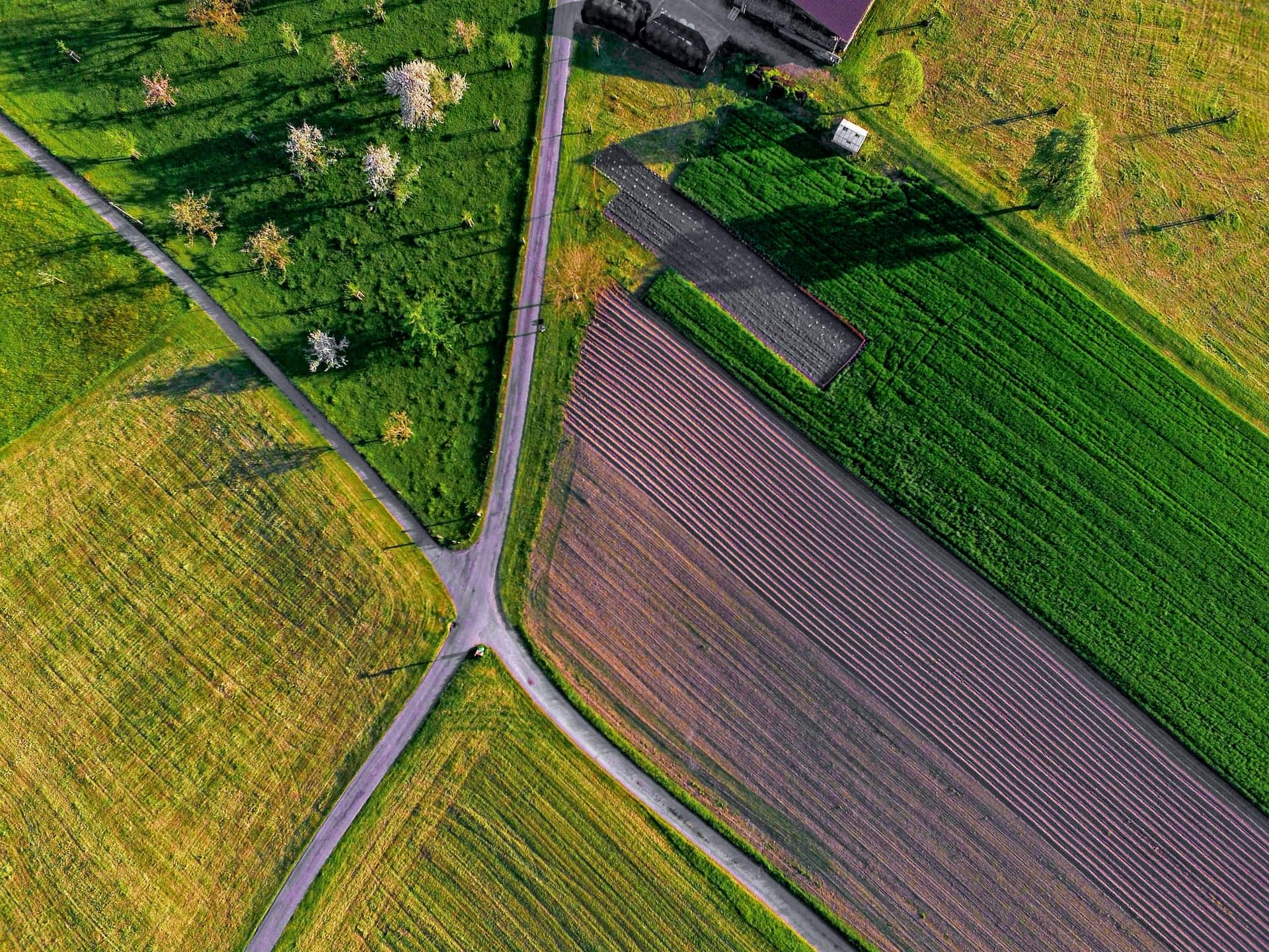
Both land and water resources are essential to agriculture in the San Joaquin Valley and other Mediterranean climates in California. These resources are under pressure from a variety of factors that have the potential to significantly affect the food production capacity of a region that contributes importantly to the food security of the state, nation and the world. The most significant challenges appear to be climate change, especially its impact on water supplies, environmental factors such as in-stream water needs, soil impairment, and urban development.
American Farmland Trust has partnered with the Conservation Biology Institute to undertake a spatial analysis to identify agricultural areas that are most at risk due to these challenges. Understanding how and where water supply shortages, soil impairment, urban growth or climatic changes may impact agriculture will contribute to the discussion of strategies for agricultural adaptation and conservation in the Valley.
This project will build on the successful effort led by CBI to identify areas where large-scale solar energy projects sited in the Valley would pose the least conflict to agricultural and environmental values (A Path Forward). As with the solar project, spatial analysis will occur at a broad Valley wide level, but with a finer grained analysis of at least two counties. A number of scenarios, representing different assumptions about physical and policy trends, will be done to further enrich our understanding of the future prospects of Valley agriculture. Input from technical experts and regional stakeholders will be sought throughout the process to help determine how to rank resource values and risks, and to help formulate future scenarios. We are now actively recruiting stakeholders to participate in the process.
The ultimate goal of the project is to encourage and inform a purposeful regional conversation about strategies that will be needed to meet the land and water resource management challenges and, thus, assure a productive and prosperous future for San Joaquin Valley agriculture.
The Desert Renewable Energy Conservation Plan (DRECP), a major component of California’s renewable energy planning efforts, is designed to provide effective protection and conservation of desert ecosystems while allowing for the appropriate development of renewable energy projects. Approximately 22.5 million acres of federal and non-federal California desert land are in the DRECP Plan Area. The federal portion of plan area was released by the Bureau of Land Management as a Land Use Plan Amendment (LUPA). The project is now transitioning into Phase II, which focuses on county-level planning designed to work in conjunction with the LUPA.
During Phase I of the project, CBI provided science support for this ambitious planning process including a wide range of spatial models and assessments (e.g., species distribution, intactness, conservation value, and climate change). CBI also developed and continues to maintain the DRECP Gateway (launched on September 26, 2014) and various interpretation applications to support the determination of the Final Plan and its implementation. One example of an interpretation application is the DRECP Climate Console, which was designed to allow users to explore climate projections to better understand how climate change could alter ecosystems in the California desert. It provides science-based and actionable climate data to encourage smarter, more comprehensive landscape-level conservation planning efforts and decisions.
During Phase II of the project, CBI is customizing the Gateway to support the adaptive management aspects of the LUPA and to support the county-level planning processes.
To access the gateway, please visit http://drecp.databasin.org/
To access the Climate Console, please visit http://drecp.consbio.webfactional.com/climate
To learn more about the DRECP, please visit www.drecp.org or visit the Data Basin Guide and Case Study about DRECP at http://databasin.org/articles/1408e0eed6754d68a06047aaa0e64c2b
Conserved lands in southern San Diego County form the cornerstone of the San Diego Natural Community Conservation Planning (NCCP) network. This region supports the largest expanse of remaining coastal habitats in southern California—coastal sage scrub, maritime succulent scrub, chaparral, riparian woodlands, vernal pools, and grasslands. Intact landscapes are critical to genetic interchange within plant and animal populations and allow dispersal and recolonization of new areas. Large landscapes that span elevational gradients, such as this core area in south San Diego County, also enable populations to shift in response to environmental and land use changes.
State Route 94 (SR-94) cuts through the heart of this core area, potentially impeding wildlife movement across otherwise intact landscapes. New residential development and a casino under construction in Jamul will increase traffic and potentially impact the wildlife value and connectivity of adjacent conserved lands. Proposed road improvements associated with these new land uses provide an opportunity to mitigate the potential barrier effects of SR-94. Scientific literature suggests that strategically-placed wildlife fencing along roads, combined with effective wildlife crossing areas (e.g., undercrossings, overcrossings, bridges) are the most effective means of influencing animal behavior and directing animal movement, thereby reducing roadkill, enhancing connectivity, and improving traffic safety.
The purpose of this document is to provide available background information and connectivity objectives for multiple taxa that use this area and to identify potential infrastructure examples that could improve connectivity across the south county preserves. This document describes land uses, vegetation communities, and existing infrastructure along 12 miles of SR-94 and identifies potential locations, by road segment, where enhancements to existing undercrossings and additional fencing could facilitate wildlife movement across conserved lands. Because there are little wildlife movement data for this area, we outline wildlife movement studies and systematic collection of roadkill data that should begin now to inform and refine the actual design and placement of wildlife fencing and crossing structures. Once implemented, post-construction monitoring should be conducted to ensure that the new infrastructure is functional and cost-effective.
CBI and AECOM worked with the San Diego Management and Monitoring Program (SDMMP) and U.S. Geological Survey (USGS) – with oversight from the wildlife agencies – to develop preserve management plans that incorporate elements of the Management Strategic Plan for Conserved Lands in western San Diego County, related Strategic Plans for invasive species and wildlife connectivity, and any relevant regional habitat conservation subarea plans. These management plans serve as pilots for the standardized development of resource management plans by other land managers throughout the region. We developed plans for two preserve complexes: (1) the Southwest Otay Mesa preserve complex, which includes lands owned and managed by the City of San Diego, County of San Diego, and California Department of Transportation (Caltrans) and (2) the Greater Crestridge Ecological Reserve Complex, which includes lands owned and managed by the Endangered Habitats Conservancy (EHC). The latter plan was finalized (including a detailed, 5-year budget) in 2017, updated with additional preserves in 2018, and is being implemented by EHC land managers.
Plan development differs from traditional approaches in that we conducted rapid assessments to identify threats that needed immediate management attention rather than comprehensive biological surveys. We also identified potentially-occurring biological resources, future survey needs, preserve-specific management priorities, SMART goals, objectives, and action items, and opportunities for coordinated management across preserve boundaries.
Funding for this project was through the San Diego Association of Governments (SANDAG), with additional funding from the Endangered Habitats Conservancy to update the Greater Crestridge Ecological Reserve Complex Framework Resource Management Plan.
The San Joaquin Valley Data Basin Gateway was created to support a multi-stakeholder effort to identify least conflict lands for utility scale solar development in the San Joaquin Valley in Central California. Stakeholders represented include the solar industry, farming community, ranching community, and environmental community. Each stakeholder group addressed the least conflict question from their perspectives and generated map-based results. After compiling the results, around 470,000 acres of land was identified as potentially desirable to solar developers and least conflict from the standpoint of the other groups. Phase I is complete with a final report due out in February 2016, but the Gateway persists with an extremely valuable data library (~600 datasets pertinent to the region) and other content, and stakeholders have expressed interest in continuing to use the system to continue refining the work into the future.
Working closely with the Natural Resources Defense Council (NRDC), CBI conducted an assessment of the risk to the bottomland hardwood/wetland forests of the US Southeast to the growing threat from the wood pellet industry largely to fuel power plants throughout the European Union (EU). The final report released by NRDC was entitled, “In the U.S. Southeast, Natural Forests are Being Felled to Send Fuels Overseas“.
This report details the threats facing Southeastern U.S. Forests, which is widely recognized as one of the world’s biodiversity hotspots, from the wood pellet industry, which has seen a 150 percent increase in wood pellet exports between 2012-2015. The report explains that 24 million acres of unprotected Southeastern forest lands are at risk and predicts that pellet manufacturing could increase to be twelve times larger than it currently is by 2020. For a one-hour webinar dedicated to this topic, see Bioenergy Threatens Wetland Forests of the US Southeast.
CBI is providing science and technical support to assist the California Energy Commission (CEC) in planning the state’s future energy needs, which includes achieving aggressive renewable energy goals with minimal damage to natural systems. Building off of previous work completed for the Desert Renewable Energy Conservation Plan (DRECP), CBI is working to improve access and transparency of scientific data, maps and analysis. As a subset of the work, CBI is supporting the Renewable Energy Transmission Initiative 2.0 (RETI). RETI, according to the CEC, “is an open, transparent, and science-based process that will explore the abundant renewable generation resources in California and throughout the West, consider critical land use and environmental constraints, and identify potential transmission opportunities that could access and integrate renewable energy with the most environmental, economic, and community benefits.”
CBI is developing additional data, models, tools, and technical assistance that align with statewide energy and climate change adaptation planning. This work extends the information and tools previously built for the DRECP planning region to other areas of the state particularly in areas with high renewable energy potential.
Climate change and related impacts such as drought and wildfire are growing concerns throughout the state. In response, CBI is developing additional datasets and visualization applications to put this information into statewide context. CBI will deliver this data and information to the CEC and other California State agencies.
The Santa Barbara County Conservation Blueprint provides a common language and platform for publicly available data to support in depth conversations and informed decisions about the Santa Barbara County landscape. This collaborative project aims to describe the current landscape, natural resources, and community values about land in Santa Barbara County.
CBI is supporting this process for the Santa Barbara County region. The process is led by the Land Trust for Santa Barbara County, Cachuma Resource Conservation District, and the Santa Barbara Foundation’s LEAF Initiative to develop a Conservation Gateway for Santa Barbara County. This process is also guided by a 12-member Steering Committee representing agriculture, conservation, resource management, and the natural sciences.
This data gathering and community engagement process led to a Conservation “Blueprint” (including a Data Basin Gateway) that is providing a science based decision-making platform for future conservation in the county, including acquisition, restoration and guidance for other potential land management opportunities. In the long-term, this process is expected to include collective visioning, tool- sharing and collaborative strategies. The effort will strengthen the region’s integrity by building community, sharing information, and facilitating stewardship.
Visit www.sbcblueprint.net to learn more about the Blueprint project and explore the online Atlas.
The Crestridge Ecological Reserve (CER) is owned by the California Department of Fish and Wildlife and managed by the Endangered Habitats Conservancy (EHC), while the South Crest Preserve Complex which is owned and managed by EHC. Together these properties comprise approximately 4,000 acres of conserved land in San Diego County, CA. They high value species and habitats, and function as a critical linkage between conserved lands in the San Diego National Wildlife Refuge to the south and the Cleveland National Forest to the north and east.
CBI has provided science support for these lands since 2000, including baseline surveys, vegetation mapping, rare plant monitoring, invasive species mapping and management, habitat restoration, and experimental programs to develop or refine Best Management Practices (BMPs) for adaptive management onsite and in the region. In addition, CBI prepared the Habitat Management and Monitoring Plan for Crestridge and is currently preparing the Resource Management Plan for the South Crest Preserve Complex. These activities are documented in reports. Please refer to Data Basin for spatial data:
https://databasin.org/groups/92c7bce8d88d43b3a800dd686195007e/content#expand=22873
https://databasin.org/groups/92c7bce8d88d43b3a800dd686195007e/content#expand=22873%2C22874
https://databasin.org/groups/92c7bce8d88d43b3a800dd686195007e/content#expand=22873%2C28744
https://databasin.org/groups/92c7bce8d88d43b3a800dd686195007e/content#expand=22873%2C28744%2C82726
Southern California NCCPs support edaphic endemic plants that face low genetic diversity due to reduced population sizes, geographic isolation, and loss of pollinators. To enhance the resilience of these species across their ranges, we must manage threats to increase population sizes, identify potentially suitable habitat to connect existing populations, find or restore new populations, and provide opportunities for shifting distributions due to climate change. The Management Strategic Plan for San Diego County requires prioritization and management for edaphic endemic plants, including the five species addressed in this proposal: Acanthomintha ilicifolia, Brodiaea filifolia, Deinandra conjugens, Nolina interrata, and Tetracoccus dioicus. Regional goals include maintaining or expanding existing occurrences or establishing new occurrences to increase resilience to environmental stochasticity, maintaining genetic diversity, and ensuring persistence over the long-term in native plant communities.
This study presents an approach for identifying and describing geographic areas that support edaphic endemic species and their habitat in a design that enhances resilience and provides opportunities for shifting distributions. We developed conceptual models to inform field studies and management, refined soils and vegetation attributes, and assessed regional population structure and threats. We used results to suggest prioritized locations for surveys, management, potential translocation, and additional conservation or acquisition. Project partners (U.S. Geological Survey and San Diego Management and Monitoring Program) modeled suitable habitat for the target species under current and future climate scenarios; we reference models as appropriate.
All target species occur on nutrient poor soils, and each species is associated with a unique suite of physical and chemical soil properties. We provide a range of variables for each species that can inform site selection for management and restoration. Testing soil before enhancing or augmenting small occurrences will allow us to locate suitable sites and eliminate or remediate unsuitable sites with remnant populations before investing management funds.
We used distribution data, habitat suitability models, genetic principles and information to develop regional population structures for each target species. We then identified populations or population groups important for long-term resilience and locations where conservation and management actions would be most beneficial.
Models predict declining habitat in the future for all target species under various climate scenarios, although the amount of predicted habitat remaining varies among species. We recommend conserving future predicted suitable habitat within or beyond San Diego County, and experimentally translocating target species into this habitat as climatic conditions change if monitoring indicates further species declines.
This work contributes to San Diego NCCP subarea plans in progress and other NCCPs. The project area includes the North County MSCP, South County MSCP, and MHCP.
CBI biologists Patricia Gordon-Reedy, Spring Strahm, and Jessie Vinje worked with the San Diego Management and Monitoring Program, U.S. Fish and Wildlife Service, California Department of Fish and Wildlife, The Nature Conservancy, Space and Naval Warfare Systems Command (SPAWAR), and San Diego County land managers on this project. The California Department of Fish and Wildlife funded this work under a Local Assistance Grant.