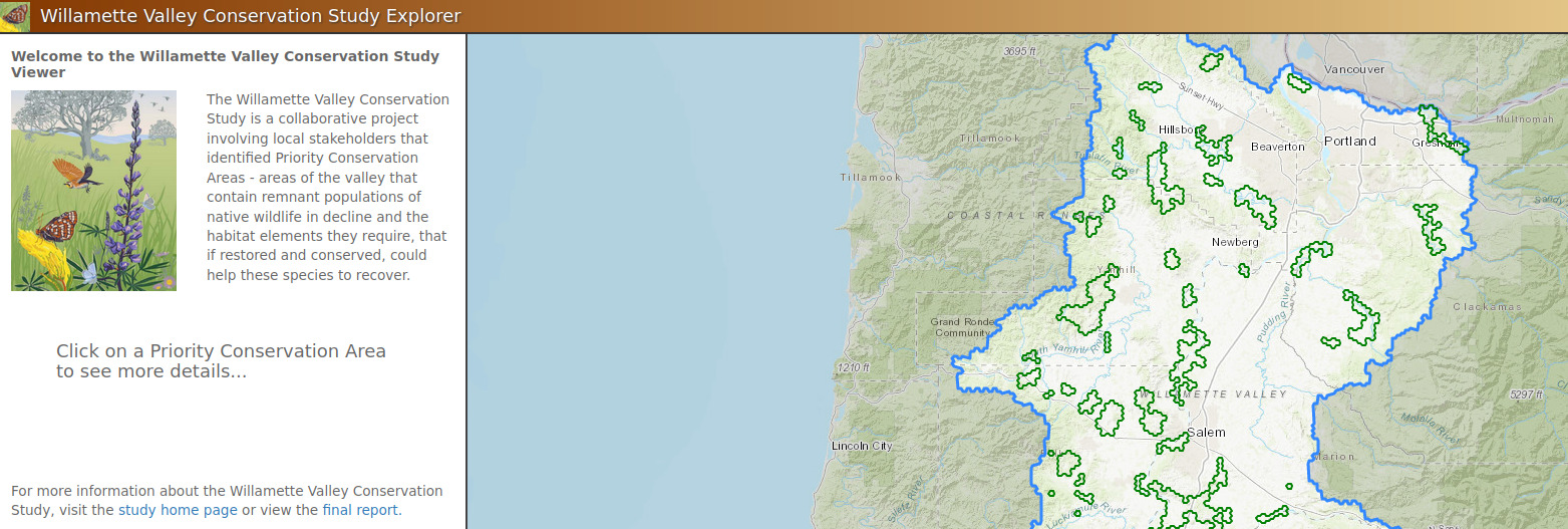
A collaborative project involving local stakeholders that identified Priority Conservation Areas
The Conservation Biology Institute partnered with The US Fish and Wildlife Service, Refuges Lands Division and North Pacific LCC, to develop an interactive web-based mapping tool to support the Willamette Valley Conservation Study (WVCS). This tool is targeted to conservation partners in the region, as well as the general public. The primary objective of this tool is to serve as a communication and data exploration tool for priority areas identified within the WVCS, and will allow users to understand the key characteristics of each priority area and better understand why each area was selected.
The USFS Forest Inventory and Analysis (FIA) team, regional partners and CBI developed the Micronesia Challenge Regional Terrestrial Monitoring Initiative tool (mcterrestrialmeasures.org) to allow users to visualize the spatial data from the Micronesia Challenge monitoring effort by regional framework indicator(s) that measure the status of managed conservation areas set aside under the program. Forest data were collected between 2003 and 2018 and are now being used to determine the status and trends in forest area, forest health, understory vegetation, biomass, and carbon storage.
The Micronesia Challenge is a commitment by the Republic of Palau, Guam, the Commonwealth of the Northern Mariana Islands, the Federated State of Micronesia, and the Republic of the Marshall Islands to preserve the marine and terrestrial resources that are crucial to the survival of the Pacific traditions, cultures and livelihoods. The overall goal of the Micronesia Challenge is to effectively conserve at least 30% of the near-shore marine resources and 20% of the terrestrial resources across Micronesia by 2020.
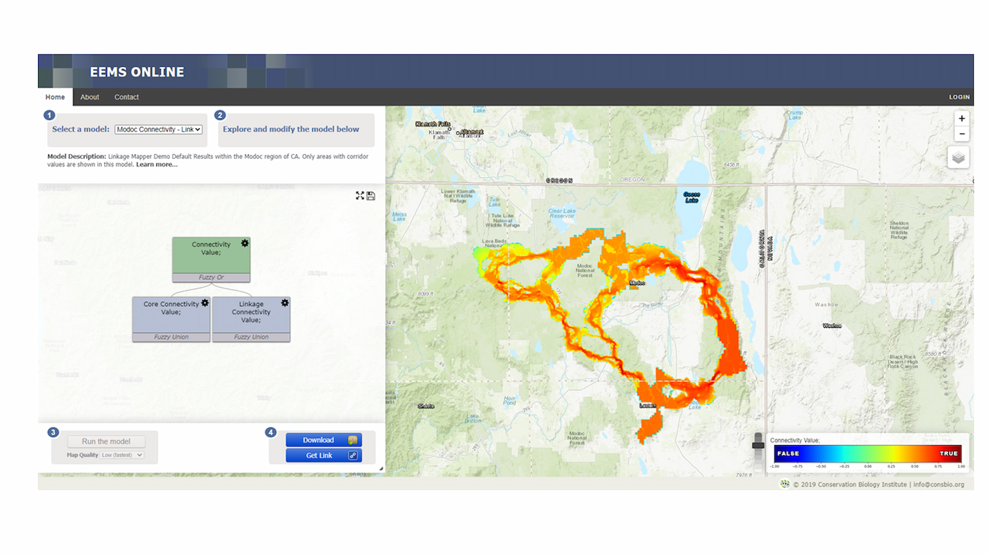
Linkage Mapper is a GIS toolbox designed to support regional wildlife habitat connectivity analyses. It consists of several Python scripts, packaged as an ArcGIS toolbox, that automate mapping of wildlife habitat corridors. The toolbox is comprised of six tools, described below.
The primary and original tool in the toolbox is Linkage Pathways. Linkage Pathways uses GIS maps of core habitat areas and resistances to identify and map linkages between core areas. Each cell in a resistance map is attributed with a value reflecting the energetic “cost”, (i.e. difficulty and mortality risk) of moving across that cell. Resistance values are typically determined by cell characteristics, such as land cover or housing density, combined with species-specific landscape resistance models. As animals move away from specific core areas, cost-weighted distance analyses produce maps of total movement resistance accumulated.
The Linkage Pathways tool identifies adjacent (neighboring) core areas and creates maps of least-cost corridors between them. It then mosaics the individual corridors to create a single composite corridor map. The result shows the relative value of each grid cell in providing connectivity between core areas, allowing users to identify which routes encounter more or fewer features that facilitate or impede movement between core areas. Linkage Pathways also produces vector layers that can be queried for corridor statistics.
The Climate Smart Restoration Tool (CSRT) was developed to provide information on seed collection and transfer of native plants. The CSRT maps current and future seed transfer limits for plant species with or without genetic information using climate data.
The goals of the CSRT are to:
● provide guidance for seed transfer by identifying areas with analogous climate for
current and midcentury time periods
● assess potential species for ecosystem restoration using compiled species data
from vegetation inventory plots
● infer vegetation transitions over time using current and midcentury climate to
predict changes in species frequencies
History of the Seedlot Selection Tool (SST) and the Climate Smart
Restoration Tool (CSRT).
The SST and CSRT were originally designed to have parallel methods to address seed transfer guidance for trees and non-trees, respectively. These web-based platforms included two approaches: generalized and genecological methods. Briefly, the generalized method uses climate variables to define seed transfer limits, and the genecological method uses existing species-specific trait data described by climate-based regression functions to define seed transfer limits. For more information on the SST methods see St.Clair et al. (2022). Given the substantial differences in the approaches described below, the genecological data within the CSRT has been transferred to the SST and the URL for the CSRT (https://climaterestorationtool.org/) houses the new generalized approach described below.
EEMS Online is a web-based mapping and modeling system designed to allow the user to explore, modify, and run models constructed within the Environmental Evaluation Modeling System (EEMS). You can also order a customized version of EEMS Online for your region, topic, and organization that can either be available to the publicly or reserved for private organizational use. Visit California Offshore Wind Energy Modeling Platform for an example.
The Seedlot Selection Tool (SST) is a GIS mapping program designed to help forest managers match seedlots with planting sites based on climatic information. The climates of the planting sites can be chosen to represent current climates, or future climates based on selected climate change scenarios. It covers the entire continental USA, Canada, Alaska, and Mexico. The tool is a result of collaboration between scientists from the U.S. Forest Service, Oregon State University, and developers and communication specialists from the Conservation Biology Institute
The Healthy Soils Program (HSP), which is managed by the California Department of Food and Agriculture (DFA), provides financial support to California growers and ranchers to implement conservation management practices on their land that help sequester carbon, reduce atmospheric greenhouse gases, and improve overall soil health. CBI’s web tool was developed to assist Healthy Soils Program applicants to submit funding proposals and help agency staff make awards more efficiently.
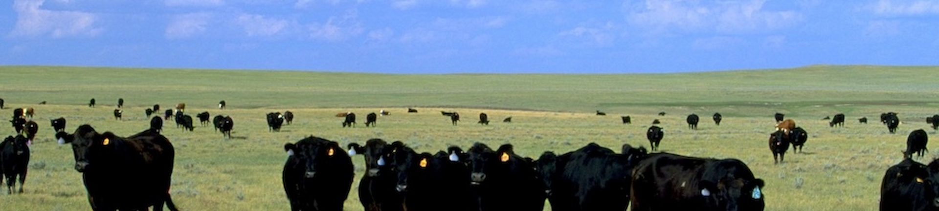
The California Department of Food and Agriculture (CDFA) Alternative Manure Management Program (AMMP) provides financial incentives for the implementation of non-digester manure management practices on dairy and livestock operations in California, which will result in reduced greenhouse gas (GHG) emissions. This web application primarily provides tools for potential applicants to map out their project site’s current practices and proposed alternative manure management practices which are supported by AMMP. The tool also assesses the proposed project’s estimated GHG reductions (following the AMMP Quantification Methodology and accompanying Benefits Calculator Tool developed by the California Air Resources Board).
The CDFA AMMP Project Planning Tool provides California dairy and livestock operators an opportunity to easily visualize an alternative manure management practice that reduces carbon emissions, using simple ways of mapping proposed operations on the farm. The Tool increases access for potential applicants to create maps describing their current and proposed manure management, thus improving their AMMP grant applications, and our ability to review projects efficiently. The CBI team did an amazing job communicating with us regularly, offering suggestions, and helping put our ideas and the rather complex elements of our grant program together into a really beautiful and user-friendly tool.
Alyssa Louie – Senior Environmental Scientist, California Department of Food and Agriculture
Helping dairy farmers choose climate-smart manure management systems for potential funding from the California Depart of Food and Agriculture through their Alternate Manure Management Program (AMMP)
The CDFA AMMP Project Planning Tool provides California dairy and livestock operators an opportunity to easily visualize an alternative manure management practice that reduces carbon emissions, using simple ways of mapping proposed operations on the farm. The Tool increases access for potential applicants to create maps describing their current and proposed manure management, thus improving their AMMP grant applications, and our ability to review projects efficiently. The CBI team did an amazing job communicating with us regularly, offering suggestions, and helping put our ideas and the rather complex elements of our grant program together into a really beautiful and user-friendly tool.
Alyssa Louie – Senior Environmental Scientist, California Department of Food and Agriculture
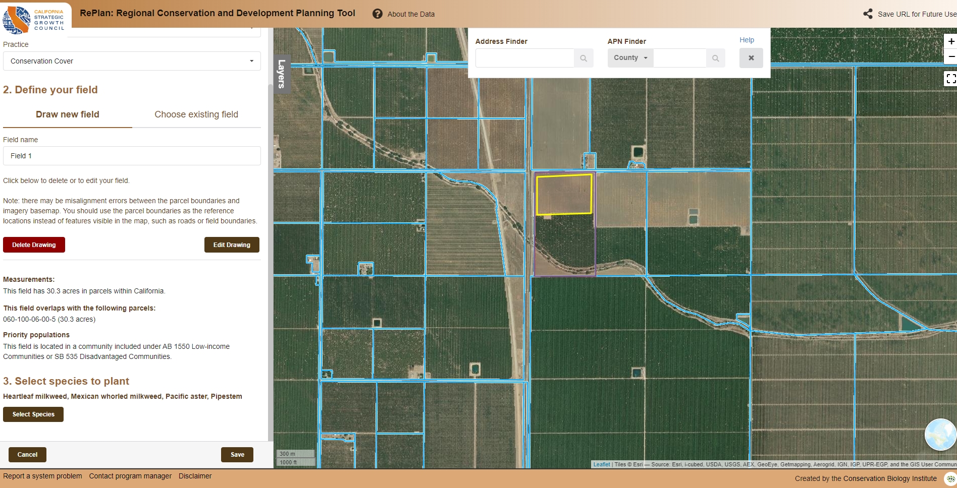
RePlan is a core component of the California Strategic Growth Council’s (SGC) Integrated Regional Conservation and Development (IRCAD) initiative. This online tool supports the development and implementation of a sustainable and balanced vision for regional conservation and economic development. RePlan integrates the latest environmental, social, and economic data with analytic and reporting tools to allow users to identify optimal locations for implementing California’s conservation, resource management and development objectives. This tool helps to align regional planning and management activities in light of State and regional conservation, development, equity and resilience goals.