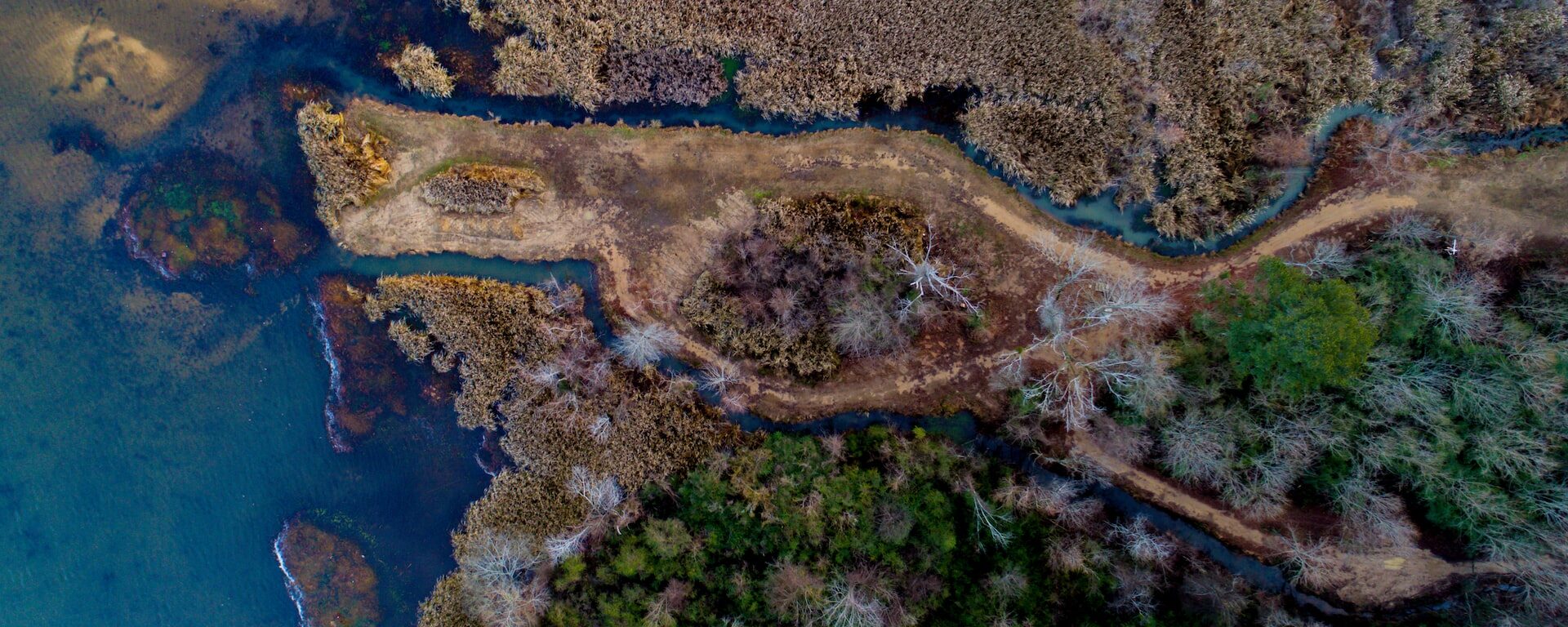
CBI recently worked with the Pacific Marine & Estuarine Fish Habitat Partnership (PMEP) to update the West Coast Estuaries Explorer, a tool designed to engage a broad range of users with detailed information about estuaries along the U.S. West Coast. The first version of this tool was developed in partnership with PMEP and the North Pacific Landscape Conservation Cooperative. The partnership between CBI and PMEP continues with support from NOAA and the Pacific States Marine Fisheries Commission (PSMFC). The Estuaries Explorer got several performance and design updates to make it easier to use and more visually engaging. In addition to the latest available information for estuary boundaries and biological habitats, the Explorer now includes aerial images for each of the estuaries in Washington, Oregon, and California. Later this year, CBI and PMEP will incorporate additional information on the location of eelgrass habitat and areas of tidal wetland loss. PSMFC has taken over long-term hosting of this exciting tool.
Conservation Biology Institute is a partner in a new $1 million grant from a new interdisciplinary NSF program to foster building an “open knowledge network.” The inspiration for this type of network comes from Tim Berners-Lee’s (best known founder of the World-wide Web) vision for the “semantic web,” which applies tags with relationships to information on the Internet, allowing computers to do basic reasoning for improving search results and answering questions. Apple’s Siri, Amazon’s Alexa, and Google’s Assistant all use these technologies.
Dr. John Gallo co-wrote the proposal and leads CBI’s participation in the team of 13 researchers and practitioners from 10 other institutions. The team is focused on improving access and contributions to tools for analyzing geographic data called spatial decision support systems. “The proliferation of online mapping technologies has greatly increased access to and utility of these kinds of tools, and a logical next step is increasing our ability to find the appropriate data and tools for your problem and link these together for more complex analyses,” says Principal Investigator Sean Gordon of Portland State University. Through engaging stakeholders in three applied case studies (the management of wildland fire, water quality, and biodiversity conservation), the interdisciplinary project team will develop and test participatory and automated methods for finding and sharing decision-relevant information using semantic web technologies.
The new NSF Convergence Accelerator program is named for its focus on bringing together interdisciplinary teams to address one of NSF’s 10 big ideas, specifically “Harnessing the Data Revolution“, also known as building an Open Knowledge Network. Eighteen other of these phase 1 grants were made, covering areas from molecular manufacturing to tracking potentially disruptive solar phenomena. The “accelerator” part comes from the short time frame. “The application required a 3-week turn around, which is very quick for a NSF grant,” Gordon said. “Our success was largely due to having formed the Spatial Decision Support Consortium, a professional networking group four years ago, so we had ideas and people ready to go.” Each phase 1 project is eligible to submit a phase 2 proposal for up to $5 million by next March, and the process will include giving a short “pitch” talk to a panel of experts and potential funders, much like a venture capital approach.
*Learn more about this ongoing project here.
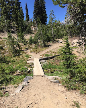
The Conservation Biology Institute and the Deschutes Trails Coalition (DTC) are in the process of developing a web-based system to assist the DTC in sustainably managing multi-use trails in Deschutes County. The collaborative process of creating a framework to support DTC’s decision making relies on modeling Environmental, Economic, Physical, and Social Sustainability of recreation activities and trails.
*Images provided by Danielle MacBain at the Deschutes Trails Coalition.
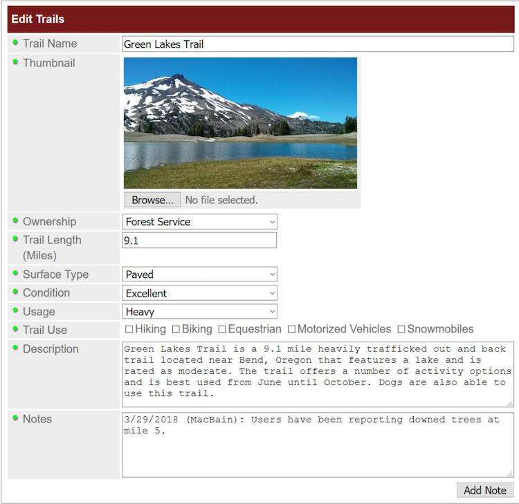
*The DTC Dashboard will include a form-based system to give users the ability to enter or modify information in the trails database.
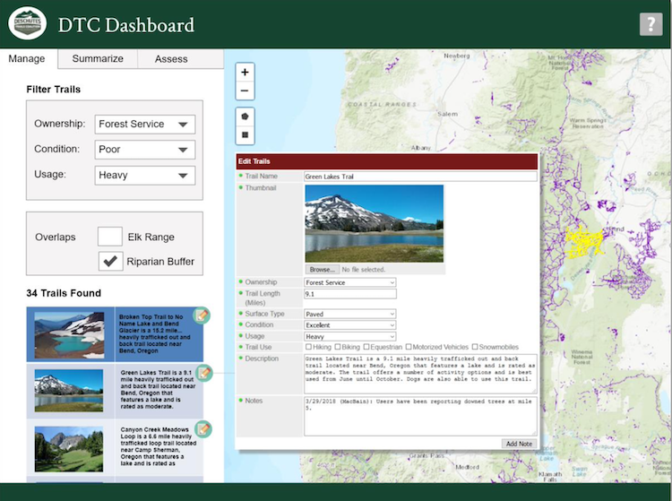
*Mockup of the DTC Dashboard (Query Tools on the Manage Tab)
Conservation Biology Institute specializes in harnessing the power of spatial data for conservation planning and decision-making. We create tools in close collaboration with state agencies that help them achieve their missions. Recently we’ve had the opportunity to work with the California Department of Food and Agriculture (CDFA).
The CDFA Healthy Soils Program promotes the development of healthy soils on California’s farmlands and ranch lands by providing financial incentives to California growers and ranchers to implement agricultural management practices that sequester carbon, reduce atmospheric GHGs and improve soil health.
Conservation Biology Institute created the CDFA Healthy Soils Program tool, an online tool to streamline the submission process for proposals to the Healthy Soils Program. This tool, a custom module of RePlan, allows a grant recipient to locate and map proposed conservation practices, view and select from recommended species for planting, and conform with multiple project eligibility requirements. All project components are then summarized in a proposal report for upload to the CDFA Healthy Soils Program project submission website.
*Find the tool here: https://sitecheck.opr.ca.gov/
CBI developed the tool for the Governor’s Office of Planning and Research (OPR) in coordination with the Department of Housing and Community Development. The tool was developed in partnership with OPR and is based on public input from partners through interviews, presentations, and workshops. Site Check is an innovative mapping tool that allows users to see if selected parcels may qualify for an existing streamlining option for housing development. The free tool allows users to map various CEQA definitions and filter parcels based on planning, transportation, and environmental criteria. Site Check is a good first step for developers and public agencies considering how California Environmental Quality Act (CEQA) may apply to a housing project. Check out the free tool here Site Check.
This tool is focused on the CEQA provisions that cover a variety of housing types. The Legislature has also created specialized provisions for specific types of projects, including affordable housing, agricultural employee housing, and motel-to-supportive housing conversions.
CBI updated the UI for the tool in 2023 and updated data, including the regional below-average Vehicle Miles Traveled (VMT), 15% below regional average VMT, parcel data, Specific Plans. Check these layers out in the tool or download them from Data Basin.
If you have any questions about Site Check, please feel free to contact Brianne Masukawa, brianne.masukawa@opr.ca.gov.
CBI has partnered with the Paulson Institute (PI), the Foreign Economic Cooperation Office (FECO) of the Ministry of Environmental Protection of China (MEP), and the State of California to provide FECO with an Environmental Risk Screening Tool that will help guide Chinese international investment projects. The overarching goal of the tool is to significantly reduce negative environmental impacts as the result of Chinese development projects around the world.
The screening tool will include interactive mapping of biodiversity and environmental data against which potential development projects can be evaluated. The tool will include a standard Biodiversity Impact Analysis using a set of internationally recognized datasets (e.g., Key Biodiversity Areas, Critical Natural Habitat, Alliance for Zero Extinction sites, and Protected Areas). The tool will also include regional and country-level biodiversity and environmental data in priority countries. The tool is not available for viewing at present. But here is a powerpoint describing its capabilities.
Supported by the California Wildlife Conservation Board, CBI will be working closely with the Strategic Growth Council, UC Davis, and other agency staff to conduct a Regional Conservation Assessment (RCA) for two pilot areas in the state – Mojave Desert and Modoc Plateau – and build an easy-to-use, online assessment tool to evaluate potential conservation investments based on a set of standards developed by the Integrated Regional Conservation and Development program (IRCAD). RCAs are designed to provide a standardized and current assessment of the biological values and ecological conditions within each ecoregion in California serving as the important context to carry out more effective and ecologically sensitive development in the state. This project builds upon existing investment through the California Energy Commission’s statewide renewable energy planning efforts.
Environmental information is often not widely available, including for the solar distributed generation energy sector. Additionally, environmental, engineering, cost, and electrical distribution grid data are typically disparate. This easy-to-use pilot screening tool developed in collaboration with Black & Veatch and funded by the California Energy Commission (CEC) integrates engineering, cost, and environmental information for planning and decision making specifically in Lancaster, California. The key benefits of such a tool include expedited project planning, reduced permitting and interconnection screening, and clearer stakeholder understanding of developable DG potential. The tool is designed to foster proactive system planning opportunities and an improved sense of regulatory impacts. This pilot screening tool can be viewed here.
The Conservation Biology Institute will partner with The US Fish and Wildlife Service, Refuges Lands Division and North Pacific LCC, to develop an interactive web-based mapping tool to support the Willamette Valley Conservation Study (WVCS). This tool will be targeted to conservation partners in the region, as well as the general public. The primary objective of this web-mapping tool is to serve as a communication and data exploration tool for priority areas identified within the WVCS, and will allow users to understand the key characteristics of each priority area and better understand why each area was selected.
This tool will be developed and managed by CBI, alongside and embedded in the North Pacific LCC’s Conservation Planning Atlas (http://wvcs.apps.nplcc.databasin.org/).
CBI is playing a key role in improving the health and resilience of wetland ecosystems in Southern California in a partnership with the Southern California Wetlands Recovery Project (SCWRP). The newly-released Marsh Adaptation Planning Tool provides data access and decision-support technology for SCWRP’s new Regional Strategy 2018, a recovery plan for tidal and non-tidal wetlands from Point Conception to the Mexican border.
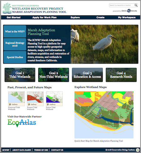
Above: The Marsh Adaptation Planning Tool homepage, with access to the Regional Strategy 2018, the spatial data that informed its development, and a special tool for planning projects that will contribute to its Work Plan.
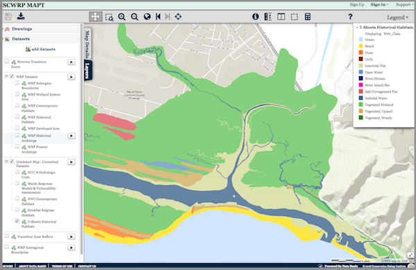
Above: The MAPT’s “Quick-Start Map” that allows the user to explore Southern California’s wetlands. Layers depicting historical and present-day wetlands, important transitions zones, and other features can be turned on and off for quick comparison. The map and its data layers can be downloaded for use in GIS, or saved and used with any other layers in Data Basin.
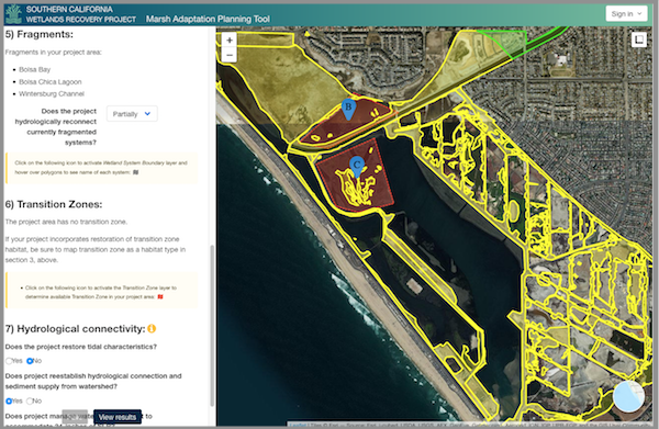
Above: The Marsh Adaptation Planning Tool’s project planning utility, where project proponents can use Regional Strategy 2018 spatial data, habitat types, and goals and objectives to inform the planning of a project and apply to have it included in the SCWRP Work Plan.