Urgent Effort to Preserve Environmental & Climate Data

According to a New York Times analysis published on February 2, 2025, “more than 8,000 web pages across more than a dozen U.S. government websites have been taken down … as federal agencies rush to heed President Trump’s orders.” Already, reports of missing data related to “climate”, “resilience” and “environment” have started flooding in. Conservation Biology Institute‘s Data Basin platform is well suited to host this type of spatially explicit data and is free to use.
In 2016, there was a similar purge of environmental data from Federal government websites, and at that time, CBI was able to preserve some of that data. During that period climate change datasets were the most targeted. Climate change data is once again being targeted as it is evidence of what All Gore called “inconvenient truths”. However, the purge target is much larger this time and many important datasets are in potential jeopardy. Anything that would “interfere” with oil and gas development, logging, and rolling back current environmental laws and accountability are threatened. The list is too long to provide.
CBI has launched an effort to preserve as much important environmental data as we are able, and you can help us in that effort.
If you have a background in GIS and would be willing to volunteer your time toward collecting and uploading data to the Data Basin platform to aid in the effort of preserving important climate and ecological data, please fill out this form, and we will be in touch about ways you can contribute to the effort.
If you’re unable to participate in this effort, but want to support it in other ways, a donation would be greatly appreciated at this time, as our hosting costs will inevitably go up as we add additional data to the platform.
New Video Tutorials

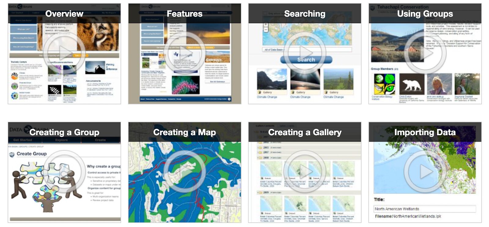
New and experienced Data Basin users alike may find our new library of tutorial videos useful. We cover everything from data imports, to map creation, to use of groups. There is likely some useful tip or trick for each of you in these videos, and we encourage you to take a look.
By disrupting wildfire regimes, climate and land use change transform ecosystems, alter carbon budgets, and drive socio-economic impacts in California. We propose to quantify how projected peri-urban growth in the wildland urban interface, climate change, and local management actions influence wildfire activity and downstream effects on vegetation transitions, carbon release, biodiversity, and vulnerable human communities.
We will model wildfire risk as a function of a limited set of stakeholder-guided, realistic future scenarios, using the LANDIS-II simulation model. Past studies have shown the importance of human ignition location and timing on wildfire activity in Southern California, a mechanism we will explore using different land use change scenarios.
We will also model and analyze the potential influence of increasing atmospheric aridity on fire size and severity in forests and compare these effects to adjacent shrubland plant communities.
Taken together, climate, land use, and other environmental variables can lead to fire-driven vegetation type conversion, which can influence carbon sequestration, biodiversity, and even future fire risk to human communities.
Finally, we will explicitly evaluate how different modeled management actions influence wildfire, plant succession, and carbon sequestration. The resulting maps and spatial products will help managers prioritize locations for conservation and management actions. Overlaying maps of vulnerable human communities and biodiversity hotspots with future wildfire change and downstream impacts can better define locations for priority action to facilitate co-benefits to human and natural resources. This research will contribute to scientific publications and be directly relevant to managers, including the Southern California Montane Forests Project.
The San Diego Zoo Wildlife Alliance (SDZWA) is a world-renowned conservation organization with a 1800-acre zoo, the Safari Park, that houses more than 2600 animal and 3500 plant species. Located in Escondido (northern San Diego County), the Safari Park also includes a 800-acre biodiversity preserve with some of the most well-preserved, California-endemic coastal sage habitat.
In 2007, the Witch fire burned through 600 acres of the biodiversity reserve and stopped just outside the Safari Park borders. Since then, the SDZWA has transformed their in-house wildfire preparedness program, including hiring a team of dedicated wildfire suppression staff, fire suppression equipment boxes scattered throughout the park, an infrared and visible spectrum camera array for early ignition detection, and a 8500-gallon water tank for aerial suppression by local first responders.
While these investments in wildfire readiness are important for protecting the Safari Park grounds, landscape-scale risk analyses are needed to determine where fires may start and spread outside of park boundaries and which additional management activities could mitigate risk from fires originating beyond Park borders. Conservation Biology Institute (CBI) and Dudek have proposed to co-create the needed wildfire risk analysis for the SDZWA Safari Park.
At the core of the risk analysis is a fusion and comparison between two commonly employed modeling efforts used in
CBI is a partner in producing a statewide wildlife connectivity ensemble model and associated mapped data in support of a connectivity action plan for the state, which is under development. The modeling will identify priority areas across the state in need of some form of mitigation to promote wildlife connectivity and reduce wildlife/vehicle collisions at the same time. The co-production process includes the close collaboration with an active Technical Advisory Group. The project is being funded by the Washington Department of Fish and Wildlife.
The Central Oregon Forest Stewardship Foundation (COFSF) mission is to increase quality and quantity of forest restoration and stewardship in Central Oregon. As part of this effort, we have created a geospatial gateway with a rich amount of information on forests, wildlife, wildfire, and climate in the area. The gateway is a customized portal that allows users exclusive access to CBI’s Data Basin and is being used for planning, implementing, and monitoring science-driven forest restoration and stewardship activities by a diverse group of partners.
COFSF embraces Shared Stewardship for Central Oregon which “challenges groups to engage in proactive planning and, in so doing, to identify a broader range of potential partners and to consider a wider array of conservation concerns. Partners work together to make decisions about priority projects and design, implement, and monitor work among multiple partners, across multiple jurisdictions, and address a wider array of conservation issues.”

Data Basin is a key enabler of this shared stewardship by providing an open and freely accessible platform to enable many siloed restoration projects to address the larger ecosystem needs and priorities. It empowers diverse stakeholders to collaborate and communicate with each other enabling multiple and durable benefits across the landscape.
The Giant Sequoia Lands Coalition (GSLC) is a collaboration of public and non-governmental organizations committed to the conservation of giant sequoia grove ecosystems. CBI is supporting the GSLC’s Sequoia Grove Protection and Resiliency Project with tools and assistance that will enable GSLC partners and stakeholders to work collaboratively to protect the species from the impacts of drought, beetles, and wildfire made more intense by climate change.
CBI is using its Data Basin platform (databasin.org) to host the Giant Sequoia Data Portal. The portal will be populated with custom maps of the sequoia groves linked to standard metrics and data for assessing grove condition, fuel treatments, and other range-wide information. To inform this giant sequoia management “dashboard” CBI is working with the GSLC to catalog an extensive collection of assessment, monitoring, and remote sensing datasets created by different agencies and projects over many decades of forest management and research. CBI will train and support the GSLC partners in their use of the Giant Sequoia Data Portal for promoting coordinated scientific research, monitoring, long-term species conservation, and continuing to share new data as it becomes available.

In the 1850s, immigrants seeking gold in California’s Sierra Nevada mountains created a connected network of open channels, wooden flumes, and pipes to direct water to their operations and the rapidly-growing foothill towns of Sonora, Columbia, and Jamestown.
170 years later, this historic system is an integral part of the water infrastructure that supports residential, agricultural, hydroelectric, ecosystem, and recreational purposes, providing nearly all of the drinking water to the west slope communities of Tuolumne County. Tuolumne Utilities District (TUD), the agency responsible for managing the 70-plus miles of raw water ditches and potable water infrastructure, is contending with a modern-day concern: the threat of severe wildfire.
Conservation Biology Institute and EN2 Resources, Inc. (en2resources.com/) partnered to develop the TUD Wildfire Defense Plan, which was adopted by Tuolumne Utilities District (TUD) in April of 2025.
This comprehensive strategy to protect Tuolumne County’s water resources and increase the community’s resilience to wildfire aligns with and implements the Tuolumne County Community Wildfire Protection Plan (CWPP). This plan also follows state and federal government directives relating to wildfire resilience for California’s communities and forests, including the California Wildfire and Forest Resilience Task Force’s Wildfire and Forest Resilience Action Plan and the U.S. Forest Service’s Wildfire Crisis Strategy Implementation Plan.

The TUD Wildfire Defense Plan contains two components:
TUD Wildfire Risk Mitigation Plan, prepared by CBI in consultation with TUD, presents prioritized locations for mitigating wildfire risks to TUD infrastructure and supports the effective planning and implementation of the prioritized projects while providing co-benefits to the community and natural resources.
The TUD Fire Water Draft Points Plan, prepared by EN2 Resources in consultation with TUD, identifies 49 strategic raw water draft points across the district to increase water availability for fire suppression, reduce demands on potable water systems, and enhance emergency response capabilities.Together these plans will help TUD manage the system as “green infrastructure”, a vision that addresses the integrated needs of people, the communities, and biodiversity under climate change. TUD, together with Pacific Gas & Electric, the US Forest Service, CAL FIRE, Tuolumne County, Tuolumne Fire Safe Council and the Tuolumne Band of Me-Wuk Indians are already working intensively to reduce fuels in the region, and this Plan will assist the agency in obtaining the funding needed to continue this important work.
The TUD Wildfire Defense Plan was developed with funding from the USDA Forest Service Community Wildfire Defense Grant. For more information about the TUD Wildfire Defense Plan, please visit https://tudwater.com/wildfire-defense-plan/.
The Marsh Adaptation Planning Tool (MAPT) supports the The Regional Strategy 2018 of the Southern California Wetlands Recovery Project. This new mapping tool – developed by CBI – illustrates and quantifies the ecological state and future potential of wetland zones. The WRP and its partners will use the MAPT to develop, evaluate, and prioritize restoration projects.
The Columbia Plateau in eastern Washington supports productive farmland and rangeland as well as native shrub-steppe habitat of which only 40% remains intact. The region also contains some of the most sought after land in the state for utility scale solar energy development, which is an important component of its future energy portfolio that strives to produce 80% of the state’s electricity from renewable sources by 2030 and 100% carbon-free by 2040.
CBI has been chosen by the Washington State University Energy Program to provide the science and mapping component in support of a voluntary, collaborative effort that brings stakeholders together in order to identify areas of least-conflict between solar energy development and other important ecological, economic, and social values in order to meet the state’s carbon-free energy goals. CBI’s contribution to this process is based on the successful pilot to this approach in the San Joaquin Valley in California. The project will include a new Data Basin gateway, which is a customized site for accessing the science and mapping resources for this project.
See the recent brochure published by Washington State University for more information.
CBI’s easy-to-use spatial analysis and sharing platform empowering people to create maps and collaborate from anywhere in the world. Has a growing list of 44,000+ users, 33,000+ datasets to choose from, and over 1000+ active collaborative groups working on a diverse set of problems.
“Data Basin has provided a fantastic means of sharing information with collaborators and intended users of data products from multiple projects. The intuitive design of the platform has meant that the learning curve for non-GIS users to meaningfully interact with my spatial data has been negligible, even as the more technical underpinnings (e.g., ability to connect with data hosted on ScienceBase) have saved me time and effort in meeting grant requirements for data sharing and documentation. Not to mention CBI staff have been phenomenally responsive to questions and suggestions along the way!” – Meredith Mclure, Lead Scientist | Conservation Science Partners