Data Basin Now Supports ArcGIS Pro Data Formats!
Data Basin now supports the latest version of the ESRI Layer Package format generated by ArcGIS Pro. These layer packages end with a “.lpkx” extension and can now be imported into Data Basin. Older layer packages generated by ArcGIS Desktop and ending with “.lpk” are still supported as well.
Alaska Yellow Cedar Species Conservation
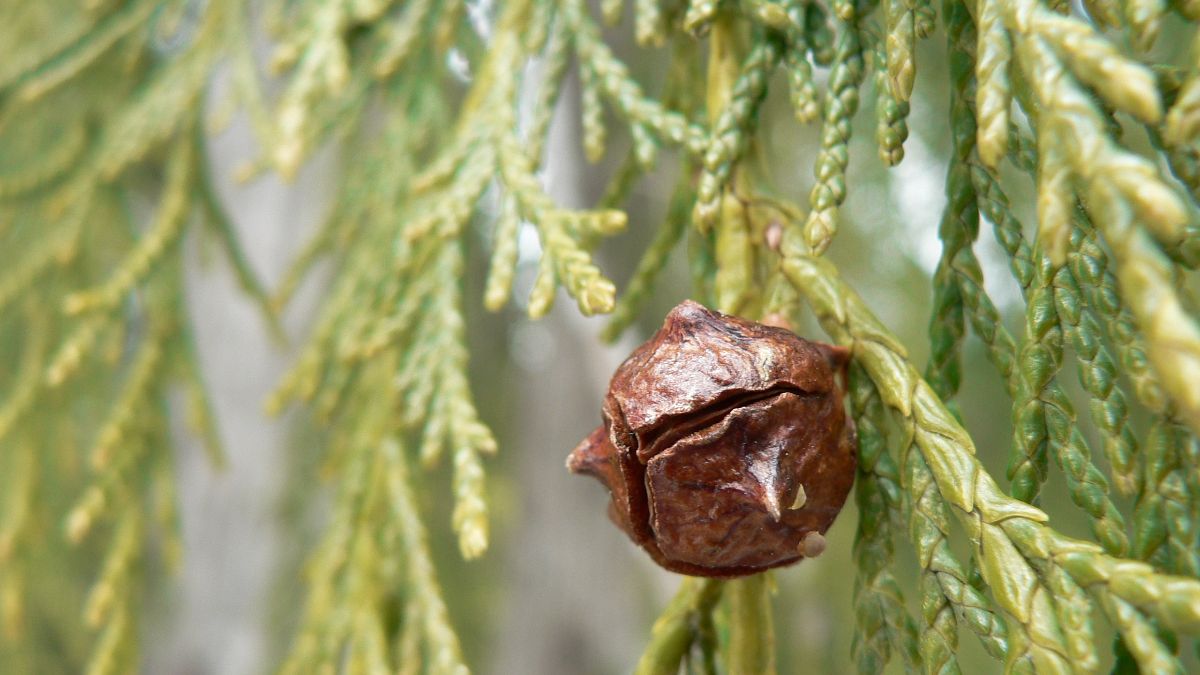
Alaska Yellow Cedar (Callitropsis nootkatensis (D. Don) D.P. Little 2004; syn Xanthocyparis nootkatensis (D. Don)) has an extensive range from Alaska to Northern California. It is a very culturally significant species for North American Tribes inhabiting its range. Its long durability because of its high resistance to decay makes it a prized timber species. It is declining in the northern part of its range due to a combination of factors associated with climate change, and is a rare species in the southern part of its range in California and Southern Oregon. These southern populations are ice-age relics that occur in isolated stands in sub-alpine zones in cool wet sites at high elevation > 5000 ft. The species was recently under review for listing as a threatened or endangered species. CBI was contracted to assess the southern relic populations and collect cones for seeds in 2018 as part of a US Forest Service effort to add these germplasms to its collections.
As part of that project, we created a Data Basin Gallery for Alaska Yellow cedar to organize and share available maps and related information on its range, occurrence, modeled distribution, etc. Data Basin provides many such tools for storing, sharing, and creating maps to support the study and conservation of individual species or landscape-level habitats.
One could create individual galleries for IUCN red-listed species or any other species of significant conservation concern. These spatial data galleries can be used to support collaborative research and conservation efforts that are either global or local in scale. Sign in to Data Basin and consider creating Galleries that support your work. Please contact Justin Brice (justin.brice@consbio.org) for assistance in uploading data.
Santa Barbara County Landscape Carbon Accounting
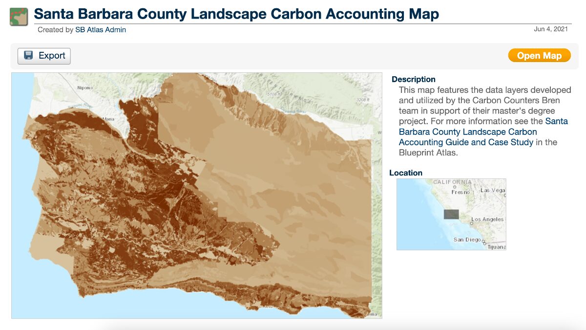
More than 85% of Santa Barbara County is covered by natural and working lands, vital to the environmental, economic, and residential well-being of the county. Natural and working lands also act as major carbon sinks but can become carbon sources depending on their management.
A group of Master’s Students from the Bren School of Environmental Studies and Management, UCSB, was able to quantify the existing carbon stocks on Santa Barbara County’s natural and working lands and was in turn able to recommend climate-smart land management practices, showing the data sources and spatial analysis that lead to their projections.
Updated Tutorial Videos Coming Soon
We are currently updating all of the Data Basin tutorial videos for our new YouTube Channel! Stay tuned as we make using Data Basin easier than ever with step-by-step guidance for users of any experience level.