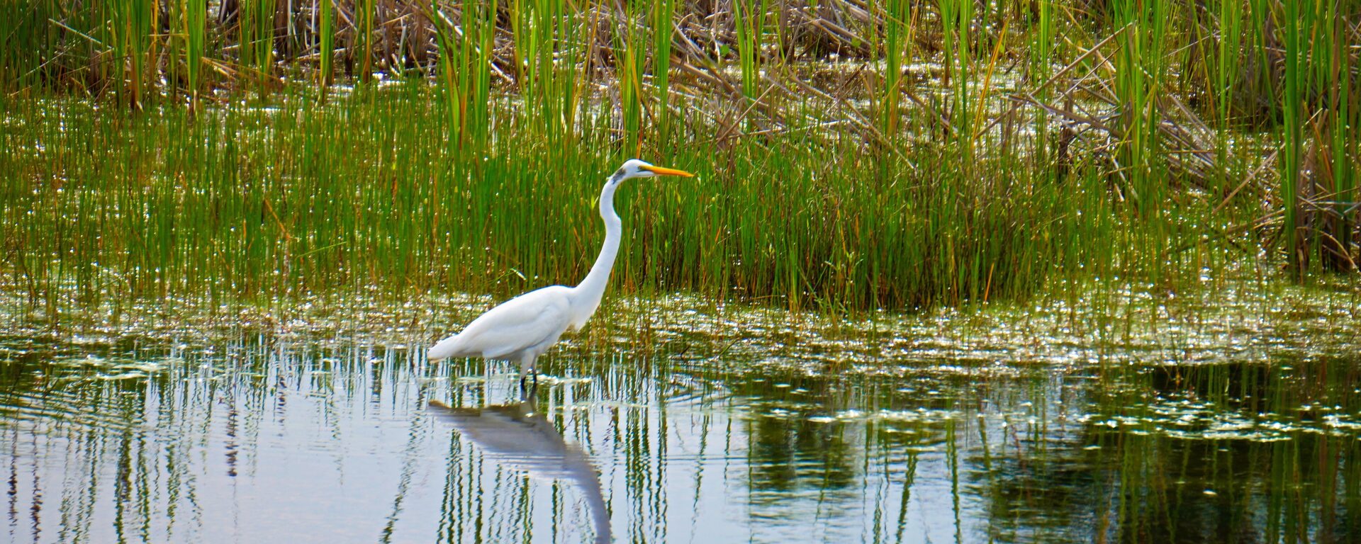
The Marsh Adaptation Planning Tool (MAPT) supports the The Regional Strategy 2018 of the Southern California Wetlands Recovery Project. This new mapping tool – developed by CBI – illustrates and quantifies the ecological state and future potential of wetland zones. The WRP and its partners will use the MAPT to develop, evaluate, and prioritize restoration projects.
The Columbia Plateau in eastern Washington supports productive farmland and rangeland as well as native shrub-steppe habitat of which only 40% remains intact. The region also contains some of the most sought after land in the state for utility scale solar energy development, which is an important component of its future energy portfolio that strives to produce 80% of the state’s electricity from renewable sources by 2030 and 100% carbon-free by 2040.
CBI has been chosen by the Washington State University Energy Program to provide the science and mapping component in support of a voluntary, collaborative effort that brings stakeholders together in order to identify areas of least-conflict between solar energy development and other important ecological, economic, and social values in order to meet the state’s carbon-free energy goals. CBI’s contribution to this process is based on the successful pilot to this approach in the San Joaquin Valley in California. The project will include a new Data Basin gateway, which is a customized site for accessing the science and mapping resources for this project.
See the recent brochure published by Washington State University for more information.
CBI’s easy-to-use spatial analysis and sharing platform empowering people to create maps and collaborate from anywhere in the world. Has a growing list of 44,000+ users, 33,000+ datasets to choose from, and over 1000+ active collaborative groups working on a diverse set of problems.
“Data Basin has provided a fantastic means of sharing information with collaborators and intended users of data products from multiple projects. The intuitive design of the platform has meant that the learning curve for non-GIS users to meaningfully interact with my spatial data has been negligible, even as the more technical underpinnings (e.g., ability to connect with data hosted on ScienceBase) have saved me time and effort in meeting grant requirements for data sharing and documentation. Not to mention CBI staff have been phenomenally responsive to questions and suggestions along the way!” – Meredith Mclure, Lead Scientist | Conservation Science Partners
CBI developed and applied a forest management decision-support system (DSS) for forest resilience planning in the southern Sierra Nevada that integrates the latest science on how vegetation, terrain, climate, and weather interact to influence fire risks and forest resilience. The interdisciplinary team led by CBI includes ecological modelers, forest ecologists, fire scientists, physicists, and statisticians. The core of the DSS will be a Forest Resilience Model built using EEMS (Ecosystem Evaluation Modeling System; Sheehan and Gough 2016). The DSS was tested, refined, and applied to resilience planning in that portion of the modeling region of greatest concern to the interagency Sequoia Regional Partnership, which is working to restore ecologically resilient conditions in and near Sequoia National Forest and Sequoia-Kings Canyon National Park.
This project addressed the need for regionally-relevant forest management decision support tools by developing new models and maps of severe wildfire risk and drought-related tree mortality in the southern Sierra Nevada. The models include multivariate statistical models of drought and fire risks, and transparent modular models using the fuzzy-logic modeling system, EEMS (Ecosystem Evaluation Modeling System (Sheehan and Gough 2016)). The statistical models used the best variables and data available at the time of the project to provide recent snapshots of forest conditions and were used to inform development of the updateable EEMS models to be used in decision-making. The EEMS models of forest resilience rely on variables and datasets that can be updated to reflect environmental change.
This project also developed a method of using statewide forest structure data from the California Forest Observatory (CFO) (California Forest Observatory 2020)) to calculate vegetation-created wind-drag at 10m horizontal and 1m vertical resolution based on how trees, shrubs, and ground cover affect winds below, within, and above forest canopies. These vegetation-based wind-drag coefficients can be used to calculate how oxygen flow to fires is affected by forest structure and thus affects fire behavior. Changes in forest structure, for example due to fires or fuels treatments, may affect fire behavior and the likelihood of extreme wildfire behavior induced by atmosphere-fire coupling (Coen et al. 2020). Because CFO data are California-wide and were expected to be annually updated, wind-drag maps could be updated annually and used to guide fuel-treatment priorities. These results can be immediately applied to improving assessment of the effects and effectiveness of fuels treatments using operational fire models, which to date have not accounted for how reducing fuels also increases ventilation (e.g., FlamMap 6.2). Although the scientific consensus has been that fuels treatments reduce fire intensity within the treatment footprint, it is essential to understand and quantify how they may also increase ventilation into neighboring areas, and hence potentially increase fire risks in unintended ways.
The DSS will be further refined and applied to resilience planning by the Sequoia Regional Partnership, whose primary focus is reducing fire risks to giant sequoia groves, fishers, and human communities.
External Team members include: Joe Werne (NorthWest Research Associates NWRA), Christopher Wikle (Department of Statistics, University of Missouri) and David Marvin (SALO Science).
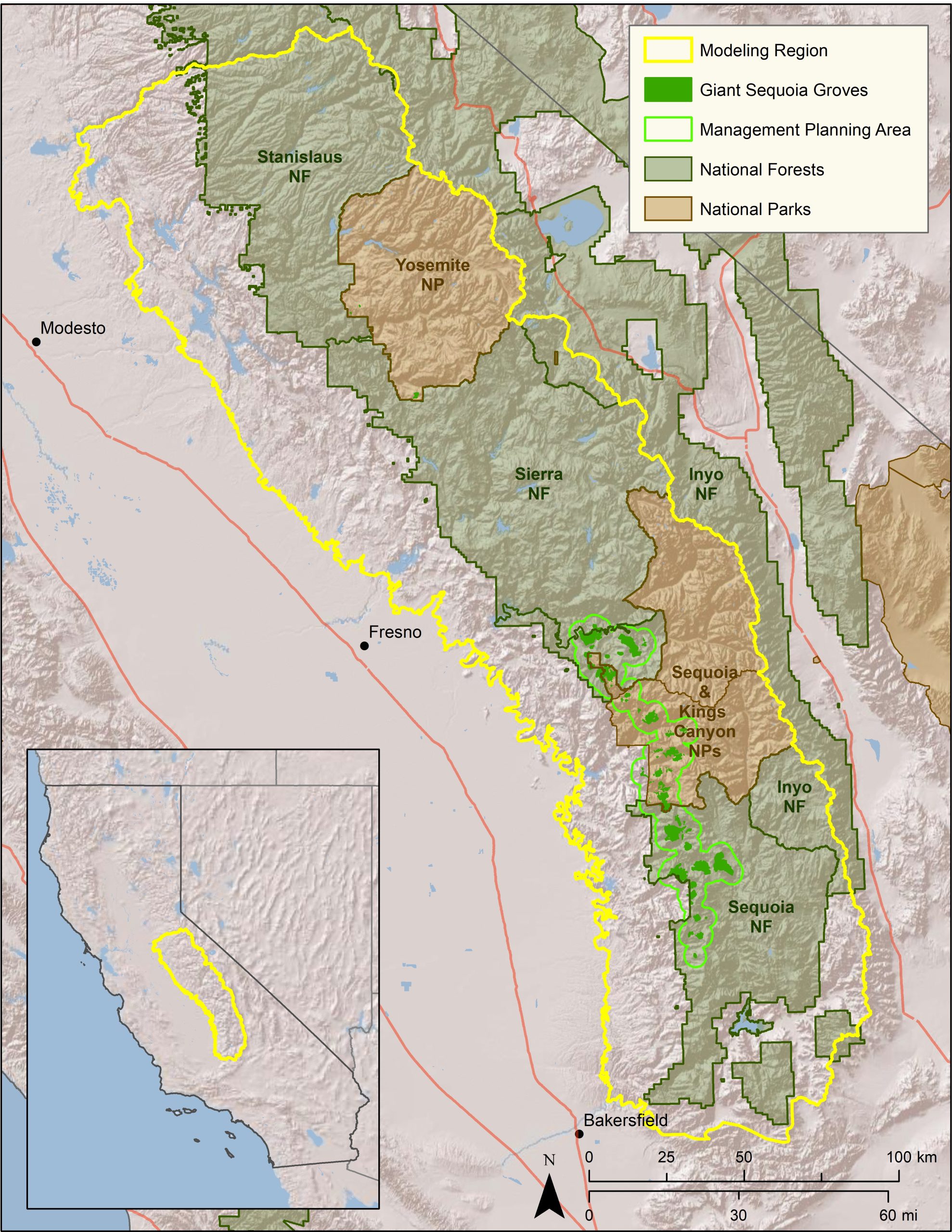 Map of project study area.
CBI has designed and launched a new Data Basin Gateway (Atlas) for the Wildlife Conservation Society Canada focusing on the Yukon Territory to assist WCS Canada researchers and their conservation partners in the region to develop effective protection of wildlife and plants being impacted by a host of environmental stressors, with special emphasis on climate change. In addition to the branded and curated gateway with relevant datasets, we have co-produced a customized application for stakeholders to view and download species distribution models (SDM) for 66 endemic plants designed to predict future changes in their distribution due to climate change. The Atlas houses relevant datasets for conservation planning in the climate-sensitive Yukon region and the tool houses the SDMs, which in combination provide powerful resources for WCS Canada and its partners to effectively plan for resilience.
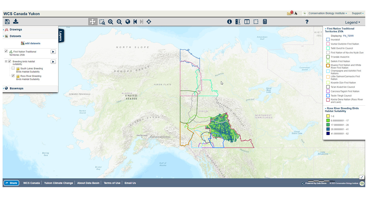
An example of a map created in the WCS Yukon Data Basin Atlas showing First Nation Territories overlaid on Ross river breeding bird habitat suitability layer
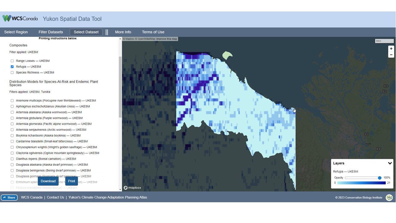
The Yukon Spatial data tool showing projected climate refugia for a Inuvialuit Planning region in the Yukon
CBI worked closely with the Department of Land Conservation Development (DLCD) and other project collaborators to carry out an expansive spatial data review and stakeholder engagement process to better understand renewable energy opportunities and constraints in Oregon. It was part of a larger effort called the Oregon Renewable Energy Siting Assessment (ORESA) project, which was funded by the U.S. Department of Defense Office of Economic Adjustment. This larger project included Oregon Department of Energy (ODOE) working closely with Oregon Department of Land Conservation and Development (DLCD) and Oregon State University’s Institute for Natural Resources (INR).
Data Basin was used to support the spatial data review process resulting in a transparent and accurate spatial data library needed for effective renewable energy planning in the state. Approximately 650 datasets were reviewed with most of them still available on Data Basin. The final Opportunities and Constraints final report was included as part of supporting materials to the larger project.
CBI is supporting the U.S. Forest Service (Region 8) in its efforts toward shared forest stewardship activities. Region 8 contains approximately 244 million acres of forestland, most of which (87%) is privately owned. The Forest Service manages around 5% of the southern forests within 14 National Forests and two Special Units with other public forests make up the remaining 8%. Because of the mixed ownership, close collaboration and shared stewardship is of paramount importance.
CBI has created a customized and curated Data Basin Gateway for the U.S. Forest Service (usfssouth.databasin.org) that supports forest stewardship organizations to access data and information to advance collaborative forest management planning. To demonstrate how to use this framework, a pilot state (North Carolina) was chosen (nc.usfssouth.databasin.org). This gateway uses the “All Lands Strategy” concept to showcase example workflows to facilitate more effective forest management and monitoring across North Carolina. CBI and the North Carolina Shared Stewardship team created supporting training materials is the form of video tutorials and how to materials.
CBI worked closely with the Natural Resource Defense Council (NRDC) to integrate relevant spatial datasets to map areas of high value from the standpoint of carbon storage and sequestration, terrestrial ecological value, and aquatic value in support of several NRDC programs, including their 30X30 campaign to protect 30% of nature in the nation by 2030. Click here to learn more about the 30×30 initiative.
Using CBI’s online modeling software called Environmental Evaluation Modeling System (or EEMS), team members were able to construct, review, and modify the models in a rigorous and highly transparent fashion from their individual remote locations. The resulting “living” models can then be used alone or together and in combination with other spatial data (e.g., existing protected areas) to add further context and insight using Data Basin. Data Basin and EEMS were effectively used to help guide NRDC’s important conservation mission.
The need to plan strategic, effective forest management is urgent in the southern Sierra Nevada, where forests have been ravaged by drought, fire, and catastrophic tree mortality. Multiple, sometimes conflicting, management objectives must be balanced, and multiple agencies need help coordinating their forest restoration actions. A common, readily accessible system evaluating landscape-scale forest condition is needed.
Conservation Biology Institute is working with the Sierra Nevada Conservancy, Sequoia National Forest, Sequoia National Parks, Sequoia Parks Conservancy, Save the Redwoods League, and others to develop forest resilience models and create a toolkit for exploring these data to support the planning of a range of resource management goals. These goals include the protection of sequoia groves, overall forest health, wildfire protection, and endangered species habitat management. The project is supported by CBI’s data sharing and mapping platform Data Basin. The project is funded by the Save the Redwood League and Sequoia National Park through its partner the Sequoia Parks Conservancy, and CAL FIRE Forest Health Research Grant Program.
Conservation Biology Institute (CBI) and American Farmland Trust (AFT), the organization behind the national movement No Farms No Food®, continue to build off their previous work on the San Joaquin Land and Water Strategy. With the support from a Conservation Innovation Grant by the USDA Natural Resources Conservation Service, this phase of work focused on identifying priority areas for groundwater recharge in Madera and Stanislaus counties as well as the greater San Joaquin Valley.
CBI and AFT have compiled informative datasets related to soils, crop types, water infrastructure, and conservation areas in the San Joaquin Valley. These will be located in a San Joaquin Valley Gateway Gallery and mapping tool (with an associated manual) to aid in identifying optimal projects with the greatest potential to increase infiltration and conserve water. These datasets will provide a broad context that will allow for multiple benefits where possible such as locating conservation easements near currently protected areas in the productive farmland regions of Madera and Stanislaus counties, California.
The Project Prioritization Tool (PPT) is a conservation decision-making tool to increase the adoption of water infiltration practices, improve groundwater recharge, and protect agricultural land in the San Joaquin Valley (SJV). This PPT manual was developed by AFT and the Conservation Biology Institute (CBI) based on the data analysis of the San Joaquin Land and Water Strategy report.