Placer County Conservation Planning Support
Placer County, California continues to be one of the fastest-growing counties in the state. Beginning in 1994, the county General Plan aimed to accommodate this growth while conserving productive agricultural lands and protecting many of its natural communities and rare species. After numerous assessments and stakeholder engagements, a draft Placer County Conservation Plan (PCCP) was released in 2011.
For the western foothills portion of the county, the PCCP focuses on protecting or restoring various oak woodland communities as well as habitat for identified aquatic and terrestrial covered species including, valley elderberry longhorn beetle, Central Valley Chinook salmon, Central Valley steelhead, California red-legged frog, northwestern pond turtle, California black rail, and Swainson’s hawk. Implementing the plan is underway and involves integrating high-value lands made available by willing sellers. The biggest challenge is finding suitable habitat to mitigate the projected impacts of new growth in a way that maintains landscape ecological integrity.
CBI was asked by the Foothills Conservation Strategy Ad Hoc Committee to integrate the available spatial data pertaining to the natural community and species targets listed in the plan and create a flexible spatially explicit model to assist county staff in identifying and systematically evaluating potential lands for protection or restoration to meet plan goals. The model housed in Data Basin contains some private data; therefore, it is available only to county staff.
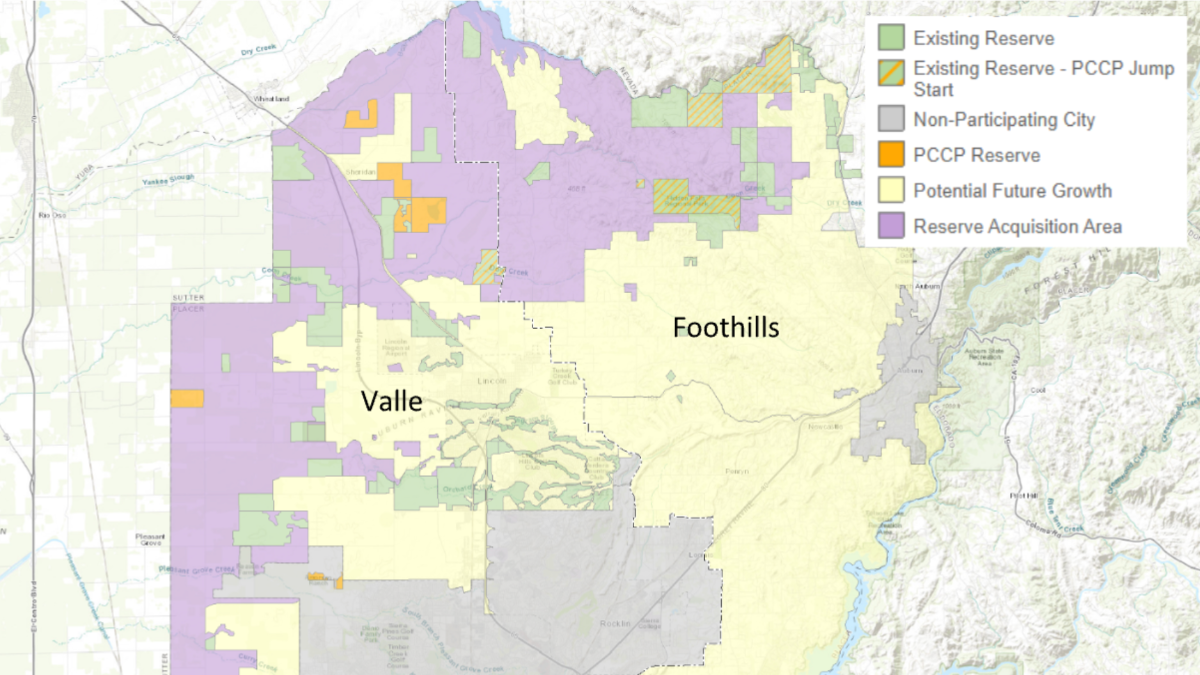
Map of the PCCP focal areas for the valley and foothills subareas. The parcel-based model created and housed in Data Basin is for the foothills region.
“CBI has made a significant contribution to the Plan implementation through the development of an on-l ine tool in Data Basin that supports the development and implementation of conservation strategies for the Sierra Nevada Foothills. Placer County staff and the PCA advisory committee are using this tool for preliminary identification of critical parcels that will be followed up with parcel-level field analysis.”
Dennis Grossman, Foothill Representative, Placer County Conservation Program Advisory Committee
New CBI Team Members!
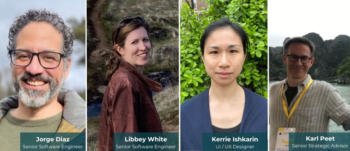
Jorge Diaz (far left) started his career in technology as an artist, animator, and designer working on both the mainstream and the educational video game industry. After completing an MS in Computer Science he started as a software engineer in the public sector. Sometime in between he taught college classes in storyboarding as well as computer science and co-owned two art supply stores with his wife. His developer experience is in accessibility, automation, full stack development, security, user interface design, and developing systems for a wide variety of user types.
Libbey White (center left) grew up enjoying the natural splendor of Montana, which instilled in her an instinctive interest in conservation. Libbey majored in biology, but was a laundromat attendant, book store clerk, ranch cook, and lab assistant, among other things, before getting close to working with data and code. She got her start in the software field thanks to willing tutors at the Center for Computational Biology at Montana State University. Since then she has held a variety of software development roles, including exhibit software developer at Oregon Museum of Science & Industry and research software developer at Knight Cancer Institute, where she created a genomic data visualization application.
Kerrie Ishkarin (center right) has a Bachelor of Fine Art and a Certificate in UX Design from Rhode Island School of Design and joined the CBI Software & Tool Team, bringing 8+ years of experience working as a user interface (UI), user experience (UX), and product designer. She has worked on desktop and mobile product designs using tools such as Figma, Sketch, and InVision to create sketches, wireframes, prototypes, and implementation-ready designs.
Karl Peet (far right) is a researcher and advocate working at the intersection of climate change, energy transition, and conservation. He is helping to shape CBI’s global engagement strategy on nature-positive infrastructure and renewable energy. Karl is also assessing strategies to meet 2030 targets of the Global Biodiversity Framework and other multilateral environmental agreements, reflecting the technical knowledge and cultural imperatives of Indigenous communities.
Data Basin Now Supports ArcGIS Pro Data Formats!

Data Basin now supports the latest Esri software file formats generated by ArcGIS Pro.