How the Environment Became a Culture War,
And Why It Doesn’t Have to Be

A message from our Executive Director, Dr. James Strittholt
When I was in high school, environmental protection was a non-partisan issue in America. Richard Nixon — second only to Theodore Roosevelt in environmental impact — created the EPA, supported the first Earth Day, and signed the Clean Water Act, Clean Air Act, and Endangered Species Act. Announcing the ESA, he declared, “Nothing is more precious and worthy of preservation than the rich array of animal life with which our country has been blessed.” Conservation enjoyed broad bipartisan support, a tradition George H.W. Bush continued as well.
The modern Republican Party has become the antithesis of these policies. So, what happened?
Reagan’s presidency marked the turning point. His campaign against federal regulation pulled environmental protection into the broader debate about government’s role in the economy. Business interests began framing environmental rules as job-killers and government overreach — an argument with real traction in rural mining, manufacturing, and logging communities that trend conservative. That framing persists to this day.
By the 1990s and 2000s, environmentalism became associated with urban liberals, even as many conservatives maintained a deep personal relationship with the land. Fossil fuel industries, facing existential regulatory threats, invested heavily in think tanks, lobbying, and deliberate doubt-manufacturing about climate science — tactics strikingly similar to those used by the tobacco industry decades earlier. The goal was never to win a scientific argument, but to create enough confusion to prevent action.
And yet the underlying values never actually divided along party lines. Polls consistently show that majorities across party lines support clean air, clean water, national parks, and specific environmental protections when asked about them on their own merits. The polarization is largely a political and media phenomenon projected onto ordinary voters. The word “environmentalism” became a partisan label detached from the genuine desires beneath it, and that gap is where enormous common ground was lost.
We don’t have to accept that loss as permanent. Love of land, clean water, and wild places has never truly belonged to one party. It belongs to anyone who has fed backyard birds, cast a fishing line, or simply wanted their children to inherit a world as beautiful as the one they were given. That American commitment never really disappeared. It’s just waiting to be called by its right name.
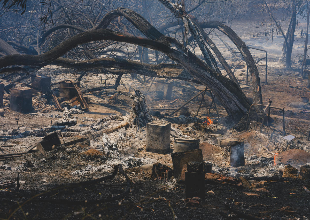
Global Wildfire Collective News
Conservation Biology Institute’s Global Wildfire Collective (GWC) initiative recently received funding to pursue its proposed FIRE-NET project. The project aims to operationalize and expand the GWC as a hub for accelerating wildfire resilience and recovery by enabling responsible knowledge transfer across fire-prone regions globally. Core research objectives include co-producing region- and ecoregion-specific resilience roadmaps that integrate scientific, indigenous, practitioner, and community expertise; developing a scalable Wildland Urban Interface (WUI) typology and probabilistic fire occurrence models to identify generalizable patterns versus context-dependent dynamics; and building a standardized foundation of measurements, models, and strategies applicable across diverse biomes. The project will also work to expand open-access digital infrastructure (including the GWC Spatial Data Gateway, multilingual Discussion Forum, and AI-supported Knowledge Base), and deliver capacity-building programs such as webinars, regional workshops, and policy engagement at the UN level.
Beyond research outputs, the project seeks to foster a durable international collaborative platform that bridges science, policy, and practice — particularly by connecting underrepresented regions such as Colombia and Chile with well-studied fire systems in the Western U.S. — ultimately advancing equitable, culturally grounded solutions to shared global wildfire challenges. Together, these activities span ecological, social, technological, and governance dimensions of wildfire resilience, positioning the Global Wildfire Collective as a central platform for integrated wildfire science worldwide.
Administered by the Buckminster Fuller Institute, this research is funded through the U.S. National Science Foundation (NSF) Fire Science Innovations through Research and Education (FIRE) program, a collaboration among NSF, NASA, Department of Defense SERDP/ESTCP, and the Gordon and Betty Moore Foundation to advance wildland fire research.
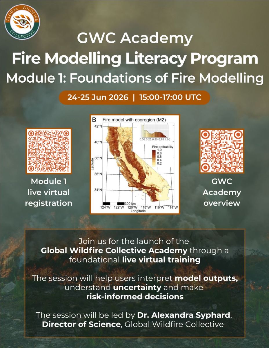
On June 24–25, 2026, GWC will host its inaugural Fire Modeling Literacy for Risk-Informed Decision-Making workshop — and registration is now open.
Leading researchers from the GWC community led by Dr. Alexandra Syphard (Senior Research Scientist at CBI) will go beyond the surface of fire modeling frameworks, revealing not just what each approach can accomplish, but where its limits lie and why those boundaries matter. Through comparative case studies, participants will come to understand a fundamental truth of fire science: there is no single “best” model — only tools matched, or mismatched, to the problem at hand.
Over two days and four hours of sessions, participants will:
- Establish a shared fire modeling vocabulary
- Gain exposure to machine learning, fire behavior, and simulation modeling frameworks
- Build foundational literacy in the modeling process
- Improve familiarity with common data sources and limitations
- Strengthen interpretation and decision framing under uncertainty
We’re offering discount codes to make FMLP training accessible across country income levels (according to the latest World Bank country income classification):
- Upper-middle income: 50% (code 50FMLP)
- Lower-middle income: 75% (code 75FMLP)
- Low-income: 90% (code 90FMLP)
- Limited fee waivers available; contact us if needed
Expanding Our Ocean of Knowledge: Two New Gateways on the Horizon
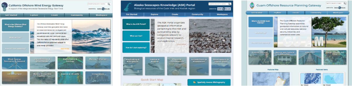
Our marine resource planning network is growing. Two new Data Basin Gateways — covering the Territory of American Samoa and the Commonwealth of the Northern Mariana Islands — are currently in development and expected to launch before year’s end.
The effort is part of an ongoing partnership with the Bureau of Ocean Energy Management (BOEM), which has been instrumental in bringing marine-focused gateways to life across the Pacific. Alongside the new additions, BOEM-supported gateways already serve California offshore wind planning, Alaska seascapes, and Guam’s offshore resources. Stay tuned for official launch announcements.
Earth Day at 56: Hope, Fatigue, and the Fight Ahead
On April 22, the 56th Earth Day was celebrated under the theme “Our Power, Our Planet.” I am old enough to remember the first one. I was in 8th grade in 1970, and I greeted that day with genuine excitement and hope. About 20 million Americans poured into the streets that early Spring day, and the modern environmental movement was born.
Much has changed in 56 years, and not all of it discouraging. Earth Day’s original vision was never just a single day of awareness — it was a catalyst for something larger. By many measures, that vision took root. Renewable energy is on the rise, recycling is commonplace, our air and water are measurably cleaner than they were in 1970, and some endangered species have pulled back from the brink. The moment has become a movement.
This year’s celebration drew over 10,000 events globally, and yet something still felt diminished. The clarion call that once rattled the halls of Congress now echoes in a crowded, distracted landscape.
Part of that is the current political headwinds. The federal government rolled back over 400 environmental protections in 2025 alone and withdrew from multiple international climate treaties and accords. Advocates describe burnout and an overwhelming sense that crises are arriving faster than solutions. That fatigue is real, and it matters because sustained movements run on hope as much as passion.
Which brings us to the harder question: are we keeping pace with the crisis? The honest answer is no. Culture change and market forces move on a timeline measured in decades. Many of the environmental crises we face (e.g., wildfire season expansion, species loss, and coral bleaching) operate on a timeline measured in years. Annual awareness campaigns, symbolic gestures, and social media moments were never going to be sufficient on their own. The movement’s task now is to convert its broad cultural reach into the kind of durable, systemic political pressure that actually bends the curve in the positive direction.
So far, it hasn’t moved fast enough. But I want to leave you with a reason to keep going.
Republicans entered this Earth Day with plans to dramatically weaken the Endangered Species Act. The vote was abruptly pulled from the floor because there weren’t enough votes to pass it, including among some Republicans. That is the cultural evolution of the original Earth Day vision at work, the people holding the line.
We have lost ground. But the fight continues, and what comes next matters enormously. The power, as this year’s theme reminds us, is still ours.
Recreation Impacts on Tribal Rights in Washington State – An Update

Outdoor recreation in the U.S. generated $1.1 trillion in economic output in 2022 and added $564 billion to the nation’s GDP. It has become not just a major industry, but a recognized driver of government conservation strategies — valued for the health, cultural, and ecological benefits it delivers alongside its economic power.
But a growing body of evidence complicates that picture. Outdoor recreation carries real ecological costs: soil compaction and water pollution, vegetation loss and the spread of invasive species, and documented disruption to wildlife behavior, stress levels, and survival. The outdoors that people seek out is, in many cases, being quietly diminished by the volume of people seeking it.
The impacts extend beyond ecology. Tribes across the western U.S. have raised urgent and well-founded concerns about the erosion of their traditional rights on public lands — rights increasingly compromised by the expansion of recreational use into culturally and spiritually significant places.
From August 2024 through December 2025, CBI worked in close partnership with numerous treaty tribes in Washington and state natural resource agencies to address this challenge directly. Together, they developed a map-based analytical framework for assessing environmental and social risks from current and planned outdoor recreation on state lands with particular attention to tribal rights. The goal was practical: identify a pathway that preserves meaningful recreational access while meaningfully reducing harm.
Relying on Data Basin and EEMS modeling software, the work now expands. CBI is building on this foundation to deepen its conservation science and analytical support for the ongoing Tribal-State process, while broadening the effort to include federal agencies and additional partners. The aim is nothing less than a durable, collaborative solution to one of the most complex land-use challenges in the American West.
Global Wildfire Collective Update
The Global Wildfire Collective has had a remarkably active few months, with major milestones across research, policy, and education.
Forest Governance Lab for Wildfire Resilience, Ecuador
In mid-April, GWC co-organized the Forest Governance Lab for Wildfire Resilience — a workshop of the Wildfire Action Accelerator — alongside the Environmental Defense Fund, Ecuador’s Ministry of Environment and Energy, and BirdLife International. This gathering brought renewed urgency to a critical moment: the Wildfire Action Accelerator Pledge had been launched at COP 30 of the United Nations Framework Convention on Climate Change in Belém, Brazil, in direct response to the global escalation of wildfires and their mounting toll on forests, communities, and the climate. Dr. Alexandra Syphard represented GWC at the event.
GWC Academy: Wildfire in Savanna Ecosystems
GWC held its fourth Academy webinar, focused on Wildfire in Savanna Ecosystems. The session featured an exceptional panel of researchers: Dr. Caroline Lehmann (Chair of Plant Ecology and Biogeography, University of Edinburgh / Royal Botanic Garden Edinburgh), Dr. Abigail Croker (Postdoctoral Research Associate, Centre for BioComplexity, High Meadows Environmental Institute), Amos Chege Muthiuru (PhD Candidate, Department of Geography, King’s College London), and Dr. Sally Archibald (Professor, School of Animal, Plant and Environmental Sciences, University of the Witwatersrand). A recording is available for those who missed it.
FireData Regional Workshop, Brasília
GWC was invited by the Amazon Cooperation Treaty Organization (ACTO) to participate in a mid-May Regional Workshop on Data and Information for Integrated Fire Management in the Amazon (FireData) in Brasília, Brazil. The workshop aims to strengthen technical exchange and regional cooperation on data systems and information platforms for Integrated Fire Management across the Amazon region. Dr. Alexandra Syphard will represent GWC at the event.
Inaugural Fire Modeling Literacy Workshop — Register Now
On June 24–25, 2026, GWC will host its inaugural Fire Modeling Literacy for Risk-Informed Decision-Making workshop — and registration is now open.
Leading researchers from the GWC community will go beyond the surface of fire modeling frameworks, revealing not just what each approach can accomplish, but where its limits lie and why those boundaries matter. Through comparative case studies, participants will come to understand a fundamental truth of fire science: there is no single “best” model — only tools matched, or mismatched, to the problem at hand.
Over two days and four hours of sessions, participants will:
- Establish a shared fire modeling vocabulary
- Gain exposure to machine learning, fire behavior, and simulation modeling frameworks
- Build foundational literacy in the modeling process
- Improve familiarity with common data sources and limitations
- Strengthen interpretation and decision framing under uncertainty
Welcome Steve Schwarzbach – CBI Welcomes Our Newest Board Member
Dr. Steven E. Schwarzbach is an ecologist and former federal science executive with extensive experience in environmental research, organizational leadership, and public-sector governance. He served as Center Director of the U.S. Geological Survey’s Western Ecological Research Center, where he led multidisciplinary teams addressing complex natural resource challenges across California and the western United States.
Prior to joining the USGS, Dr. Schwarzbach spent more than a decade with the U.S. Fish and Wildlife Service, advancing research on environmental contaminants and their effects on wildlife and ecosystems, and later leading scientific programs that informed regulatory and management decisions.
Since retiring from federal service, Dr. Schwarzbach has remained active in regional conservation and resource management, including service on the El Dorado County Fish and Wildlife Commission and in leadership with the El Dorado Resource Conservation District. He brings to boards a combination of scientific rigor, strategic leadership, and a long-standing commitment to public service. We are thrilled he has chosen to join us!
Dr. Paul R. Ehrlich: A Tribute
A message from our Executive Director, Dr. James Strittholt.
My introduction to Paul Ehrlich came through an unlikely venue — the Tonight Show Starring Johnny Carson in the early 1970s when I was in high school. Along with Carl Sagan, Ehrlich was a regular guest, and together these two giants made science feel urgent, accessible, and exciting. Sagan’s cosmos was captivating, but it was Ehrlich’s passion for biology that truly connected. As a young want-to-be biologist, I was hooked.
Sagan left us in 1996. Last month, on March 13th, Paul Ehrlich followed, passing away at 93. He lived a remarkably full life authoring 50 books spanning topics from butterfly identification to ecological sustainability, and sparking one of the most important and contentious environmental conversations of the 20th century with his 1968 book The Population Bomb, co-authored with his wife Anne.
In the late 1970s, Ehrlich’s influence on my education became even more direct. My college textbook for Ecosystem Ecology was Ecoscience: Population, Resources, Environment (1977), co-authored by the Ehrlichs and John Holdren. All 1,051 dense, substantive pages of it. Decades later, it still sits on my bookshelf and remains a foundational resource for understanding the physical and natural world and humanity’s path toward genuine sustainability.
If you want to hear Ehrlich at his most candid and unfiltered, I encourage you to seek out one of his final podcast interviews; for example, the interview he gave to Population Balance in 2022. He doesn’t hold back. And given where the world stands today, his words feel even more relevant than when he spoke them.
Some Good News for Endangered Species, but…
On Monday, March 30, 2026, a federal court in the Northern District of California delivered a significant victory for wildlife protection. The ruling, in a case brought by the Center for Biological Diversity, Sierra Club, and WildEarth Guardians (represented by Earthjustice) struck down regulations that had gutted the Endangered Species Act. Those regulations originated during the first Trump Administration and were only partially addressed by inadequate Biden-era rules. The ESA has enjoyed over 80 percent public approval for decades.
The court was unambiguous: federal agencies must use the best available science when assessing harm to species, cannot ignore incremental damage to critical habitat, and must take every measure to reduce harm to imperiled species.
The administration’s response was swift and extraordinary. The very next day, it convened the Endangered Species Committee (informally known as the “God Squad”) and used it to exempt Gulf of Mexico offshore oil and gas drilling from ESA protections, citing the ongoing conflict with Iran as a threat to domestic energy supplies. The God Squad, comprised of the Secretaries of Agriculture, Interior, and Army, the Chair of the Council of Economic Advisors, and the administrators of the EPA and NOAA, was established in 1978 precisely for situations where no alternative could deliver equivalent economic benefit, or where the national interest demanded an exemption. In 53 years, the panel has granted only two exemptions — and only one was ever upheld, for a dam project on Wyoming’s Platte River that threatened the whooping crane.
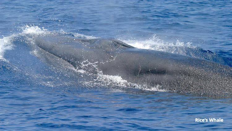
Numerous marine species in the Gulf are now at increased risk. For example, Rice’s Whale, which was listed as endangered in 2019, has only 50 individuals remaining — its entire known range overlapping directly with Gulf drilling operations.
The Gulf’s track record with offshore drilling should give everyone pause. In 2010, BP’s Deepwater Horizon blowout killed 11 workers and released 134 million gallons of oil into the Gulf, killing thousands of marine mammals, sea turtles, and birds and contaminating 1,300 miles of shoreline. The disaster forced the closure of over a third of federal waters to fishing and cost the tourism and fishing industries billions of dollars. Earlier this month, a new spill spread oil across 373 miles of coastline.
Nonetheless, in mid-March the Trump administration approved BP’s new $5 billion ultra-deepwater drilling project in the Gulf of Mexico.
What could possibly go wrong?
Bats, Bugs, and Plants: CBI Partners with Bat Conservation International on a New Decision-Support Tool
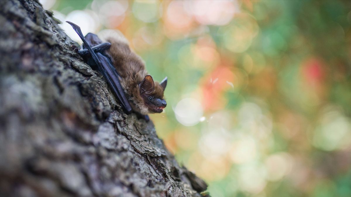
We’re excited to announce a new collaboration between CBI and Bat Conservation International (BCI) to develop a national “bat gardening” tool. Led by CBI’s Ecologist Dr. Chris Cosma, the project will help users identify the most effective native plants for supporting bats in their region, following the logic that the right plants support the right insects, and the right insects support healthy bat communities. It’s a simple idea, made actionable through some genuinely complex science.
Under the hood, the tool will be built on a comprehensive, harmonized dataset linking bat species to their arthropod prey and those arthropods back to their native plant associations. Spatial modeling, phenology data, and phylogenetic relationships will be used to fill gaps in the observational record and build ecoregion-specific trophic networks, ultimately identifying keystone native plants that best support bat food webs in each part of the country.
The final product will be accessible to conservation practitioners, land managers, and the general public alike, with the goal of making it easy for anyone to take meaningful action for one of North America’s most undervalued groups of wildlife. We’re thrilled to be working with the BCI team on this one, stay tuned for updates as the project gets underway!
New Publication by CBI’s Dr. Alexandra Syphard and Heather Rustigian-Rosmos
Where will California’s plants be able to survive as the climate changes — and what does that mean for the protected areas we rely on to conserve them? A new study co-authored by CBI’s Dr. Alexandra Syphard and Heather Rustigian-Romsos, published in PLOS ONE, tackles this question for the Golden Gate Biosphere Network, a high-biodiversity mosaic of habitats stretching along the central to northern California coast.
Using carefully constructed ensemble species distribution models, the team projected how suitable habitat for six dominant plant species might shift by late century. Their findings are a reminder that climate change doesn’t produce uniform outcomes: habitat may expand for some species while contracting for others, projected shifts don’t always move upslope or northward as commonly assumed, and soil conditions can be just as important as climate in determining where plants persist.
The paper also offers practical guidance for conservation managers working within fixed reserve boundaries — underscoring the value of identifying climate refugia and the importance of planning across scales, since conditions inside a protected area may not reflect what’s happening across a species’ broader range.
International Workshop of the Wildfire Action Accelerator
Forest Governance Lab for Wildfire Resilience
In light of the global escalation of wildfires and their growing impact on forests, communities, and the climate, the Wildfire Action Accelerator Pledge was launched during COP 30 of the United Nations Framework Convention on Climate Change in Belém, Brazil. This international commitment aims to strengthen fire governance in tropical regions through preventive approaches.
The Wildfire Action Accelerator Pledge is structured around four strategic pillars: i) the recognition and integration of traditional knowledge and the leadership of Indigenous Peoples and Local Communities; ii) the incorporation of Integrated Fire Management into climate and forest policies; iii) the mobilization of sustainable financing for prevention and resilience; and iv) the strengthening of South–South and international cooperation.
Within this framework, Environmental Defense Fund (EDF), in coordination with the Ministry of Environment and Energy of Ecuador and with the support of our partners BirdLife International and the Global Wildfire Collective, is pleased to announce its upcoming workshop: Wildfire Action Accelerator: Forest Governance Laboratory for Wildfire Resilience, which will take place from April 14 to 16, 2026, at the Hotel y Centro de Convenciones San José de Puembo, Quito, Ecuador.
This high-level technical and policy meeting will bring together government representatives, technical experts, and strategic stakeholders from the Amazon region to strengthen regional coordination and consolidate a platform for cooperation among initiatives, countries, and strategic partners on Integrated Fire Management.
THIS EVENT IS BY INVITATION ONLY
IF YOU ARE INTERESTED IN ATTENDING, PLEASE EMAIL
INFO@GLOBALWILDFIRECOLLECTIVE.ORG
Some Hopeful News
For many months now, the lead story in our monthly newsletter has focused on one of the latest attacks on science and conservation posing serious threats to the sustainability of our planet. I was contemplating what would be the lead story this month – there seems to be an endless supply – but I found myself avoiding tackling the next installment of concerning news.
Then, I read an update on the Brazilian rainforest and felt a rush of genuine hope. So I decided to set my list of concerns aside and share some good news for a change in the hope you will feel some uplifting too. Indigenous communities vehemently opposed the Brazilian government giving access to the Tapajos River as an export corridor for animal feed plantations by giant agribusiness companies, which would likely have led to serious ecological impacts. Because of the commitment by local communities, the Brazilian government recently announced it will revoke the permit giving access to the river. In a statement by the Tapajos and Arapiuns Indigenous Council, “What won today was life. The river won, the forest won, the memory of our ancestors won.”
There is more good news – the Amazon hit its lowest deforestation rate in over a decade. In the past, gains in the Amazon usually came at the expense of the neighboring Cerrado savanna, but not this time. The deforestation rate there also declined.
These may be seen by some as minor victories in the fight to save life on this planet, but these are important victories. They have significant on-the-ground benefits that are worth celebrating. Additionally, it demonstrates how, at a time when the attack on the natural world by powerful forces seems overwhelming, the people can be catalysts for change and when they work with other decision makers can deliver big results. What else can we accomplish?
Draft Southern Sierra Nevada Fisher Habitat Dashboard Released
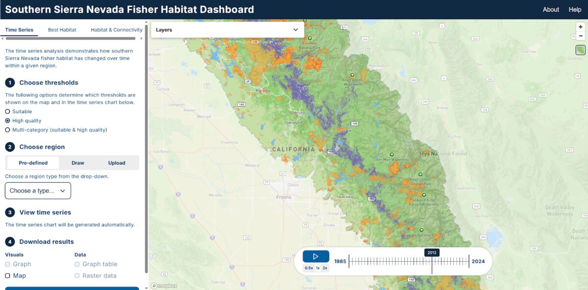
The Southern Sierra Nevada Fisher, a distinct population of the Pacific fisher (Pekania pennanti), was listed as an endangered species by the U.S. Fish and Wildlife Service in 2020. CBI, led by Dr. Wayne Spencer as principle investigator, is coordinating a multi-agency initiative to conserve and recover the species, which faces ongoing threats from high-severity wildfire, habitat fragmentation, and rodenticide exposure.
As part of an updated Conservation Assessment and Strategy of the species, the CBI team has developed an easy-to-use online dashboard to provide information on changes to fisher habitat from 1985 to 2024 based on a type of automated wildlife habitat monitoring system developed by scientists at the USFS Rocky Mountain Research Station and collaborators called the “Living Maps”.
The draft dashboard includes three primary tabs…
Time Series
Users can visualize and graph suitable habitat, high-quality habitat, or both for a predefined region, user-drawn polygon, or uploaded boundary. The tool displays habitat trends from 1985 to 2024, with additional years to be incorporated as new Living Maps data become available. Results can be downloaded in both graphical and map formats.
Habitat & Connectivity
This section presents changes in fragmentation metrics relevant to fisher ecology across the seven principal habitat core areas, along with connectivity modeling results spanning the full 1985–2024 period across the broader region.
Best Habitat
Designed specifically for land managers, this tab identifies contiguous blocks of high-quality habitat that overlap a user-defined project area by at least 60 acres, supporting project planning and conservation prioritization.
Dr. Wayne D. Spencer – Recipient of the Raymond F. Dasmann Professional of the Year Award

At a recent meeting of the Western Section of the Wildlife Society, Dr. Wayne Spencer (long-time Senior Scientist at CBI) was awarded the Dasmann Award, which is the most prestigious award by the Society honoring wildlife professionals who have made an outstanding contribution to wildlife resources management and understanding in California, Nevada, Hawaii or Guam. A tremendous and well-deserved honor. Congratulations, Wayne!
Celebrating Our Associate, Dr. Dominick A. DellaSala
We also wish to congratulate our Associate, Dr. Dominick A. DellaSala, on receiving a 2026 Planet Earth Award from the Alliance of World Scientists. Dominick’s decades-long career in global biodiversity conservation, forest ecology, and climate science reflects an extraordinary commitment to protecting ecosystems and advancing evidence-based conservation policy. From peer-reviewed science to congressional testimony, public education, and influential writings, his work bridges rigorous research with impactful advocacy — embodying the values of the Planet Earth Award.
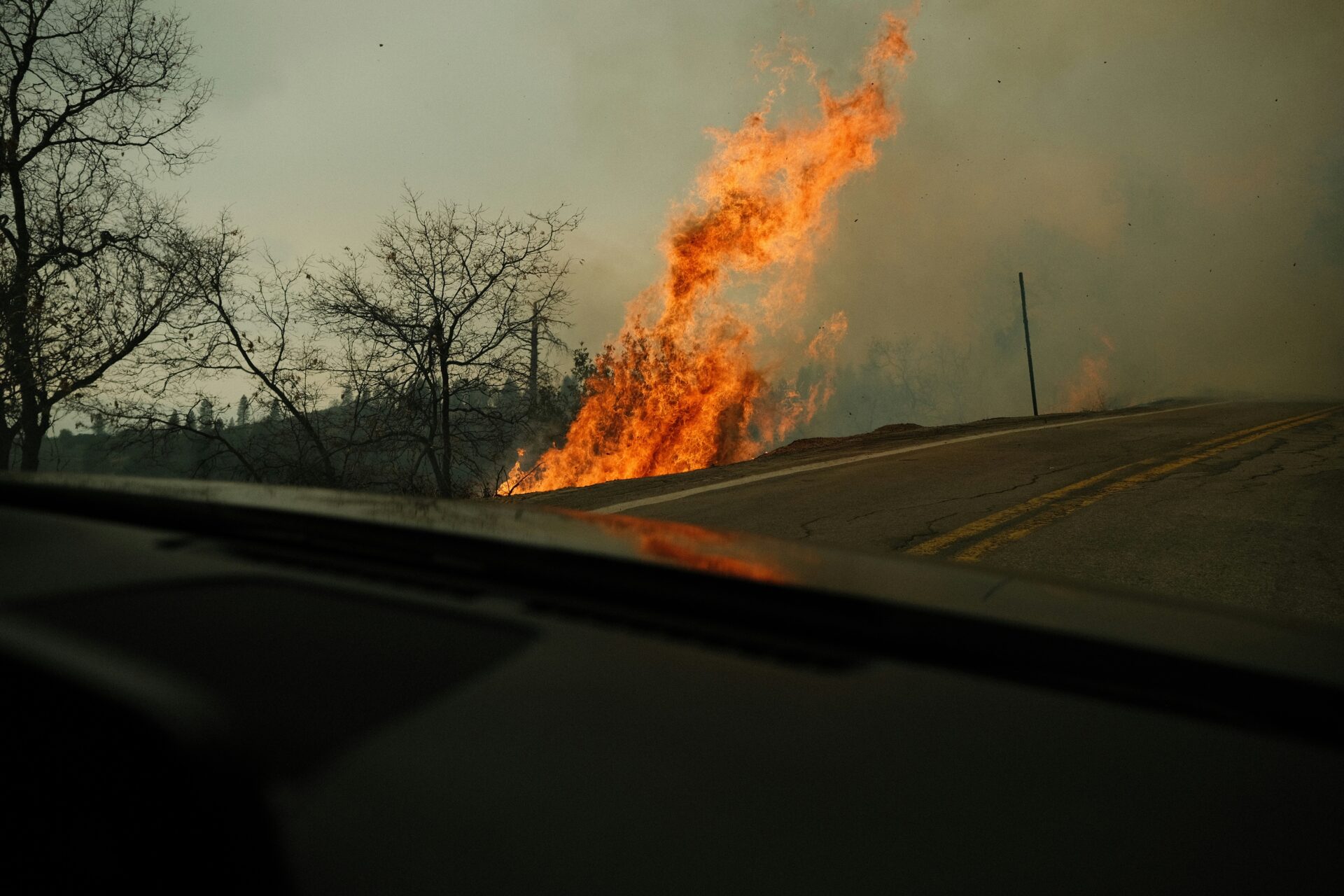
Fixing Forests or Fast-Tracking Risk?
Examining the Fix Our Forests Act
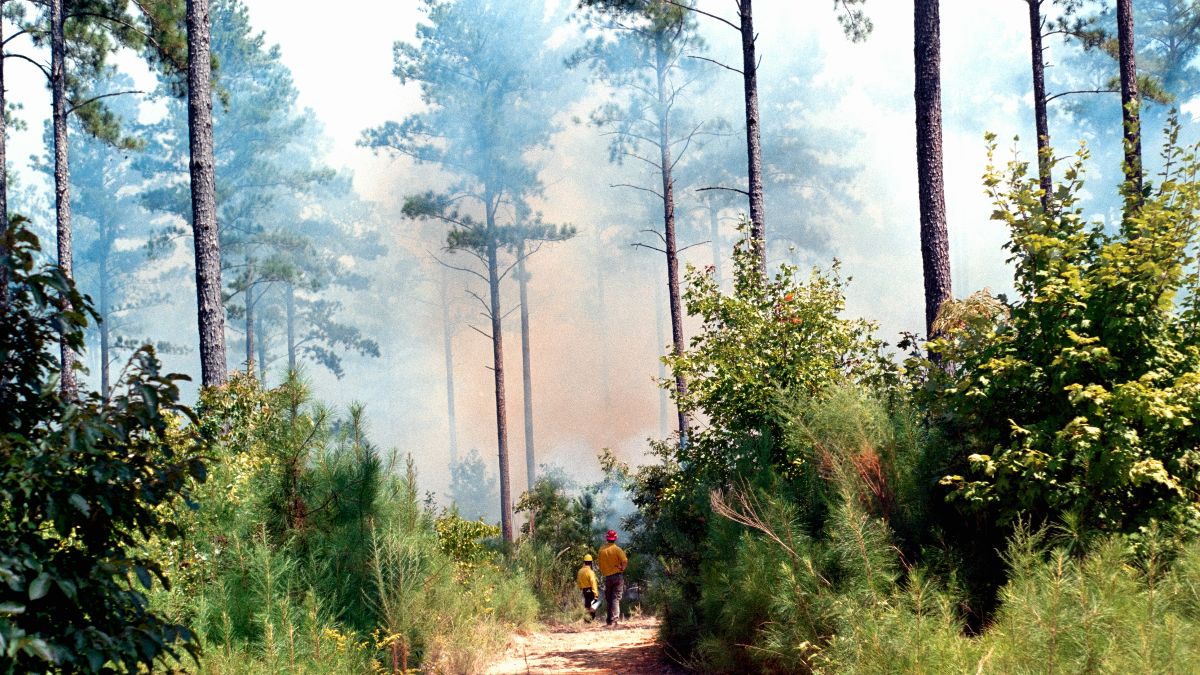
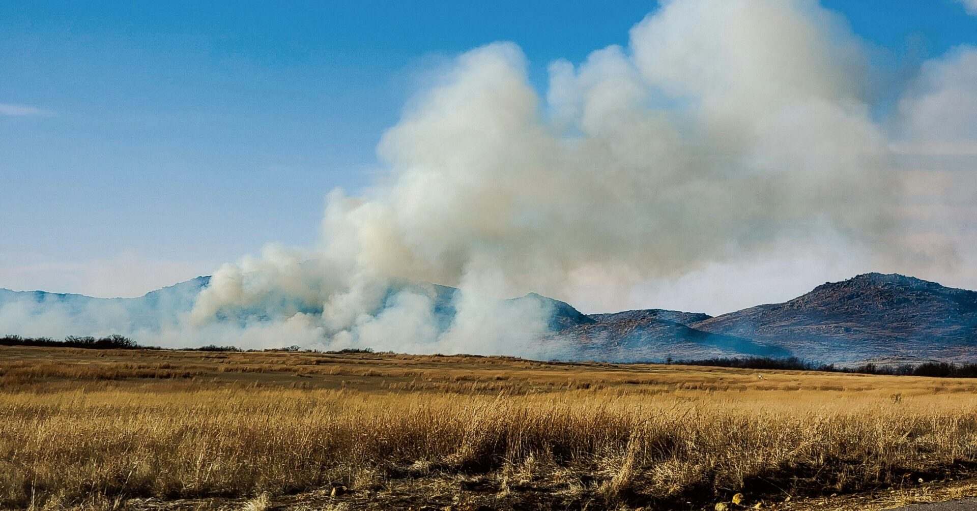
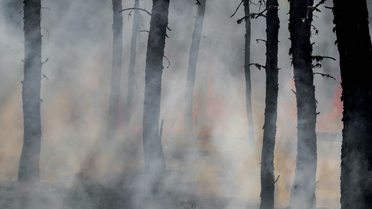
Catastrophic wildfires are now a recurring headline across much of the western United States—millions of acres burned, lives disrupted or lost, and communities and livelihoods destroyed. Public concern is both justified and urgent, and people are increasingly looking to government leaders for meaningful action.
In response, policymakers have advanced the Fix Our Forests Act, which is moving through Congress with bipartisan support, but the Act may not achieve its stated wildfire risk reduction goals.
While the Act contains several components, its core approach prioritizes faster and more expansive forest fuels treatments such as mechanical thinning and prescribed fire by rolling back long-standing environmental safeguards that have guided federal land management for decades. The legislation also significantly curtails public and Tribal oversight and sharply limits judicial review, compressing the window for legal challenges from six years to just 150 days. Without adequate time to challenge implementation, how can accountability be maintained?
Although the Act contains provisions that are broadly supported by the environmental community, such as increased support for wildland firefighters and their families in cases of serious injury or death, it has also created significant divisions within the conservation community. Concerns about weakened environmental protections and reduced public participation are well founded; however, more fundamentally, there are legitimate scientific questions about whether the forest management activities promoted by the Act will achieve their intended outcomes.
When fuel treatments are carefully designed and matched to forest type, they can enhance ecological resilience and reduce wildfire risk. However, applying inappropriate treatments in unsuitable ecosystems (such as chaparral) can produce the opposite outcome. Concerns also remain about provisions allowing treatment of very large areas (up to 10,000 acres) without full environmental safeguards. If treatments are poorly sited or insufficiently tailored, they may simplify forest structure by reducing structural complexity and canopy cover, resulting in drier surface fuels and increased oxygen availability that can intensify fire behavior following ignition. In addition, the expanded access needed to implement and maintain large-scale treatments often requires temporary or permanent road construction, a well-established driver of human-caused wildfire ignitions. Together, these risks highlight the importance of careful siting, scale-appropriate implementation, and integration of fuel treatments within a broader, science-based fire management framework.
The Fix Our Forests Act represents a predictable response to an escalating wildfire crisis, but despite its intent, it poses significant risks to both forest ecosystems and the communities it seeks to protect. Assuming the Act passes, what happens if treatments fail or increase risk? What safeguards exist to course-correct? The Fix Our Forest Act is a high-stakes experiment with reduced safeguards and severely limited mechanisms for correction. It would be prudent to require meaningful monitoring and enforceable triggers to make the necessary revisions.
New Data Basin Gateway Launched
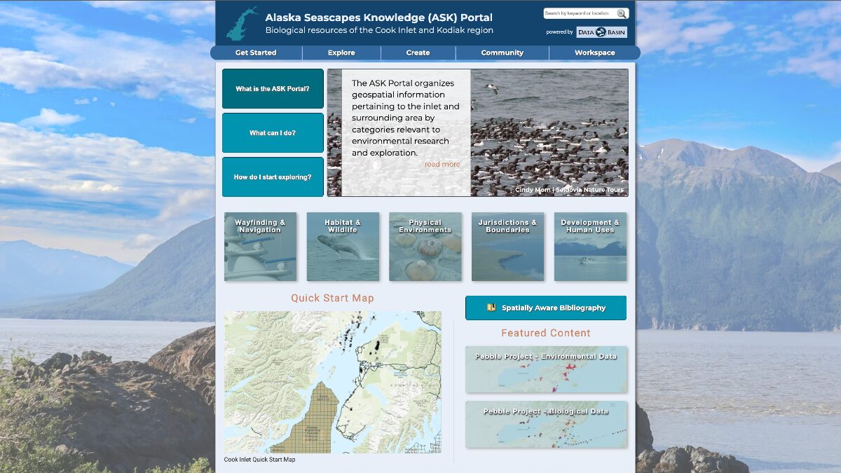
The latest Data Basin Gateway, the Alaska Seascapes Knowledge (ASK) Portal, launched last week. In partnership with Bureau of Ocean Energy Management (BOEM), Alaska Department of Fish and Game, and Nuka Research, the focus of the gateway is to provide a collaborative, online platform to contribute and organize geospatial information pertaining to Cook Inlet and the Kodiak region of the state. The integration of the rich existing and growing datasets and supporting documentation empowers users to make better decisions for ecological sustainability of these valuable marine and coastal environments.
Different Trees, Same Rules: What Shapes Tropical Forest Diversity Worldwide
Tropical regions differ a lot in how many kinds of trees they have overall. The tropical Americas, for example, have many more tree species than Africa or Southeast Asia. So 115 researchers from around the tropics wanted to know whether these big differences also show up at smaller, local scales and whether the same kinds of environmental conditions shape tree diversity in all tropical regions, even though they contain very different tree species.
To test this, researchers used data from 429 one-hectare forest plots across the tropics and combined it with information on climate, soils, and terrain. Using a machine-learning model, they predicted how many tree species occur in each plot. Together, environmental factors explained about 86% of the differences in tree diversity from place to place.
Even though tropical regions have very different evolutionary histories and species, the way local tree diversity responds to environmental conditions is remarkably similar across continents. This suggests that the same basic environmental factors shape how many tree species can coexist in a place, no matter which species are present.
These results point to a strong and widespread role for environmental “niches” in determining local tree diversity across the tropics and they raise an important challenge for ecologists to explain why these patterns are so consistent worldwide.
Endangered Species Act in Jeopardy – Again

Protecting the nation’s endangered species has been a national priority for more than a century, beginning with the passage of the Lacey Act in 1900. The Act strengthened state efforts to protect wildlife by making it illegal to transport unlawfully taken animals across state lines. In the decades that followed, Congress passed a series of laws to extend protections to the country’s most imperiled species. These efforts often focused on individual species—such as the brown pelican, bald eagle, and whooping crane—or on entire taxonomic groups, including birds, fishes, sea turtles, and marine mammals.
In 1973, President Richard Nixon signed the Endangered Species Act (ESA) into law with overwhelming public and bipartisan support. The ESA replaced earlier endangered species laws and established the most comprehensive framework for wildlife protection in U.S. history.
The ESA prohibits the “take” of endangered species by any person, including individuals, corporations, and government entities. “Take” is broadly defined to include actions that harm species, such as significant habitat modification or degradation—a definition that has been central to protecting essential habitat and supporting species recovery. In 1995, the U.S. Supreme Court upheld this interpretation. Today, the ESA protects 1,662 U.S. species and 638 foreign species, and public support remains high at 84 percent.
Since the Reagan administration, the ESA has faced persistent challenges from corporate interests that see its regulations as obstacles to development. These efforts have led to regulatory rollbacks, chronic underfunding, and legislative maneuvers, including delays in listing species, blocks on new listings, and loopholes undermining protections.
Most recently, the Trump administration proposed sweeping changes that would weaken the law’s effectiveness. These revisions prioritize corporate profits over species survival, restrict critical habitat designations, and make it harder to list new species despite an existing backlog. Agencies would also face new procedural hurdles that could remove essential recovery tools, limit habitat offsets, and redefine environmental “baseline” conditions—even though such baselines naturally change over time.

Despite these challenges, the ESA’s success is well documented. The recoveries of species such as the bald eagle, American alligator, grizzly bear, gray wolf, and many others would not have been possible without the protections provided by the Endangered Species Act.
For a complete ESA history, check out https://www.fws.gov/esa50/our-history/pre-1973
To follow the story and take action, check out https://www.endangered.org/take-action/
Spotlight on Species Recovery: The West’s Vanishing Porcupines
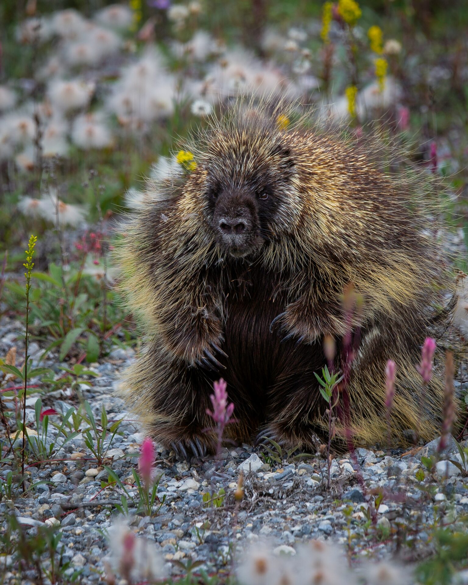
Porcupines are disappearing across the western United States, and scientists are racing to understand why. Once common, these iconic rodents now face threats from habitat loss, historic eradication campaigns, and changing forest ecosystems. Their decline also affects other species, such as the endangered fisher, which includes porcupines as an important food source.
Our own Dr. Wayne Spencer has been active in species recovery efforts, contributing expertise and insights into protecting vulnerable wildlife. He encourages readers to learn more about the challenges facing porcupines and the broader implications for ecosystem health.
New Research Article from CBI’s Dr. Alexandra D. Syphard

CBI’s senior research scientist, Dr. Alexandra D. Syphard, recently published a new research article titled, Causal analysis of fire regime drivers in California. In this work, Dr. Syphard explores the complex challenges facing wildlife and ecosystems in landscapes experiencing rapid environmental change. Her research emphasizes how human activities, such as land development and resource management, intersect with natural processes to influence species distributions and habitat quality.
The study provides valuable insights for conservation planning, offering strategies to prioritize habitat protection, mitigate human impacts, and support species recovery. By combining advanced modeling techniques with real-world data, Dr. Syphard’s work helps inform decisions that balance ecological resilience with the realities of land use.
This publication underscores CBI’s ongoing commitment to advancing science-based approaches to conservation and highlights Dr. Syphard’s leadership in addressing some of the most pressing environmental challenges of our time.
Tomorrow is Giving Tuesday, and your gift matters now more than ever

Giving Tuesday is here — and your support today will power the conservation science our world urgently needs.
With your support, CBI is driving impact on multiple fronts:
- Reversing pollinator decline by matching native pollinators with regionally appropriate food plants, and working with scientific and management teams to develop, implement, and track recovery efforts.
- Recovery of endangered species such as the Pacific fisher and Stephens’ kangaroo rat. Working with teams of scientists and managers to develop recovery plans, implement them, and monitor their success.
- Protection of forests such as California’s giant sequoias. Working with scientists and land managers to safeguard the world’s largest trees from growing threats, particularly recent catastrophic wildfires.
And behind all of this is a critical foundation: open, accessible, science-based data and information.
Earlier this year, our volunteers rescued thousands of essential spatial datasets so they would not be lost to the public. Now they need to be processed and shared — and your Giving Tuesday donation ensures that these data remain open-access and actionable for researchers, land managers, and communities everywhere.
If you’re able, please make a Giving Tuesday donation today. The first $8,000 received will be matched 1:1 by an anonymous donor. Your generosity directly fuels the tools, data, and science that drive conservation forward.
2025 State of the Climate: A Planet on the Brink
The 2025 report warns that climate change is no longer a future threat—it’s a present crisis. Global temperatures, greenhouse gas concentrations, ice loss, ocean heat, and extreme weather events are all at record highs, while forests, coral reefs, and wildlife face unprecedented pressure. Human activities—fossil fuel use, deforestation, overconsumption, and inequitable resource use—are driving ecological overshoot, worsening social and environmental risks. The report highlights that only rapid, transformative action across energy, food, and conservation systems, alongside social and political shifts, can prevent catastrophic outcomes. Climate change is also a justice issue: vulnerable communities bear the greatest burden, despite contributing least to the crisis. The window for meaningful action is closing, but coordinated global effort, systemic change, and social tipping points offer a path to a sustainable, equitable future.
Modeling Fire: Comparing Frameworks, Scales, and Solutions
As wildfires grow in size and complexity, the tools we use to study them must keep pace. From predicting fire behavior in at-risk communities to projecting forest changes over the next century, fire science relies on specialized computational models tailored to different questions, scales, and users.
Tomorrow, December 2nd, five leading researchers will showcase how their modeling approaches address these challenges—what each model can accomplish, where it falls short, and why understanding those limits is critical. Through comparative case studies, this workshop will highlight a key insight: there’s no single “best” model—only the right tool for the question at hand.
Featured speakers
- Dr. Michael Gollner, UC Berkeley – Simulating fire spread in the wildland–urban interface
- Dr. Robert Scheller, NC State University – Integrating social dynamics and climate change in LANDIS-II
- Dr. Melissa Lucash, University of Oregon – Modeling climate-driven shifts in boreal forest structure
- Dr. Trent Penman, University of Melbourne – FLARE Wildfire Research
- Dr. Alexandra D. Syphard, Conservation Biology Institute & Global Wildfire Collective – Applying machine learning to map fire occurrence
Whether you’re a researcher, practitioner, or policymaker, this session offers a rare look at how model choice shapes our understanding of fire’s past, present, and future.
New Article written by GWC Charter Member, Dr. Susan Cutter
In a compelling new analysis published in The Conversation, disaster resilience expert and Global Wildfire Collective Charter Member, Susan Cutter, of the University of South Carolina makes a powerful case for restoring FEMA’s independence. Originally established in 1979 as an independent federal agency designed to work across government to support state and local governments in times of crisis, FEMA lost its autonomy after September 11, 2001, when it was absorbed into the Department of Homeland Security. Since then, the agency has faced persistent complaints about delays caused by layers of bureaucracy and red tape, leaders with little experience in emergency response, and policy whiplash. The consequences were devastating during Hurricane Katrina, when FEMA’s slow deployment and lack of coordination led Congress to declare the response a failure.
As climate change drives an unprecedented surge in extreme weather events—from catastrophic floods and wildfires to intensifying hurricanes—the need for a nimble, effective federal disaster response has never been more urgent. Restoring FEMA as an independent, Cabinet-level agency would enable faster deployment of federal resources, streamline assistance to disaster survivors, and improve long-term recovery efforts. With communities across America facing increasingly frequent and severe climate disasters, bureaucratic inefficiency isn’t just frustrating—it’s deadly. Rather than dismantling FEMA or further constraining its capabilities, Cutter argues that we must return the agency to its original vision: an independent force capable of mobilizing the full power of the federal government when disaster strikes and states are overwhelmed.
Giving Tuesday, December 2nd!

This Giving Tuesday, help protect the data, science, and partnerships that safeguard our planet’s future.
Our open-access platform, Data Basin, remains free for everyone—but keeping it that way depends on your support. Hosting, data curation, and essential updates all require operational funding from people like you. This year, with the help of our dedicated volunteers, CBI rescued thousands of critical spatial datasets from federal libraries before they were lost to the public. These data are now safe—but they need to be processed to make them accessible to scientists, land managers, and communities everywhere.
At the same time, as wildfires grow more frequent and severe, access to reliable data has never been more vital. Through the Global Wildfire Collective’s Spatial Data Gateway, CBI provides free, open access to critical wildfire information that helps communities prepare for and respond to fire risk. Your support makes this possible—and helps us go beyond the data to host workshops, connect with local leaders, and put science into action where it’s needed most.
This year, your gift is more than a donation—it’s an investment in open science, resilient communities, and a safer planet for all.
U.S. Surrendering Leadership in Protecting Internationally Traded Wildlife
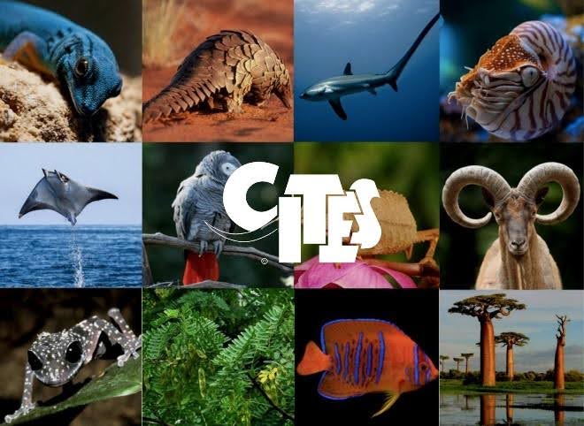
CITES is an international treaty, signed by 185 nations in 1973, that ensures global trade in wild animals and plants does not threaten their survival. Today, 40,900 species are listed under CITES protections—6,610 animal species and 34,310 plant species—across three levels ranging from total trade bans to tightly regulated trade.
For the past five decades, the United States has been a global leader in CITES, reflecting its position as the world’s second-largest wildlife importer after China. However, that leadership role appears to be shifting.
At the upcoming 20th Conference of the Parties (COP20), to be held in Samarkand, Uzbekistan in late November, delegates will consider 51 proposals to regulate wildlife trade. Historically, the U.S. has submitted about a dozen proposals per meeting, but this year it will submit only five—none of which seek to increase protections. Instead, two proposals call for downlisting species (the Guadalupe fur seal and peregrine falcon), one seeks the deletion of the already-extinct Caribbean monk seal (last seen in the 1960s), and another would amend trade rules for American ginseng by exempting farmed plants, potentially increasing risks of laundering wild-collected specimens.
Other species considered for action by the U.S., such as the painted woolly bat from Southeast Asia—popular in U.S. décor and trinket markets—were ultimately excluded, meaning protections for these species will be delayed for at least another two to three years.
Not submitting a proposal does not mean the U.S. will oppose stronger protections for traded species, but its current lack of leadership is raising concern within the conservation community. Countries that put forward proposals are granted more speaking time at international meetings, giving them greater influence in swaying others. With so few submissions, the U.S. will have a much weaker presence.
A Place For Pollinators
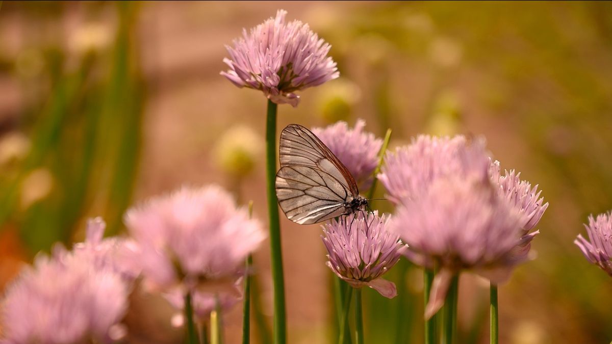
A recent Flora Magazine article from the California Native Plant Society spotlights the development of the Pollinator Companion, a data-driven tool within Calscape that models plant–pollinator interactions to inform restoration and habitat planning. The platform builds on foundational work by CBI’s very own Dr. Chris Cosma, whose doctoral research at UC Riverside produced the original predictive framework, Butterfly Net. Now, as co-lead of the Morpho Initiative, Dr. Cosma continues to advance methods that integrate large biodiversity datasets to enhance the accuracy and accessibility of pollinator-plant relationship modeling across California’s diverse ecosystems.
Modeling Fire: Comparing Frameworks, Scales, and Solutions

As wildfires grow in scale and complexity, the models we use to understand them must evolve just as quickly. From forecasting fire spread in vulnerable communities to projecting century-long forest shifts, fire science depends on computational tools designed for different questions, scales, and users.
On December 2, join four leading researchers as they reveal how their modeling frameworks tackle these challenges—what each can achieve, where their limits lie, and why those boundaries matter. Through comparative case studies, this workshop will explore a central truth: there’s no single “best” model, only tools suited—or unsuited—to the problems we aim to solve.
- Dr. Michael Gollner, UC Berkeley – Simulating fire spread in the wildland–urban interface
- Dr. Robert Scheller, NC State University – Integrating social dynamics and climate change in LANDIS-II
- Dr. Melissa Lucash, University of Oregon – Modeling climate-driven shifts in boreal forest structure
- Dr. Alexandra D Syphard, Conservation Biology Institute & Global Wildfire Collective – Applying machine learning to map fire occurrence
Interior Proposed to Rescind Public Lands Rule
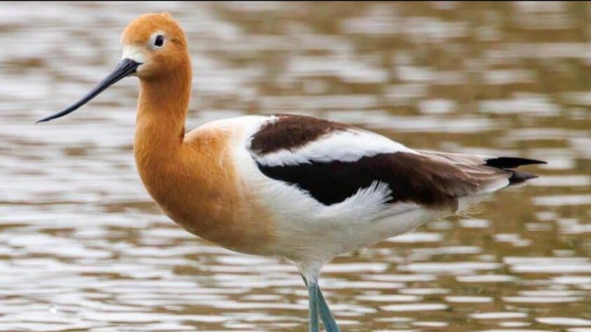
Importance of Groundwater Versus Surface Water in Creating Shorebird Habitat in the Central Valley of California
Online Panel Discussion: Resilient Landscapes and Prepared Communities
The Climate Crossroads: Urgent Warnings, Political Backsliding, and the Power of Truth
Earlier this year, James Hansen and colleagues published a paper titled Global Warming Has Accelerated: Are the United Nations and the Public Well-informed? The authors present extensive evidence leading to a stark conclusion: the climate crisis is more severe than widely reported, and only an urgent global response can meet the challenge. We are already experiencing stronger storms, record-breaking floods, extreme heatwaves, prolonged droughts, and devastating wildfires. These impacts will not only persist but intensify, threatening countless lives and causing enormous economic losses. Perhaps most alarming, the study warns that if current trends continue, the Atlantic Meridional Overturning Circulation (AMOC) – a critical ocean current system – could collapse within 20 to 30 years. Such a tipping point, described as the “Point of No Return,” would drive catastrophic sea-level rise and irreversible shifts in Earth’s climate system.
Now is not the time to deny reality or delay action – yet that is precisely the path the U.S. is taking. The current administration remains the only government preparing to withdraw from the Paris Agreement, while also dismantling international climate partnerships and rolling back energy and climate commitments through executive orders. In August 2025, NPR reported that NASA had been directed to develop plans to terminate at least two satellite missions that track atmospheric carbon dioxide. These satellites also provide crucial data on plant growth, and news of their potential loss has raised alarm among both scientists and farmers.
Confronted by the mounting scientific evidence of a rapidly changing climate, the fossil fuel industry and its political allies have mounted an aggressive global campaign to dismiss climate science as alarmist and portray solutions to reduce greenhouse gas emissions as unrealistic. They promote technological fixes such as carbon capture and emphasize adaptation strategies – rebranded as “resilience” – as sufficient responses to what they frame as an exaggerated problem. To justify inaction, climate science critics even cloak their stance in terms like “climate realism,” while downplaying the escalating risks.
There are three recent YouTube presentations that provide valuable information on this critically important topic. The first is video titled, New Research DEBUNKS Climate Disinformation presented by Dave Borlace from the channel called “Just Have a Think,” which was posted on August 17, 2025. The video focuses largely on a book by Genevieve Guenther called The Language of Climate Politics: Fossil Fuel Propaganda and How to Fight It, with other supporting information. You can also watch a presentation by the author that she gave at The Metcalf Institute in May of this year. The last video is a fact-filled and passionate presentation by Al Gore called, Why Climate Action Is Unstoppable – and “Climate Realism” Is a Myth. Together, these provide a solid update about where we are regarding the climate crisis.
Announcing the North American Forest Initiative
Dr. Dominick DellaSala, a long-time CBI Associate, has dedicated over four decades to nonprofit conservation work as a global biodiversity and climate scientist. He has also served as President of the North America Section of the Society for Conservation Biology. An internationally recognized author, he has published more than 300 peer-reviewed articles and co-authored nine award-winning books, including Temperate and Boreal Rainforests of the World: Ecology and Conservation, Mixed-Severity Fire: Nature’s Phoenix, and Conservation Science & Advocacy for a Planet in Peril: Speaking Truth to Power. Dr. DellaSala will soon be launching a new CBI initiative focused on North American forest conservation. Content is currently being added to the CBI website describing the important work Dr. DellaSala and his colleagues are doing and is expected to launch publicly around mid-month. This important initiative will be a valuable resource for all who care about the long-term protection of forests. Please check in here over the coming weeks.
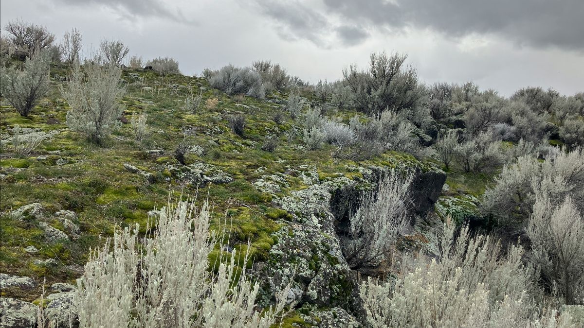
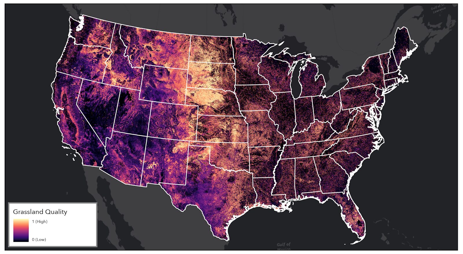
National Grassland Quality Modeling

Over the past two years, CBI spatial modelers have been developing map-based products to support the USDA Conservation Reserve Program (CRP). A central goal of this work is to generate more accurate maps of grassland quality, enabling large-scale evaluation of ecosystem services. This spatially explicit approach provides USDA with the information needed to track the relative conservation success of a program that voluntarily safeguards over 26 million acres of private farmland nationwide.
To achieve this, CBI integrated cutting-edge remote sensing data with key environmental indicators and applied machine learning techniques within the Google Earth Engine platform. Draft models have already been produced at a national scale, with advanced methods tested in several grassland-rich states. Each model incorporates three primary components: vigor, composition, and landscape structure and resilience. Preliminary results (Figure 1) have also been built into an online assessment tool, which is currently under review.
Dr. Alexandra Syphard Featured on NPR – Insights on Roads, Wildfires, and Unintended Consequences
We’re delighted to share that Dr. Alexandra Syphard, Senior Research Scientist at CBI and Director of Science at the Global Wildfire Collective, appeared on NPR on August 28, 2025, to discuss proposed changes to the Roadless Rule and their potential implications for wildfire risk.
Dr. Syphard eloquently invoked the Sevareid Principle, reminding listeners that “the law of unintended consequences is a very real law.” She emphasized that while roads may facilitate access for fire suppression, they also tend to increase fire ignitions—as data shows up to four times more ignitions within 50 meters of roads than in roadless areas. Moreover, road construction transforms vegetation—favoring flammable grasses in place of mature forest—and thereby amplifying fire risk.