
CBI has designed and launched a new Data Basin Gateway (Atlas) for the Wildlife Conservation Society Canada focusing on the Yukon Territory to assist WCS Canada researchers and their conservation partners in the region to develop effective protection of wildlife and plants being impacted by a host of environmental stressors, with special emphasis on climate change. In addition to the branded and curated gateway with relevant datasets, we have co-produced a customized application for stakeholders to view and download species distribution models (SDM) for 66 endemic plants designed to predict future changes in their distribution due to climate change. The Atlas houses relevant datasets for conservation planning in the climate-sensitive Yukon region and the tool houses the SDMs, which in combination provide powerful resources for WCS Canada and its partners to effectively plan for resilience.
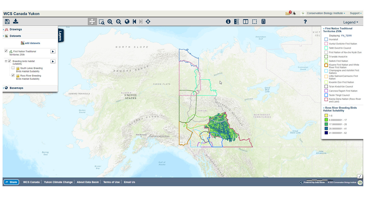
An example of a map created in the WCS Yukon Data Basin Atlas showing First Nation Territories overlaid on Ross river breeding bird habitat suitability layer
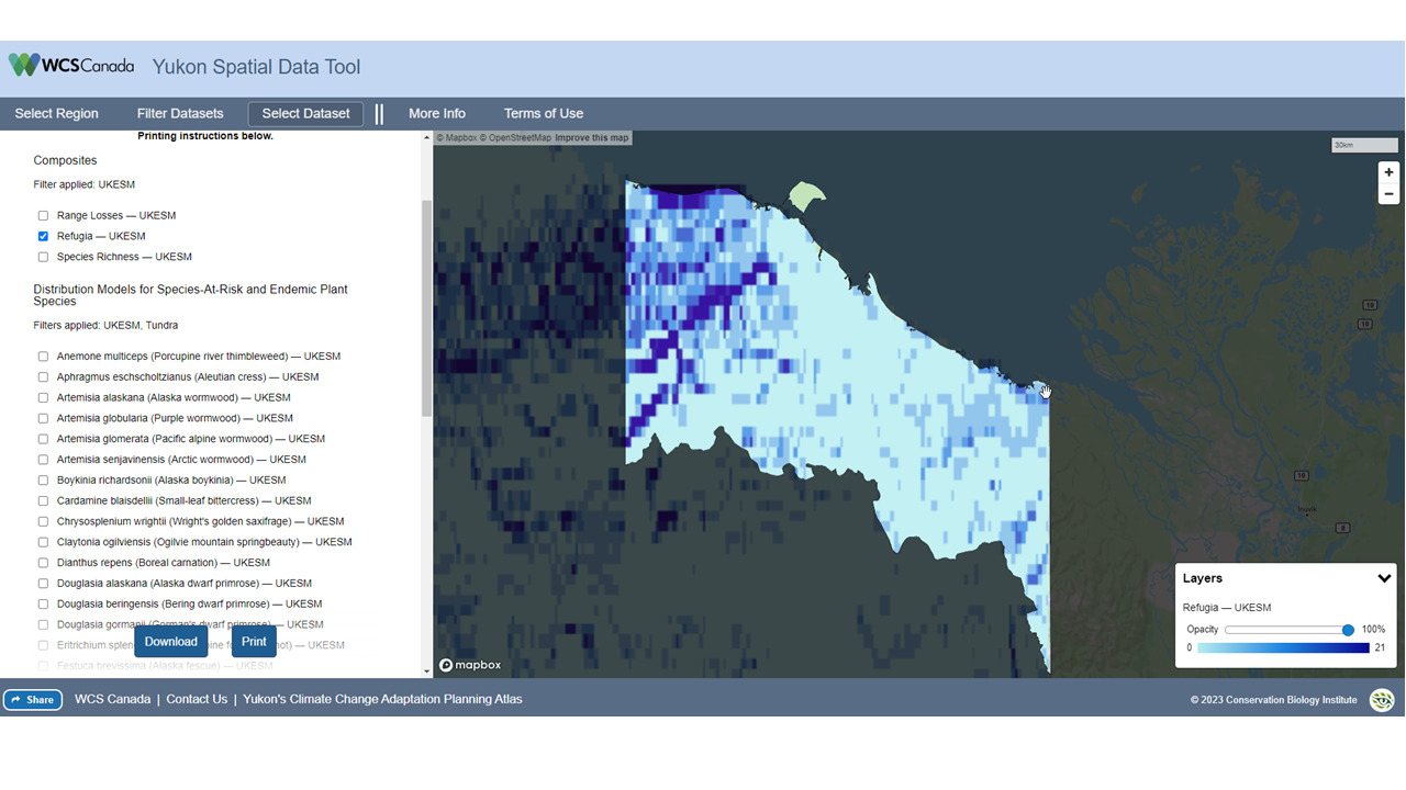
The Yukon Spatial data tool showing projected climate refugia for a Inuvialuit Planning region in the Yukon
Project Details
Location
Date
Services Provided

Conservation Software Solutions

Data Basin