The Stephens’ kangaroo rat (Dipodomys stephensi) is an endangered mammal of grassland habitats in southern California. CBI is helping to conserve the species using satellite technology & advanced mapping techniques.
The Stephens’ kangaroo rat (Dipodomys stephensi) is an endangered mammal of grassland habitats in southern California. CBI is helping to conserve the species using satellite technology and advanced mapping techniques.
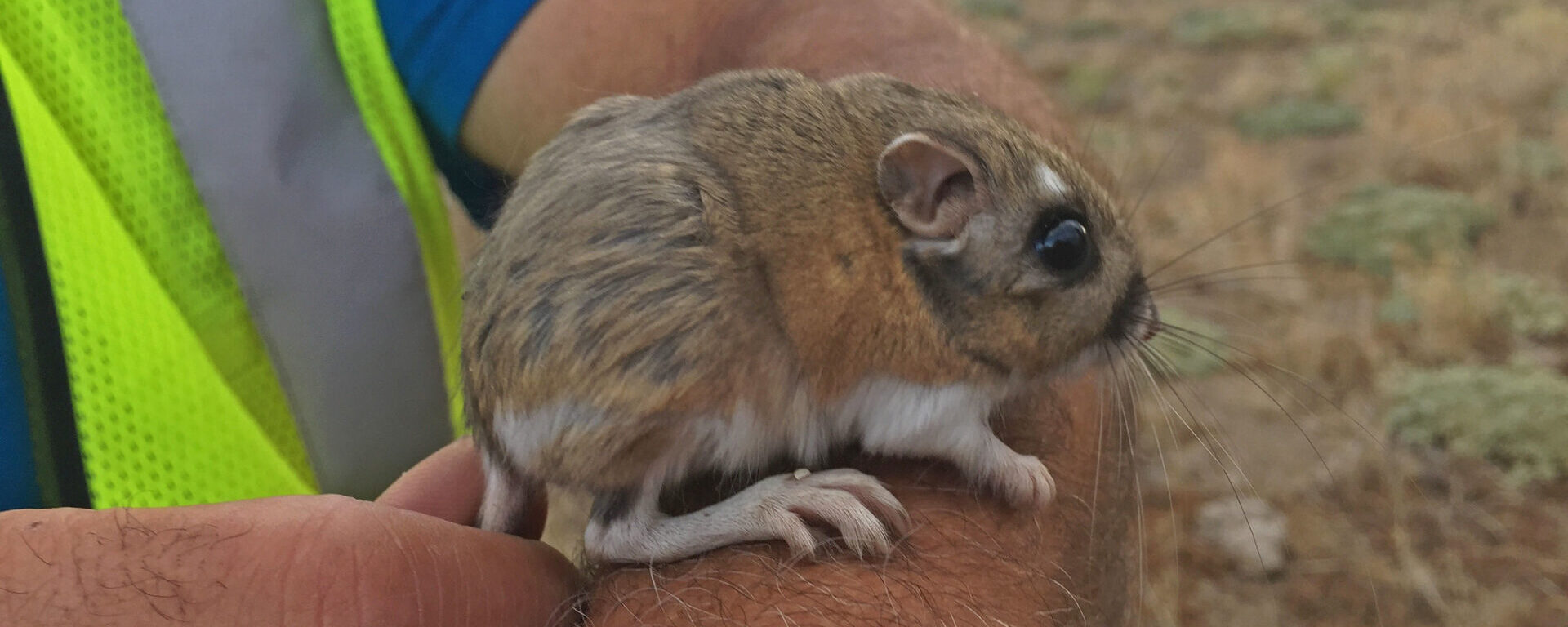
Kangaroo rats (or Krats, as biologists often call them) are seed-eating rodents restricted to arid regions of southwestern North America. The 20 or so Krat species are biologically similar to jerboas of the Mideast–and like mideastern jerboas and the kangaroos of Australia, they use their large hind limbs to bound efficiently and elusively through open habitats, especially deserts and grasslands. Being mostly nocturnal, Krats also have huge eyes for night vision and keen ears for hearing predators, like owls and foxes.
Stephens’ kangaroo rat (or biological shorthand, SKR) occupies open, undeveloped grasslands in western Riverside and San Diego counties in southern California. Because much of their habitat has been paved over and fragmented by development, the SKR was listed as Endangered under the the US Endangered Species Act and Threatened under the California ESA in the 1980s. Numerous ecological reserves have since been established to conserve remaining populations. Unfortunately, these scattered Krat reserves are not consistently managed, monitored, or even understood by the responsible resource management agencies, largely because it is difficult to map and track suitable habitat conditions over space and time. Traditional habitat variables, such as vegetation and soil types, are not nuanced enough to reflect the on-ground conditions that SKR need, and management and monitoring approaches differ amongst the reserves.
CBI is helping remedy this situation by using satellite imagery and innovative habitat modeling techniques to develop reliable statistical models to map habitat suitability across the species’ geographic range. In partnership with the US Fish and Wildlife Service, the Riverside County Habitat Conservation Agency (RCHCA), and species experts, we are developing a coordinated approach to mapping SKR habitat suitability to manage and monitor the species in a more scientifically consistent and justified manner. Specifically, we are using European Sentinel-2 satellite imagery, in concert with other reliable geographic data, to develop habitat suitability maps that can be routinely updated over time across the species range as conditions change. The resulting models will be used to inform management and monitoring efforts to conserve and recover this charismatic endangered species.
Project Details
Location
Date
Services Provided

Conservation Planning & Management

Scientific Research & Modeling

Spatial Analysis & Mapping