Software Details
Related Posts
CBI Contact

CBI Authors + Contributors


A beta-version of an Assessment tool for USDA's Conservation Reserve Program (CRP)
The current prototype version of the CRP tool allows USDA staff, land owners, and third-party organizations to view pertinent spatial information and guide decision making in relation to the status of certain CRP farms in 1) Washington state, 2) Kansas and Colorado states, 3) Mississippi state. In this tool, we focus on farm tracts in WA, KS and CO that are under grasslands practices, while for tracts in Mississippi that are under tree-based practices.
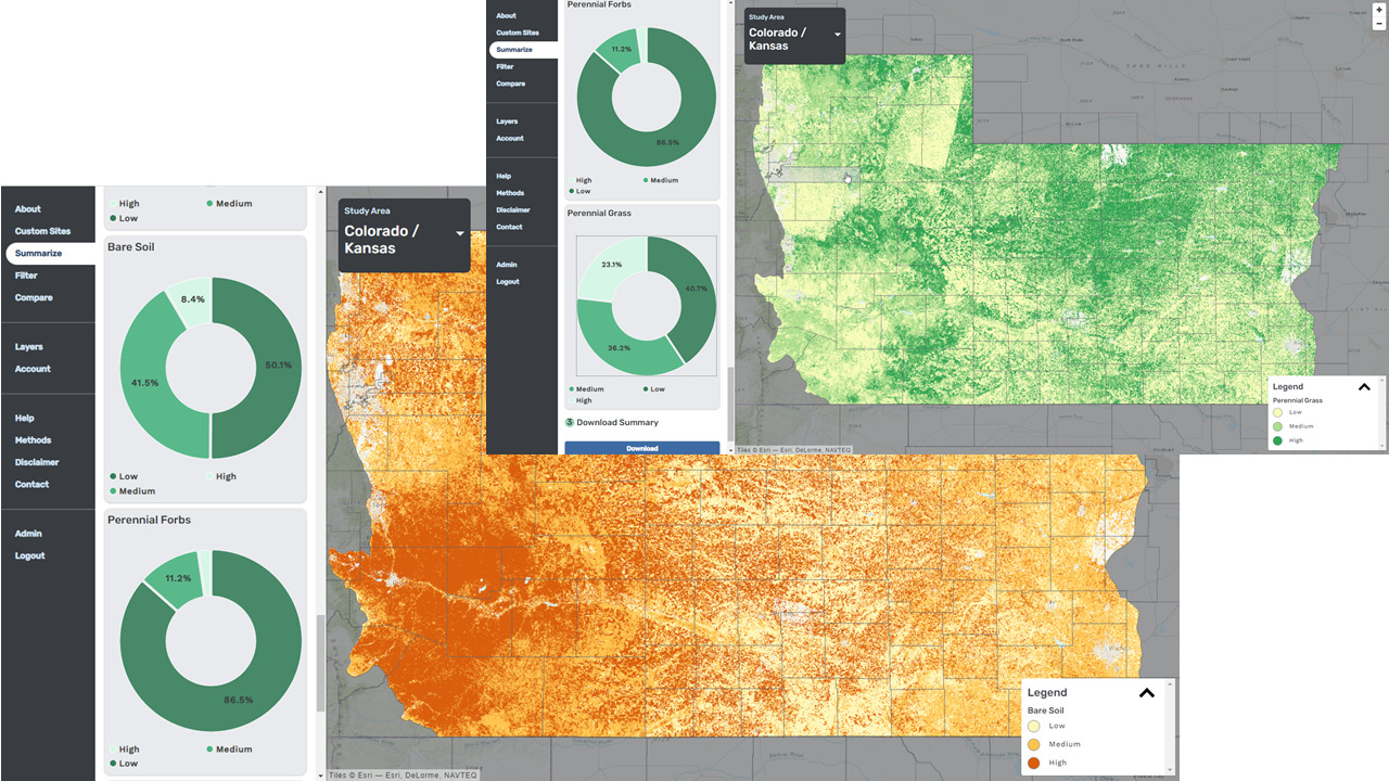
The tool showing the modeled occurrence of bare soil and perennial grass in Eastern Colorado and Western Kansas study areas. Such models can assist USDA FSA staff and landowners in assessing the land cover on CRP tracts and take necessary management actions to increase the quality of cover to enhance conservation outcomes.
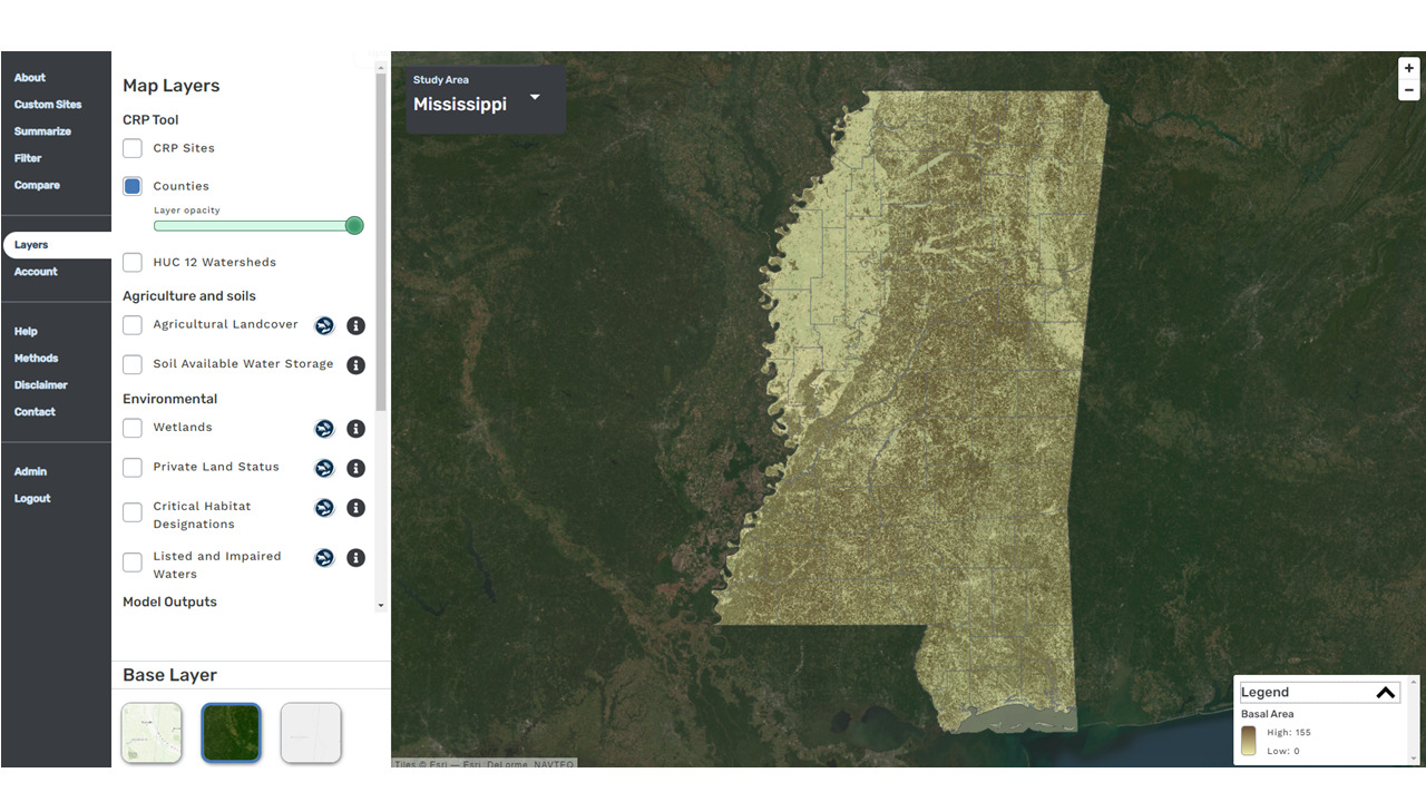
The tool showing the modeled tree basal area layer for the state of Mississippi. Users can explore the average basal area for any area in the state including CRP tracts
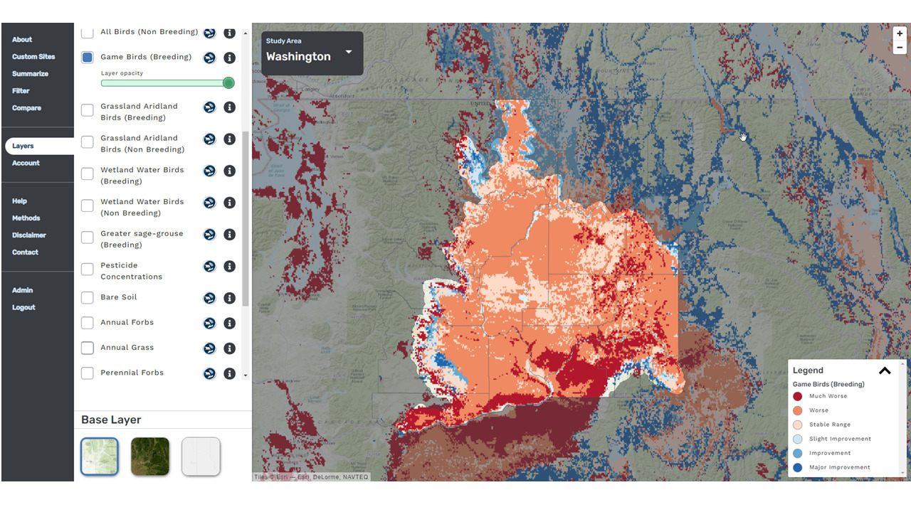
The tool showing users where to expect stable or worsening habitats for breeding game birds with climate change for eastern parts of state of Washington. The layer was modeled using E-Bird and Audubon data. The CRP tool has many useful data layers and information can be filtered, summarized, or compared to guide planning and policy decisions.