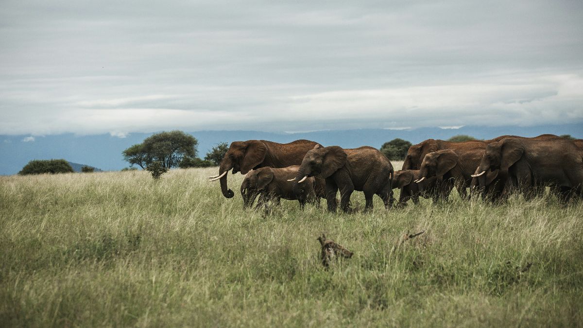
New Publication: “New research illuminates the ecological importance of gray wolves in the American West”
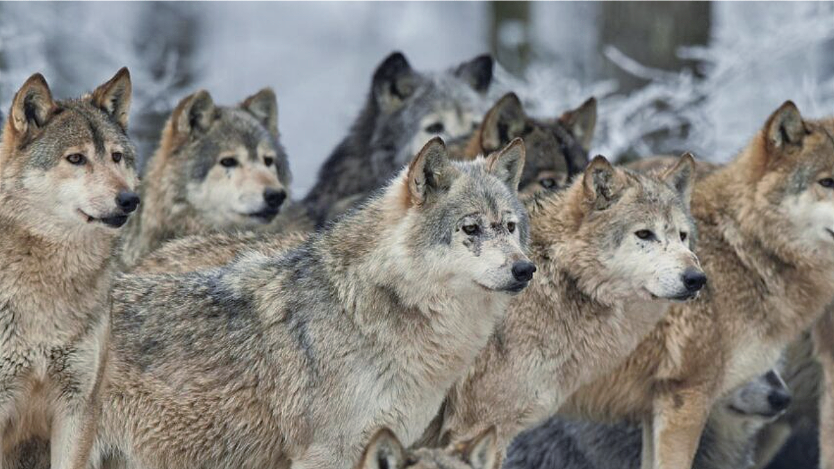
A recent publication in the journal Bioscience illustrates the importance of top predators in shaping natural ecosystems (in this case, gray wolves in the western U.S.). Led by William Ripple, a scientist at Oregon State University and CBI Associate, the research explores how the loss of gray wolves in the West impacts plant and animal communities and the overall function of the ecosystem.
By the 1930s, gray wolves were removed from most of the Western U.S. and its national parks. Examining three national parks (Yellowstone, Olympic, and Wind Cave), the authors of this publication clearly demonstrate that the significant increase in ungulate populations correlates with the declines in deciduous trees that occurred following the removal of these animals.
The paper also calls attention to “shifting baselines” wherein increasingly degraded conditions are often viewed as reflecting the historical state of the system. The authors write, “Studying an altered ecosystem without recognizing how or why the system has changed over time because of the absence of a large predator could have serious implications for wildlife management, biodiversity conservation, and ecosystem restoration, like diagnosing a sick patient without a baseline health exam.”
It is clear that the loss of top predators has major consequences for the health of natural ecosystems; however, as the authors remind us, there are likely other factors such as fire suppression, invasive species, and overgrazing that we need to examine closely. By acknowledging the historical presence of large predators, other anthropogenic legacies, and their potential ecosystem effects, researchers can contribute to more effective conservation and management strategies in national parks and beyond.
New Publication: “Sustainable nature-based solutions require establishment and maintenance of keystone plant-pollinator interactions”
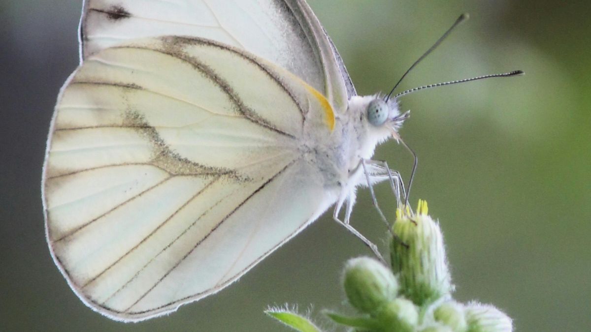
CBI’s ecologist, Chris Cosma, co-authored a recent publication that focuses on ecosystem regulators on the opposite end of the animal food chain – insects.
As global climate change continues to threaten biodiversity and the provision of ecosystem services, nature-based solutions (NBS) seek to integrate societal and ecological aspects of environmental problems, thereby benefiting humans while minimizing ecosystem degradation. Despite the recognition that ecosystem services rely on biodiversity conservation, NBS generally has not given sufficient attention to the biodiversity component, especially as it pertains to insects. Although NBS encompasses ecosystems of all types, at their core, many NBS depend upon plants that, in turn, depend upon pollinators.
Unfortunately, populations of many insect pollinators such as bees, butterflies, and moths have plummeted in recent decades. These declines highlight the interconnected nature of plant and pollinator conservation. The reproduction of almost 90% of angiosperms and 70% of the main human food crops are tied to the animals that pollinate them. Thus, the global change-driven loss of pollinators represents both the loss of biodiversity and the loss of a critical ecosystem service. The sustained success of NBS therefore depends upon preserving resilient pollinator communities, which can be accomplished by prioritizing keystone species and interactions that maintain function under future climates.
New Publication: “Evidence of increasing wildfire damage with decreasing property price in Southern California fires”
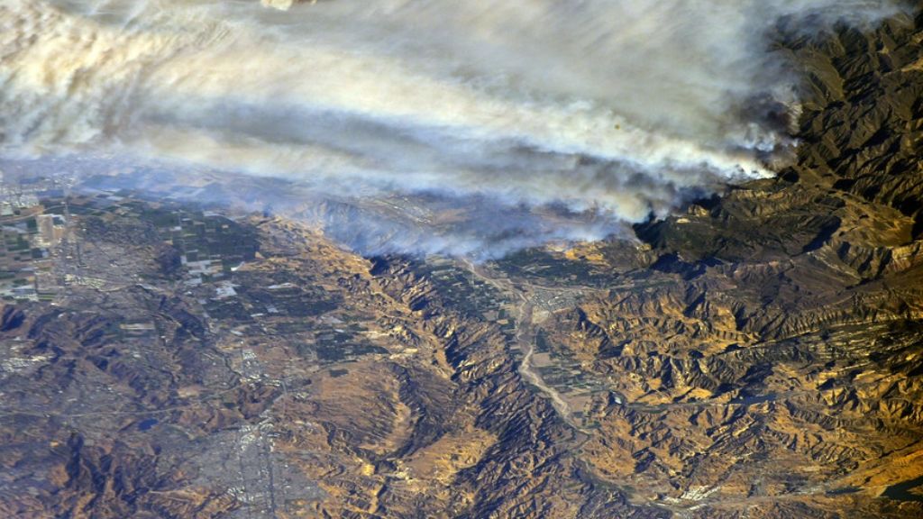
Alexandra Syphard and Erin Conlisk of CBI’s Conservation Planning & Management Team helped examine the disproportionate socio-economic impact of wildfires in Southern California. Using the Zillow Transaction and Assessment Database (ZTRAX), spatial analysis of wildfire severity, home destruction, and property value was examined within fire perimeters occurring from 2000–2019.
The authors found evidence to support the hypothesis that lower-priced properties were more likely to be damaged, however, the likelihood of damage and the influence of property value significantly varied across individual fire perimeters. When considering individual fires, properties within two 2003 fires (Cedar and Grand Prix – Old Fires) showed statistically significant decreasing burn damage with increasing property value. Occurring in 2007 and later, three fires (Witch-Poomacha, Thomas, and Woolsey) showed no significant relationship between price and damage.
Further exploration into this topic is needed. In the meantime, decision-makers should consider allocating wildfire risk mitigation resources such as fire-fighting and wildfire structural preparedness resources to more socioeconomically vulnerable neighborhoods in Southern California.
The Wildfire Academy
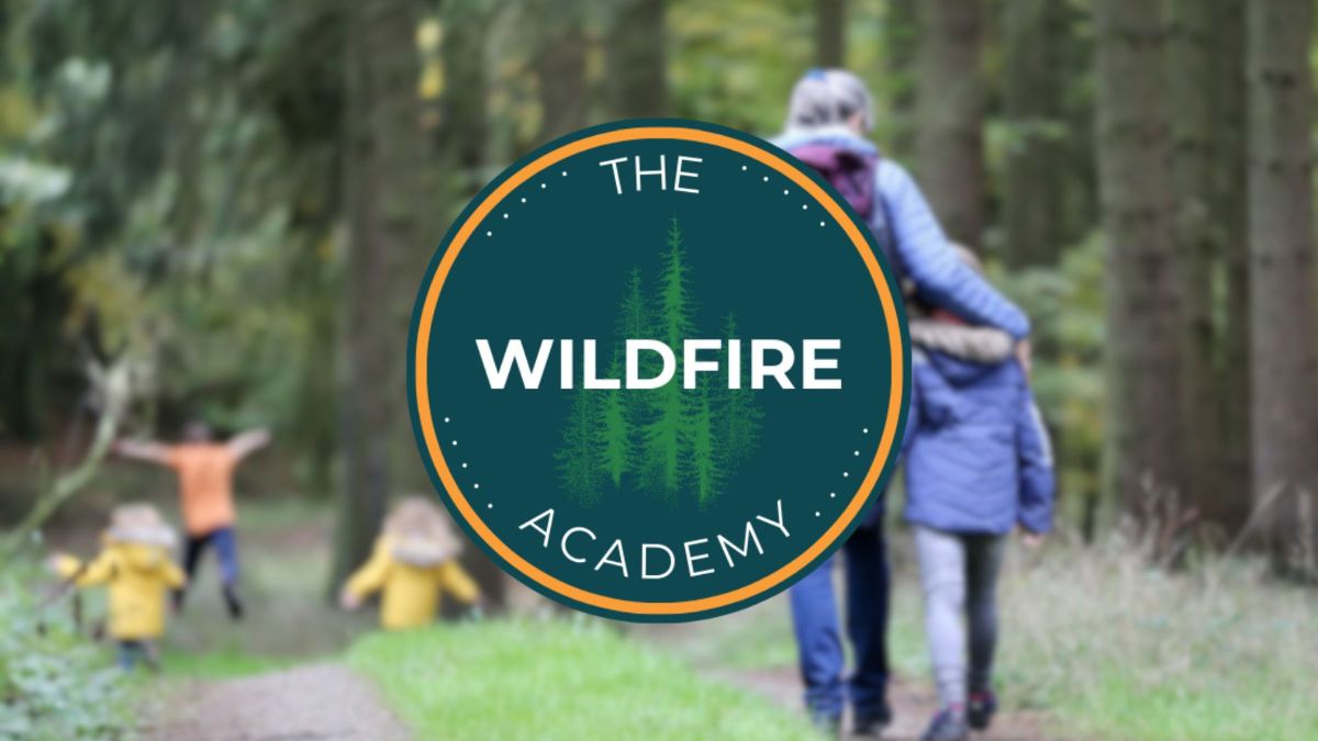
In the past several years, CBI has developed a reputation for expertise in the applied science of wildfire prevention, management, and recovery. Our team of experts is constantly in demand, and we have come to recognize that our team’s knowledge and approach have the opportunity to scale its impact through education. As such, CBI has embarked upon the creation of The Wildfire Academy, an educational program that addresses the impact of wildfire grounded in the best available science and accessible to all. The program is being designed to educate landowners, students, policymakers, and other decision-makers on this important topic as we continue to live in a rapidly changing world.
We are actively seeking sponsors for the program, if interested, or for any other inquiries, please email us at marketing@consbio.org.
Placer County Conservation Planning Support
Placer County, California continues to be one of the fastest-growing counties in the state. Beginning in 1994, the county General Plan aimed to accommodate this growth while conserving productive agricultural lands and protecting many of its natural communities and rare species. After numerous assessments and stakeholder engagements, a draft Placer County Conservation Plan (PCCP) was released in 2011.
For the western foothills portion of the county, the PCCP focuses on protecting or restoring various oak woodland communities as well as habitat for identified aquatic and terrestrial covered species including, valley elderberry longhorn beetle, Central Valley Chinook salmon, Central Valley steelhead, California red-legged frog, northwestern pond turtle, California black rail, and Swainson’s hawk. Implementing the plan is underway and involves integrating high-value lands made available by willing sellers. The biggest challenge is finding suitable habitat to mitigate the projected impacts of new growth in a way that maintains landscape ecological integrity.
CBI was asked by the Foothills Conservation Strategy Ad Hoc Committee to integrate the available spatial data pertaining to the natural community and species targets listed in the plan and create a flexible spatially explicit model to assist county staff in identifying and systematically evaluating potential lands for protection or restoration to meet plan goals. The model housed in Data Basin contains some private data; therefore, it is available only to county staff.
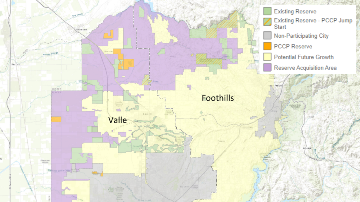
Map of the PCCP focal areas for the valley and foothills subareas. The parcel-based model created and housed in Data Basin is for the foothills region.
“CBI has made a significant contribution to the Plan implementation through the development of an on-l ine tool in Data Basin that supports the development and implementation of conservation strategies for the Sierra Nevada Foothills. Placer County staff and the PCA advisory committee are using this tool for preliminary identification of critical parcels that will be followed up with parcel-level field analysis.”
Dennis Grossman, Foothill Representative, Placer County Conservation Program Advisory Committee
New CBI Team Members!
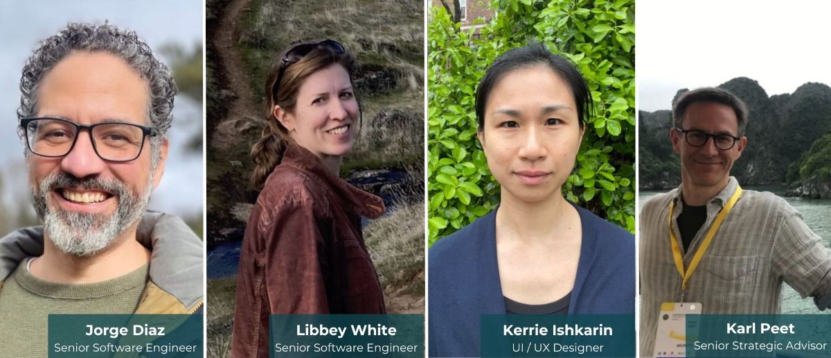
Jorge Diaz (far left) started his career in technology as an artist, animator, and designer working on both the mainstream and the educational video game industry. After completing an MS in Computer Science he started as a software engineer in the public sector. Sometime in between he taught college classes in storyboarding as well as computer science and co-owned two art supply stores with his wife. His developer experience is in accessibility, automation, full stack development, security, user interface design, and developing systems for a wide variety of user types.
Libbey White (center left) grew up enjoying the natural splendor of Montana, which instilled in her an instinctive interest in conservation. Libbey majored in biology, but was a laundromat attendant, book store clerk, ranch cook, and lab assistant, among other things, before getting close to working with data and code. She got her start in the software field thanks to willing tutors at the Center for Computational Biology at Montana State University. Since then she has held a variety of software development roles, including exhibit software developer at Oregon Museum of Science & Industry and research software developer at Knight Cancer Institute, where she created a genomic data visualization application.
Kerrie Ishkarin (center right) has a Bachelor of Fine Art and a Certificate in UX Design from Rhode Island School of Design and joined the CBI Software & Tool Team, bringing 8+ years of experience working as a user interface (UI), user experience (UX), and product designer. She has worked on desktop and mobile product designs using tools such as Figma, Sketch, and InVision to create sketches, wireframes, prototypes, and implementation-ready designs.
Karl Peet (far right) is a researcher and advocate working at the intersection of climate change, energy transition, and conservation. He is helping to shape CBI’s global engagement strategy on nature-positive infrastructure and renewable energy. Karl is also assessing strategies to meet 2030 targets of the Global Biodiversity Framework and other multilateral environmental agreements, reflecting the technical knowledge and cultural imperatives of Indigenous communities.
Data Basin Now Supports ArcGIS Pro Data Formats!

Data Basin now supports the latest Esri software file formats generated by ArcGIS Pro.
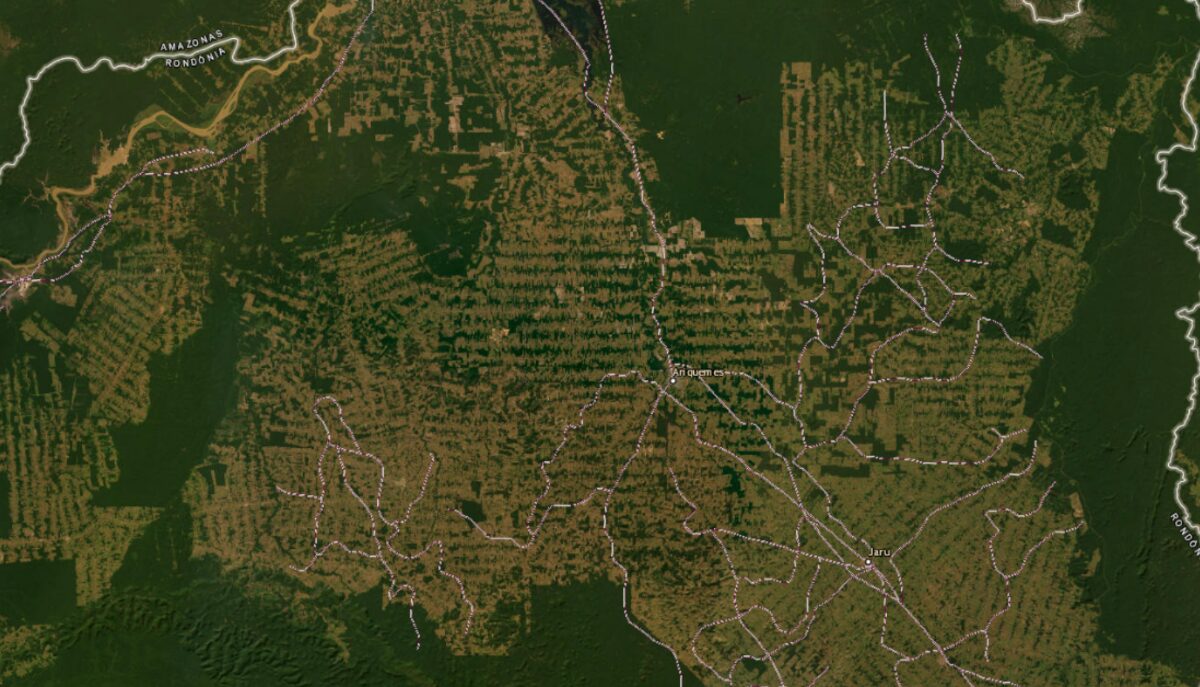
Roads Drive Tropical Forest Biodiversity Loss
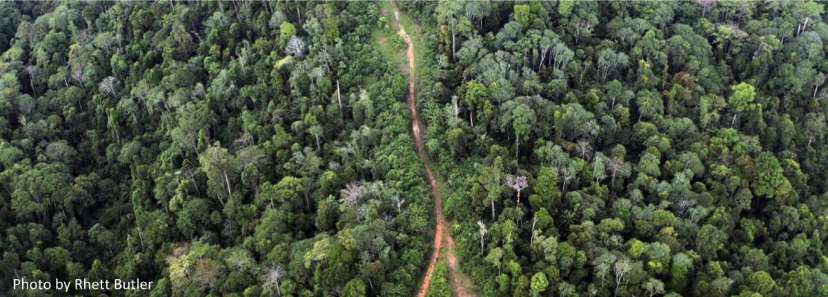
There are around 40 million miles of roads in the world with another 15.5 million miles projected to be added by 2050, which is the fastest expansion rate of road building in history. Roads continue to be constructed around the world including the U.S., which leads the world in the number of linear miles (>7 million miles), but the most recent concentration of new road building is in the tropical nations. Even more troubling is that many roads are being constructed informally or illegally and, therefore, do not appear on any map. These are sometimes referred to as “ghost roads”.
In a recent article in Nature, the authors conducted a study on roads in the Asia-Pacific region and found 3.0 to 6.6 times more roads exist than are shown in any leading roads dataset. These ghost roads are being built to gain access to pristine tropical forest areas for various purposes: agriculture expansion, logging, mining, poaching, and land speculators – all with serious ecological consequences. Roads were shown to be the strongest correlate to deforestation out of 38 potential variables. The authors conclude that “ghost roads are among the gravest of all direct threats to tropical forests.”
Unfortunately, the Asia-Pacific Region is not alone. The same issue has been recorded in many other parts of the world (e.g., the Amazon region and Congo Basin).
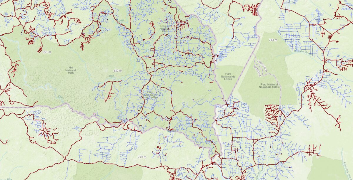
Of course, roads are a vital infrastructure for modern societies, so where should they go? An article by Distinguished Research Professor Bill Laurance, published in The Conversation, describes a global strategy for road building. Bill and his coauthors intersected areas of relative environmental value with areas of relative agricultural potential identifying priority areas for both and where in the world these two uses are in conflict.
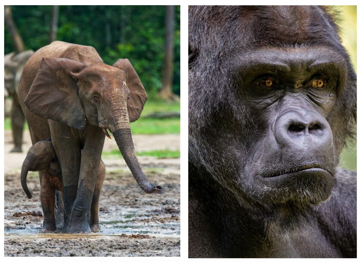
Improving road networks in areas of high agricultural potential and low environmental value are good candidates as they have immediate value to local people. In the high environmental value areas, especially in direct conflict with potential new agricultural land, it would be wise to avoid the first cut into these areas as once there is an initial access road constructed many more roads rapidly follow with serious consequences to the local biodiversity. For example, in the Congo region of Africa, 60 percent of the forest elephant population has been lost over the last decade and the critically endangered eastern lowland gorilla (Grauer’s Gorilla) population is estimated to be 6,800 individuals.
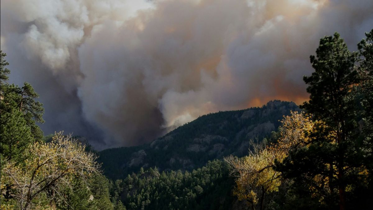
New Publication: Chile’s Valparaíso hills on fire
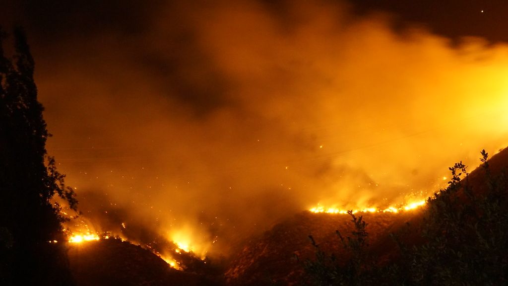
Our Senior Research Scientist, Alexandra Syphard, is a co-author of the paper in Science, Chile’s Valparaíso hills on fire, which highlights human-caused ignitions, flammable plantations, and prolonged droughts making Chile one of the most fire-prone places in the world. A record-breaking Chile wildfire in February destroyed thousands of homes, caused 133 human fatalities, and burned thousands of hectares of stressed vegetation. Wildfire mitigation in Chile will require many steps, including (1) governance and land-use planning, (2) restoring and managing native forest vegetation, (3) removing highly flammable forest plantations, (4) prohibiting the conversion of recently burned native forests into exotic forest plantations or new urban developments, and (5) strengthening fire prevention programs in Chile helping reduce human-caused ignitions.
The Little Things That Run the World
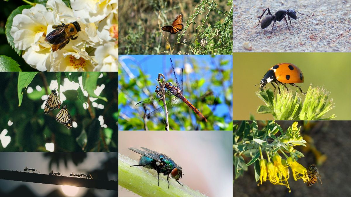
In 1987, in a brand new journal called Conservation Biology, the pioneering entomologist E.O. Wilson published a short article titled “The Little Things That Run the World (The Importance and Conservation of Invertebrates)”. In it, Wilson painted a chilling picture of what the world might look like without insects. As the most diverse group of animals on the planet, insects account for around 80% of all known species. They form the foundation for all other life, performing many critical ecosystem functions including pollination, soil maintenance, nutrient cycling, pest control, and as a food source for numerous animals. Their importance to humans cannot be overstated: as just one example, one out of every three bites of food we eat is provided by pollinating insects. Thus, without insects, humankind—along with most of life on Earth—would soon vanish.
Now, almost 40 years later, we risk seeing Wilson’s hypothetical insect-less future become reality. As scientists continue to learn about the essential roles insects play, entire species are being lost (5% to 10% over the last 150 years) and over 40% of insect species have declined over the last decade. Since Wilson wrote his now-famous article, global insect populations have declined by around one-third. There are many contributing factors: pesticides, pollution, climate change, invasive species, and above all, loss of native habitat. While they get less attention than mammals or birds, the ongoing loss of insects is an existential threat that requires urgent attention.
CBI has worked on a limited number of insect conservation projects. However, given the growing crisis, we feel it is important to increase our focus on this critical issue. Towards this goal, we are thrilled to announce the addition of Dr. Chris Cosma to our team, who brings with him fresh approaches to insect conservation (see below). For example, given their immense diversity and variable responses to environmental change, the species-by-species approach to conservation, which is a common strategy for larger organisms, may not be suitable for insects. Instead, adopting a community-level focus, and integrating tools such as ecological network analysis and spatial analyses, offers great hope for protecting and restoring the world’s insects. Additionally, unlike many larger organisms which rely heavily on large protected areas, the battle to save insects will be won by restoring small, stepping-stone habitats to increase connectivity across human-dominated landscapes. This includes the largely untapped resources of marginal lands in agricultural and urban areas (including hedgerows, private yards and gardens, and road medians). It is in part the little things that we can do—such as converting lawns to native plants and advocating for wildflower plantings along highways—that will help save the little things that run the world.
Welcome Dr. Chris Cosma

CBI welcomes Chris Cosma to CBI! Chris recently earned his Ph.D. from the University of California, Riverside where he specialized in Lepidopteran Conservation Biology. Chris received numerous grants and awards while at the university. Most recently, he serves as Co-lead of a working group funded by the National Center for Ecological Analysis and Synthesis (NCEAS) tasked to improve our practical knowledge of plant-insect relationships to advance pollinator conservation. Chris brings considerable knowledge and energy to protecting and restoring insect populations, especially moths and butterflies, and will initially be working on improving the conservation effectiveness of private lands enrolled in the USDA Conservation Reserve Program.
Earth Day 2024
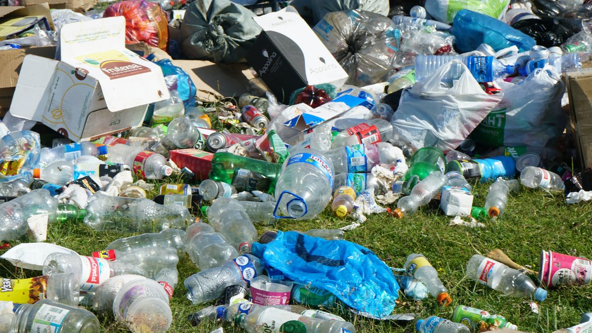
I remember the first Earth Day on April 22, 1970. I was in 8th grade anticipating the move to the high school in the fall. But on that Wednesday afternoon, I still remember heading out with my garbage bag and my collecting stick (nail at the end of an old broom handle) and going about the school grounds picking up paper and plastic waste. It was not viewed as a big deal by the school – I was out alone that day, but it meant a lot to me to honor the first Earth Day in some way. This year, the theme is ‘Planet vs Plastics’. Plastics in the environment have grown over the last 54 years – we have a plastics problem. Most have heard about the Pacific Garbage Patch, which is actually two patches – one off the coast of California and one off the coast of Japan. According to NOAA Marine Debris Program, it would take an estimated 67 ships one year to clean up less than 1 percent of the North Pacific. Closer to home – our bodies – there is growing alarm about nanoplastics finding their way into our bloodstream. Researchers at the National Institutes of Health reported that, on average, a liter of bottled water included 240,000 tiny pieces of plastic. Little did I know that the plastic I was picking up with my stick back in 1970 would turn out to be a much bigger problem.
First Data Basin Newsletter Comes Out This Month!
As you may recall from our March edition, we have a new monthly newsletter coming out for our sister website this month! With over 50,000 users, we are very excited to have a new way of keeping people up-to-date with user experiences, high-resolution mapping, and tips on how to best utilize our rapidly growing initiative, Data Basin!
More Monthly Newsletters
World Rewilding Day
March 20th is World Rewilding Day! Started in 2021 by the Global Rewilding Alliance, this day was created to raise awareness about this progressive approach to conservation. Enabling natural processes to shape and repair ecosystems, this type of ecological restoration aims to maximize biodiversity and reduce human impacts on the environment. Cost-effective and practical over small to large extents, rewilding projects aim to protect, restore, regenerate, and nurture the natural world for fresh air, clean water, and landscapes that thrive full of life of all kinds. More than anything, rewilding is a social movement participated in by people from all over the world working to restore areas to make them wild again. Join the movement!
Connectivity Map for the State of Washington

With our considerable experience in wildlife connectivity and spatial modeling, CBI was chosen by the Washington Department of Fish and Wildlife to help produce a comprehensive connectivity map for wildlife in the state of Washington. Working closely with the project core team and a talented Technical Advisory Group comprised of various experts, CBI is providing the integrative science and spatial modeling needed to support the statewide action plan. Work is just getting underway with the first products becoming available during the summer months of this year. Stay tuned for an update as this important project progresses.
Upcoming Data Basin Newsletter

Starting in mid-April, CBI will be coming out with a new, monthly newsletter for our sister website, Data Basin! Be the first to know about new tools, updated datasets, and a few tips and tricks on how best to utilize the site!
Publication: Widespread synchronous decline of Mediterranean-type forest driven by accelerated aridity

Our Senior Research Scientist, Alexandra Syphard, is a co-author of the paper, Widespread synchronous decline of Mediterranean-type forest driven by accelerated aridity. This article highlights the abrupt, large-scale ecosystem change in the form of climate-induced tree mortality. By assessing climatic and productivity trends across the world’s five Mediterranean forest ecosystems from 2000 to 2021, researchers have detected extensive forest browning and productivity decline in Chile – and given the ongoing decline in regional water balance, the sustained recovery of this forest is uncertain. The unprecedented wildfires in Chile, which began last month, are believed to be the deadliest on record killing hundreds of people and reducing entire neighborhoods to ash.
New Publication: The geography of social vulnerability and wildfire occurrence (1984–2018) in the conterminous USA
Rapidly increasing in severity every year, wildfires are a natural hazard that affects different populations unequally. Our Senior Research Scientist, Alexandra Syphard, has co-authored a new publication, The geography of social vulnerability and wildfire occurrence (1984–2018) in the Conterminous USA which explores how characteristics of social vulnerability are associated with wildfire occurrence nationwide. By identifying all non-urban census tracts in the USA that have experienced a wildfire since 1984, and by using 26 different measures of social vulnerability, the research team compared this data to that of non-urban census tracts that have not experienced a wildfire. They found the following notable social vulnerabilities in areas that have experienced wildfire over this time period: (1) higher unemployment rates, (2) higher employment in extractive industries, (3) larger percentage of people living in mobile homes, (4) greater percentage of Native Americans, (5) larger percentage of people with less than 12th-grade education, (6) higher populations of people with special needs.
Having broken the data down into eight different regions and comparing tracts with a high proportion of wildland-urban interface to that of a low proportion of wildland-urban interface, researchers found that these social vulnerability characteristics are generally consistent across all regions of the country.
More Monthly Newsletters
Old Growth Forests Require Immediate Protection
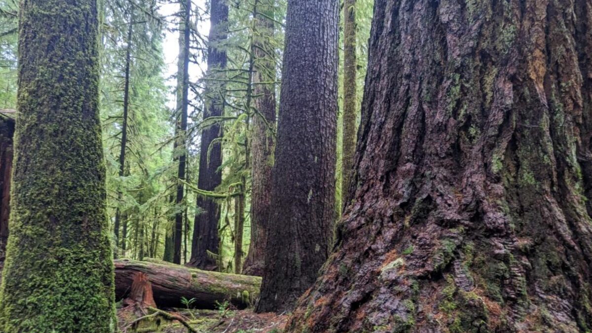
As reported in our last newsletter, the Biden Administration is striving to achieve more protections for remaining old-growth and mature forests on federal lands. However, regulatory changes take time to implement and in the meantime, more of these important forests will be felled. Two CBI Associates Dr. Beverly Law (Professor Emeritus at Oregon State University) and Dr. Dominick DellaSala (Chief Scientist for Wild Heritage) have been extremely active in galvanizing action to speed up the protection of these forests. In her latest article in The Conversation entitled, “Old Forests are Critically Important for Slowing Climate Change and Merit Immediate Protection from Logging”, Dr. Law describes why protecting these forests is so important. Dr. DellaSala organized a recent Scientist Letter to the President urging him to place a moratorium on logging of old-growth and mature forests on federal lands to prevent these critical forests from being lost while the regulations are fully implemented. These forests are simply too important and too rare to be impacted by bureaucratic delays.
Alliance of World Scientists
The Alliance of World Scientists (the Alliance) is an international assembly of scientists (over 27,000 scientists from 180 countries) with the goal of amplifying the voices of scientists from all over the world to prevent further widespread catastrophic damage to the planet, especially from climate change. Founded and led by Dr. Bill Ripple of Oregon State University, a long-time CBI Associate, the Alliance has produced numerous publications and has engaged in regular public outreach where it has actively advocated for science-based actions to help save the planet. CBI and the Alliance have recently forged a new partnership to support the mission. Initially, CBI is hosting its new website and helping the Alliance raise much-needed financial support.
Protecting a Legacy Water System from Wildfire
This section of flume of called “Flume A” is a one-mile long gold-rush era wooden structure that diverts water from the south fork of the Stanislaus River to a branching system of earthen channels and other shorter sections of flumes below. Laborers in the 1800s, sometimes hanging from ropes in the steep canyons, built this and the four other wood and metal flumes of Tuolumne County to supply high-pressure water to hydraulic mining, sluicing operations, and lumber mills.
In the 1850s, immigrants seeking gold in California’s Sierra Nevada mountains created a connected network of open channels, wooden flumes, and pipes to direct water to their operations and the rapidly-growing foothill towns of Sonora, Columbia, and Jamestown. 170 years later, this historic system is an integral part of the water infrastructure that supports residential, agricultural, hydroelectric, ecosystem, and recreational purposes, providing nearly all of the drinking water to the west slope communities of Tuolumne County. Tuolumne Utilities District (TUD), the agency responsible for managing the 70-plus miles of raw water ditches and potable water infrastructure is contending with a modern-day concern: the threat of severe wildfire.
Conservation Biology Institute is proud to partner with EN2 Resources, Inc. and the Tuolumne Utilities District (TUD) to develop the TUD Wildfire Defense Plan, a roadmap for addressing wildfire risk to the water system and water treatment facilities.
The TUD Wildfire Defense Plan will have two components: CBI is heading up a Wildfire Risk Mitigation Plan to guide projects that achieve fuel reduction, habitat enhancement, and recreation benefits. EN2 is developing a Wildfire Protection Draft-Points Plan for strategically identifying raw water draft points along the raw water ditches for fire response and preserving precious potable water. Together these plans will help TUD manage the system as “green infrastructure”, a vision that addresses the integrated needs of people, the communities, and biodiversity under climate change. TUD, together with Pacific Gas & Electric, the US Forest Service, CALFIRE, Tuolumne County, Tuolumne Fire Safe Council and the Tuolumne Band of Me-Wuk Indians are already working intensively to reduce fuels in the region, and this Plan will assist the agency in obtaining the funding needed to continue this important work.
The TUD Wildfire Defense Plan will be completed by the end of the year. Funding for this project comes from the USDA Forest Service Community Wildfire Defense Grant.
More Monthly Newsletters
Climate Change and Bird Flu
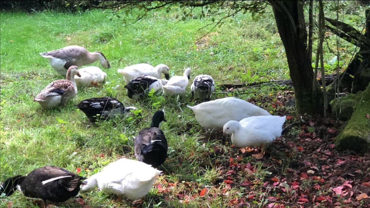
This has been a solemn week at our small farm in western Oregon. Avian influenza (also known as bird flu) has appeared for the first time. Eight chickens and our lone female goose “Larry” succumbed to the disease this week and all 12 ducks are being humanely euthanized to help stop the spread as I write this article. They call the culling process “depopulating”, which is accurate and necessary, but the term somehow feels too insensitive when applied to our friends. We kept these birds mainly for pleasure – they were a joy in so many ways and the organic eggs were a nice bonus.
Avian influenza around the world is very much on the rise, impacting both wild and domestic birds with some viral strains becoming more virulent and crossing over to impact mammals, including humans. This latest outbreak of the H5N1 virus began in the U.S. in 2021 and it continues to make headlines for its tenacity and spread to new places – it was recently reported for the first time in Antarctica. As clearly demonstrated by our collective experience with COVID-19, viruses are simple organisms with the incredible ability to rapidly mutate making them extremely challenging to control. Recent trends with many viruses (including bird flu) are beginning to alarm scientists who believe change in climate is a contributing factor. Culling infected animals is argued to be inadequate to control this growing global health threat to wild and domestic animals and humans. We should not wait until this or other animal virus jumps to humans – we know what can happen then. The development of vaccines or other proactive treatments needs to be taken seriously now.
As for our little farm, we will wait out our quarantine and try again in spring – which seems so far away. The farm is eerily quiet and we miss our friends.
Executive Order on Protecting Old Growth Forests

Reforestation and proforestation (letting natural forests grow old) is an important component in combating climate change. On April 22, 2023 (Earth Day) the Biden Administration announced executive order 14072, which laid out several directives to land managers to strengthen protections for old-growth and mature forests on federal lands. U.S. Forest Service (USFS) and Bureau of Land Management (BLM) staff developed definitions for the different forest types in the country and conducted an inventory of old and mature forests on federal lands. Based on these definitions and inventory, the USFS and BLM manage 32 million acres of old growth and 80 million acres of mature forests.
An update to this executive order was released on December 19, 2023, which includes a directive to the Forest Service to amend all 128 forest management plans to conserve and restore old-growth forests throughout the system. This announcement includes the Northwest Forest Plan, which covers federally managed forests in Washington, Oregon, and California and includes 25% of the remaining old growth in the national forest system.
There are considerable stressors to our nation’s forests (e.g., wildfire and insect and disease outbreaks) that will make what seems straightforward quite complex, but these announcements and actions are important to monitor in order to achieve the most effective outcomes.
Thank you…

Back in 1994, David Johns became my first boss after graduate school. I had just finished my Ph.D. at The Ohio State University and became the first science support staff for a new non-profit initiative called The Wildlands Project. Later, Pam Frost and I elected to set off on our own and created the Conservation Biology Institute in November 1997. David Johns was one of the first board members and has provided support and guidance in a variety of ways over these many years. David is a passionate conservationist and he would frequently challenge us to be bolder in using our science to advance political and social change. Law and political science are his profession – what did we expect. We may not have always agreed on how best to achieve our stated mission, but his knowledge and experience in conservation is rich and I could always count on him to challenge us to strive to have a larger conservation impact.
And now, after 27 years of service, David has elected to step off the board. Thank you for staying with CBI for all these years, through all of the highs and occasional lows. He will remain a person we can always call on for guidance – I am sure we’ll take him up on it.
More Monthly Newsletters

COP28 Conference
As you receive this newsletter, the 28th annual international climate meeting, called COP28 (COP – Conference of the Parties) begins in Dubai, United Arab Emirates. Attendance may hit an all-time record with at least 45,000 attendees expected. However, that’s not the only record being broken.
Analyzing the data from the first 10 months of 2023, the National Centers for Environmental Information reports that there is a 99% chance that 2023 will be the warmest on record; the planet had its warmest October on record this year. Global ocean temperatures set a record high during this period as well and Antarctica experienced its sixth consecutive month of lowest sea ice extent ever recorded. For 28 years now, the COP process has brought representatives from around the world together to address the climate crisis. In 2015, a landmark treaty during the COP21 meeting (the Paris Agreement) set a goal to limit global temperature rise to 1.5 degrees Celsius, which has recently been reported as unlikely, but not impossible.
After this much time, why is progress so slow? In a recent TED talk, Al Gore discusses two main obstacles: (1) relentless opposition from the fossil fuel industry, including capturing the COP process and (2) the global financial system often works against progress.
Not all of the news is negative. This is not the time to succumb to hopelessness – now is the time to act. I urge you to take 25 minutes to listen to this TED talk. It will not only help put the COP28 meeting into perspective but will provide an update as to where we stand on the climate crisis and where we need to go.
Data Basin Tops 50,000 Members

Exciting news! Earlier this month, the number of registered Data Basin users topped the 50,000 mark. A number of new system updates and feature upgrades will be launched over the next couple of months.
We Welcome Dr. Jean Palmer-Moloney to the CBI Board
We are excited to welcome Dr. Jean Palmer-Moloney to the CBI board of directors. Dr. Palmer-Moloney has spent her life studying the chaos of systems and the often-tangled complexity of human-environment interaction. With two PhDs, she has experience across the scientific, academic, nonprofit, policy, and environmental communities, recruited often to give meaning and context to highly technical material and to serve as a go-between for engineers and scientists, policy analysts, and decision-makers. As a research scientist, hydrogeographer, and educator with experience and expertise in coastal resources management, her values and core beliefs are well aligned with CBI’s work. We look forward to working closely with Jean both in her role as a board member and potentially as a collaborator in some of our project work.
More Monthly Newsletters
It’s a Wrap!
Year 2 of Rangewide Monitoring of Stephens’ Kangaroo Rat
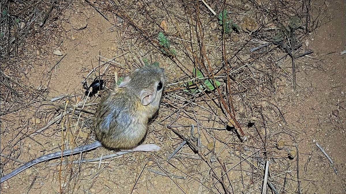
In September 2023, biologists from the Riverside County Habitat Conservation Agency (RCHCA) completed a second year of systematic population monitoring for the Stephens’ kangaroo rat (SKR) across the species’ range in Riverside and San Diego Counties, California. After decades of uncoordinated monitoring efforts by diverse land management agencies, this new program represents a significant milestone as the first standardized field assessment of the species’ status since it was listed as endangered more than 50 years ago. CBI designed the program in partnership with RCHCA, U.S. Bureau of Land Management, U.S. Fish & Wildlife Service, U.S. Geological Survey, Department of Defense, San Diego Zoo Global, and other experts as part of the SKR Rangewide Management and Monitoring Plan.
During 2022-23, the new monitoring program surveyed 79 randomly selected habitat sites across the range for evidence of kangaroo rats. Evidence was found on 34 of these sites, each of which was then trapped with 25 evenly spaced live-traps over two moonless nights to verify SKR occupancy and to estimate local population numbers. These first two years of data provide an unbiased view of how SKR populations vary across the landscape, establishing a sound baseline for continued annual monitoring to track population changes in response to environmental changes and management actions.
Two major patterns emerge from the data so far: (1) SKR are more common on preserves specifically managed by RCHCA and other agencies to benefit the species than on other lands that may support SKR; and (2) SKR numbers declined from 2022 to 2023, apparently due to record rainfall last winter. As biologists anticipated, the rains greatly increased the density of grasses in SKR habitat, crowding out more favorable food sources and making it difficult for kangaroo rats to move about.
Monitoring in future years will continue filling out this picture, tracking population status and trends. Hopefully, results will document a conservation success story for a species that was once so close to extinction.
Our Participatory Planning Approach in the News

It’s no secret that, over the past few years, electric vehicles have become vastly popular. At this point in time, it’s crucial not to make mineral mining – the critical resource for the batteries that power these vehicles – its own worsening environment impact on the planet. Previously, in partnership with the California state government, academic institutions, and others, CBI played a large role in a stakeholder-led process mapping least-conflict lands for solar development in the San Joaquin Valley in California. As Ethan Elkind said in his article, A California model for solar sites could be a boon for critical mineral mining, CBI’s planning tools and approach (like those used in San Joaquin Valley and more recently used in the Columbia Plateau region in Washington) could also be used as an exceptional approach to identify least-conflict lands for mineral extraction areas to ensure mineral mining is only executed at sites that would keep the procurement of these materials as ecologically sustainable as possible.
CBI Welcomes New Board Member
We are excited to welcome a new member to our Board of Directors, Mindy Weck. Mindy leads Business Development and Strategy for Hundzsoil, a pioneering firm specializing in an organic soil amendment that reduces agricultural water use by up to fifty percent and has great promise for combatting increasing water scarcity issues across many geographies. Mindy has a passion for nature-based education programming and founded the Synapse School Nature Days Program run through the Riekes Center in the California Bay Area in addition to her service to both the Wilderness Awareness School in Duvall, WA and The Hill School in Middleburg, VA. We look forward to her engagement with CBI and the opportunity to tap into her creativity and personal/professional network. Welcome, Mindy!
More Monthly Newsletters
The leaves are changing, and so are we!
A message from our President…

This month I am excited to announce changes to the executive leadership roles at the Conservation Biology Institute and to announce our new strategic path forward.
The Main Story…
When Pam Frost (my wife) and I created the Conservation Biology Institute 26 years ago with the help of a handful of others, it was with a clear mission: use conservation science to create a healthier, more ecologically sustainable planet. We felt we needed to create a new organization (vs. working for an existing entity) to ensure we remain focused and committed on advancing conservation science solutions while maintaining the highest degree of scientific and personal integrity. If we were going to invest the energy to dream, we might as well dream big. Starting in our spare bedroom 26 years ago, CBI was built from the ground up. It has not always been an easy journey, but we are grateful to have had the opportunity to make a significant difference towards achieving our mission to this point with hopefully a much larger impact in the future.
CBI’s unique approach is to bring “all three legs of the stool” to the table to help clients and partners tackle complicated conservation problems, namely:
1. World-class conservation scientists, geospatial experts, and software engineers
2. Advanced software applications, including the flagship Data Basin mapping and analysis platform
3. A holistic, proactive, and collaborative engagement model
Our expanding board of directors and executive leadership team believe the time is now to scale the unique CBI skill sets to address the increasing environmental degradation posed by human activity, including climate change. We want to build on our successes, transfer more knowledge outside the U.S., expand our in-house science expertise, engage more people in our work and set CBI up for success over the next 26 years and beyond.
To expand our impact, I am excited to announce changes to the executive team. Effective September 1, 2023, CBI board member Robin Jones has stepped into the Executive Director role at CBI. I will remain as the Chief Science Officer for the organization as well as continue to serve on the board of directors. Pam Frost will continue in her role as Chief Operations Officer and current role on the board. Gladwin Joseph will also remain as Chief Projects Officer.
“I could not be more thrilled to be joining such a passionate and impactful group of conservation scientists, geospatial analysts, and software engineers in their efforts to preserve and heal our ecosystems at such a critical time in our planet’s history. I’m excited to apply my years of business experience toward helping this organization grow and thrive for years to come. I am very much looking forward to working alongside CBI’s esteemed team that drives the research, applied science, analytics, and technology they are using to address the world’s critical environmental issues.” – Robin Jones
Robin is the ideal complement to our existing expertise. She brings 25 years of experience including executive and/or founding roles at several entrepreneurial ventures, executive roles at multiple software companies including Esri, and a rich academic background in biological sciences and business at Stanford and UC Berkeley. Robin’s strategic priorities are to:
- Continue to build CBI as a world-class organization that continues to help create an ecologically sustainable planet via its top-notch ecological scientists, GIS and software experts, and collaborative engagements.
- Scale up the organization’s conservation global impact.
- Build a recurring funding model to ensure a rich, impactful software platform roadmap.
Everyone at CBI is thrilled and excited to have Robin as the new Executive Director while retaining the previous leadership as part of the executive team. CBI’s future is bright and that is more important than ever as there is an ever-increasing amount of work to be done to try to save our planet.