CBI is collaborating with the Southern California Wetlands Recovery Project (SCWRP) scientists and partners to deliver a data-sharing platform and custom tools to enhance SCWRP’s communication and support decision-making.
CBI is playing a key role in improving the health and resilience of wetland ecosystems in Southern California in a partnership with the Southern California Wetlands Recovery Project (SCWRP). The newly-released Marsh Adaptation Planning Tool provides data access and decision-support technology for SCWRP’s new Regional Strategy 2018, a recovery plan for tidal and non-tidal wetlands from Point Conception to the Mexican border.

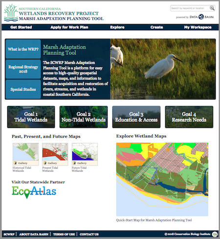
Above: The Marsh Adaptation Planning Tool homepage, with access to the Regional Strategy 2018, the spatial data that informed its development, and a special tool for planning projects that will contribute to its Work Plan.

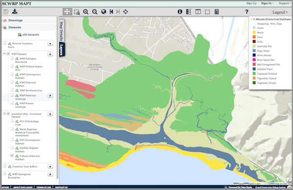
Above: The MAPT’s “Quick-Start Map” that allows the user to explore Southern California’s wetlands. Layers depicting historical and present-day wetlands, important transitions zones, and other features can be turned on and off for quick comparison. The map and its data layers can be downloaded for use in GIS, or saved and used with any other layers in Data Basin.

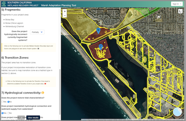
Above: The Marsh Adaptation Planning Tool’s project planning utility, where project proponents can use Regional Strategy 2018 spatial data, habitat types, and goals and objectives to inform the planning of a project and apply to have it included in the SCWRP Work Plan.


